Sarah Ann in Logan County, West Virginia — The American South (Appalachia)
The Family
Hatfield Cemetery
Photographed by Mark Parker, July 11, 2026
1. The Family Marker
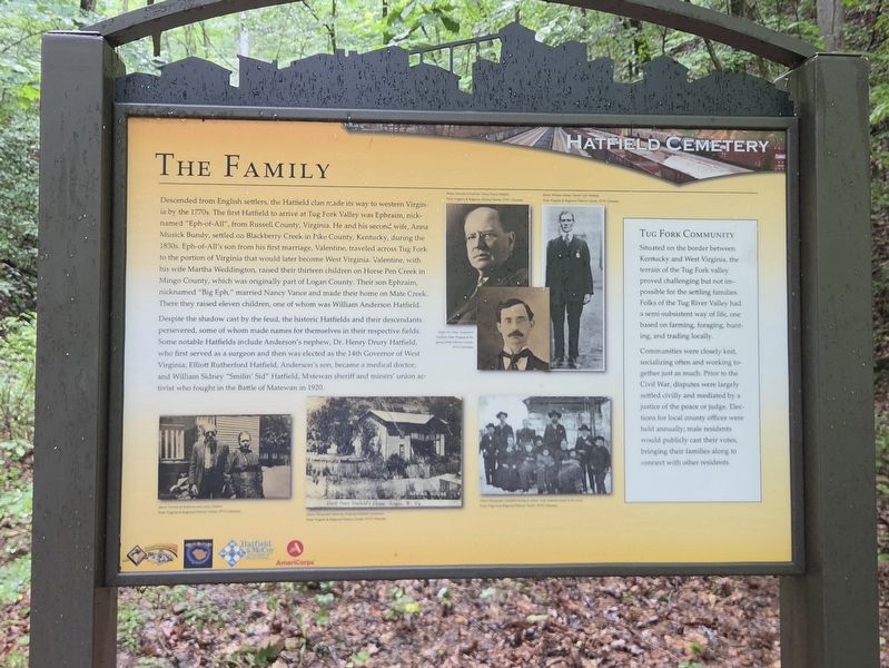
Descended from English settlers, the Hatfield clan made its way to western Virginia by the 1770s. The first Hatfield to arrive at Tug Fork Valley was Ephraim, nicknamed "Eph-of-All", from Russell County, Virginia. He and his second wife, Anna Musick Bundy, settled on Blackberry Creek in Pike County, Kentucky, during the 1830s. Eph-of-All's son from his first marriage, Valentine, traveled across Tug Fork to the portion of Virginia that would later become West Virginia. Valentine, with his wife Martha Weddington, raised their thirteen children on Horse Pen Creek in Mingo County, which was originally part of Logan County. Their son Ephraim, nicknamed "Big Eph" married Nancy Vance and made their home on Mate Creek. There they raised eleven children, one of whom was William Anderson Hatfield.
Despite the shadow cast by the feud, the historic Hatfields and their descendants persevered, some of whom made names for themselves in their respective fields. Some notable Hatfields include Anderson's nephew, Dr. Henry Drury Hatfield, who first served as a surgeon and then was elected as the 14th Governor of West Virginia; Elliott
this page online
[Sidebar]
Tug Fork Community
Situated on the bonder between Kentucky and West Virginia, the terrain of the Tug Fork valley proved challenging but not possible for the settling families. Folks of the Tug River Valley had a semi-subsistent way of life, one based on farming, foraging hunting and trading locally.
Communities were closely knit, socializing often and working together just as much. Prior to the Civil War, disputes were largely settled civilly and mediated by a justice of the peace or judge. Elections for local county offices were held annually; male residents would publicly cast their votes, bringing their familles along to connect with other residents.
[Captions]
Below: Portrait of Governor Henry Drury Hatfield.
West Virginia & Regional History Center, WVU Libraries
Below: William Sidney "Smilin' Sid" Hatfield.
West Virginia & Regional History Center, WVU Libraries
Right: Dr. Elliott Rutherford Hatfield
West Virginia & Regional State History Center, WVU Libraries
Above: Portrait of Anderson and Levicy Hatfield
West Virginia & Regional History Center, WVU Libraries
Above: Photograph capturing Anderson Hatfield's Homeplace
West Virginia & Regional History Center, WVU Libraries
Above: Photograph of Hatfield family in winter, with Anderson seated at the center
West Virginia & Regional History Center, WVU Libraries
Erected by National
Photographed by Mark Parker, July 11, 2026
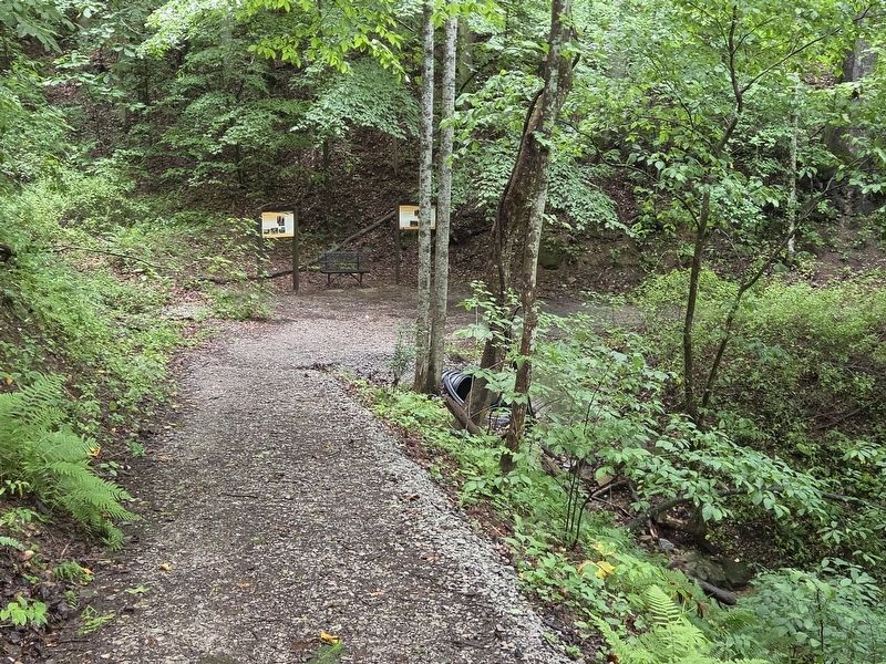
2. The Family Marker (right) at the end of the second incline on the Hatfield Cemetery trail
Topics. This historical marker is listed in these topic lists: Agriculture • Government & Politics • Science & Medicine • Settlements & Settlers. A significant historical year for this entry is 1920.
Location. 37° 42.244′ N, 81° 59.549′ W. Marker is in Sarah Ann, West Virginia, in Logan County. It can be reached from Jerry West Highway (West Virginia Route 44) half a mile south of Philips Street, on the right when traveling south. The marker is on the Hatfield Cemetery trail at the end of the second incline. Touch for map. Marker is at or near this postal address: 12602 Jerry West Hwy, Sarah Ann WV 25644, United States of America. Touch for directions.

Regionally, this marker is in the Southern Coalfields. It is also in the American South, specifically in the Upper South, in Appalachia, and specifically in Southern Appalachia. Globally, it is in North America, the Western Hemisphere, the Western World, and the Anglosphere. Historically, it finds itself in what was once the territory of the Mississippian Culture.
Photographed by Mark Parker, July 11, 2026
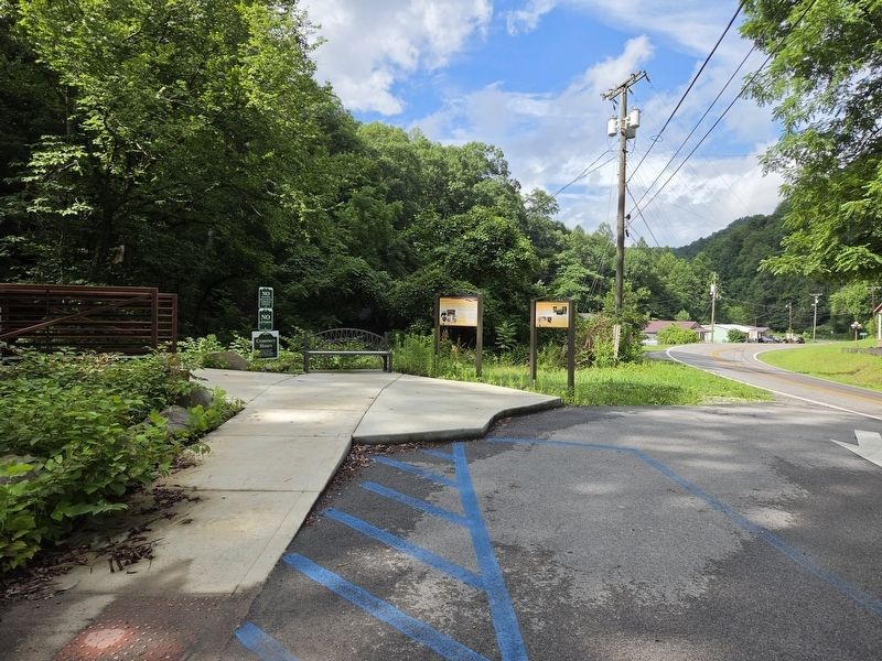
3. Hatfield Cemetery trailhead of Jerry West Hwy (WV Hwy 44)
Other nearby markers. At least 8 other markers are within walking distance of this marker: The Resting Place (a few steps from this marker); Hatfield Cemetery (about 500 feet away, measured in a direct line); The Land (about 500 feet away); The Feud (about 600 feet away); The Man: "Devil Anse" Hatfield (about 600 feet away); Devil Anse Hatfield's Homeplace (approx. ¼ mile away); Hatfield Family Well (approx. ¼ mile away); Devil Anse Hatfield's Homeplace Bridge (approx. ¼ mile away). Touch for a list and map of all markers in Sarah Ann.
Credits. This page was last revised on July 23, 2026. It was originally submitted on July 23, 2026, by Mark Parker of Hickory, North Carolina. This page has been viewed 13 times since then. Photos: 1, 2, 3. submitted on July 23, 2026, by Mark Parker of Hickory, North Carolina. • Devry Becker Jones was the editor who published this page.
