Near Sheffield in Warren County, Pennsylvania — The American Northeast (Mid-Atlantic)
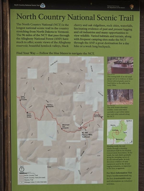
North Country National Scenic Trail
Photographed by Mark Parker, July 16, 2026
1. North Country National Scenic Trail Marker
Find Your Way- Follow the blue blazes to navigate the NCT.
[Captions]
The rusting hulk of an old small gauge rail car is evidence of abandoned railroad grades used to haul timber to the mills in thenearly 1900s.
Photo: Tina Toole
The ANF boasts abundant wildlife. Listen and watch carefully to spot white-tailed- deer and other animals along the NCT.
Photo: Mike Evans
Heading north, the trail climbs through a stunning switchback built by the Student Conservation Association. To the south, the trail climbs gradually along the sweeping curves of an old railroad grade. In both directions evidence of early equipment used in the oil and logging industries, so important to the area, is apparent.
For More Information Visit https://northcountrytrail.org for free downloadable maps and information on volunteer activities.
Erected by National
this page online
Topics. This historical marker is listed in these topic lists: Parks & Recreational Areas • Railroads & Streetcars • Roads & Vehicles.
Location. 41° 38.162′ N, 79° 2.567′ W. Marker is near Sheffield, Pennsylvania, in Warren County. It is on Pennsylvania Route 666 0.1 miles south of Henrys Mill Road, on the left when traveling south. The marker is at a pulloff area at the Henry Mills Trailhead. It is south of a bridge over the Tionesta Creek. Touch for map. Marker is at or near this postal address: 6367 PA-666, Sheffield PA 16347, United States of America. Touch for directions.

Regionally, this marker is in Northwestern Pennsylvania and specifically in the Pennsylvania Wilds. It is also in the American Northeast, in the Mid-Atlantic, in Appalachia, and specifically in Northern Appalachia. Globally, it is in North America, the Western Hemisphere, the Western World, and the Anglosphere. Historically, it finds itself in what was once the Haudenosaunee (Iroquois) Confederacy and also one of the original Thirteen Colonies.
Photographed by Mark Parker, July 16, 2026
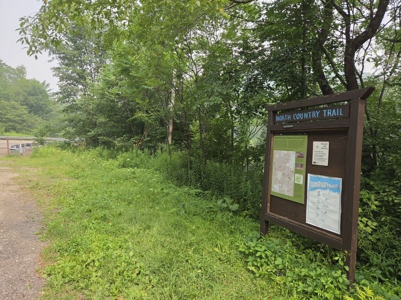
2. Wide view of North Country National Scenic Trail Marker at travel kiosk
Other nearby markers. At least 8 other markers are within 13 miles of this marker, measured as the crow flies: S/Sgt. John G. Gertsch (approx. 4½ miles away); Sheffield Memorial Park (approx. 4½ miles away); Sheffield (approx. 4½ miles away); Iroquois Main Road (approx. 10.9 miles away); Minenwerfer Trench Mortar (approx. 11.8 miles away); Forest County Veterans Club Memorial (approx. 11.8 miles away); Marienville (approx. 12.3 miles away); Camp ANF-3 (approx. 12.7 miles away). Touch for a list and map of all markers in Sheffield.
Another marker is no longer nearby. Pigeon (was approx. 7.7 miles away but has been confirmed missing).
Credits. This page was last revised on September 17, 2026. It was originally submitted on July 23, 2026, by Mark Parker of Hickory, North Carolina. This page has been viewed 13 times since then. Photos: 1, 2. submitted on July 23, 2026, by Mark Parker of Hickory, North Carolina. • Bill Pfingsten was the editor who published this page.
