Tucker in DeKalb County, Georgia — The American South (South Atlantic)
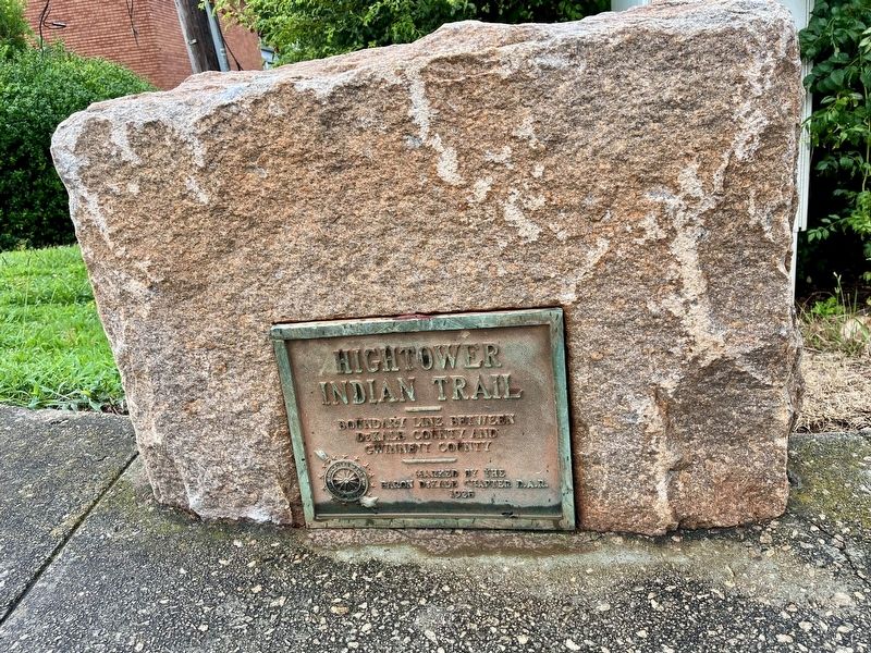
Hightower Indian Trail

Photographed by Tracy Andersen Roberts, July 24, 2026
1. Hightower Indian Trail Marker
Boundary line between DeKalb County and Gwinnett County
Marked by the Baron DeKalb Chapter D.A.R.
1928
Erected 1928 by Daughters of the American Revolution.
Topics and series. This historical marker is listed in these topic lists: Indigenous Peoples and Communities • Roads & Vehicles. In addition, it is included in the Daughters of the American Revolution (DAR) series list. A significant historical year for this entry is 1928.
Location. 33° 52.037′ N, 84° 11.456′ W. Marker is in Tucker, Georgia, in DeKalb County. It is at the intersection of Lawrenceville Highway (U.S. 29) and Sandpiper Drive, on the right when traveling west on Lawrenceville Highway. Touch for map. Marker is at or near this postal address: 4880 Lawrencville Highway, Tucker GA 30084, United States of America. Touch for directions.

Regionally, this marker is in the Piedmont and in Metro Atlanta. It is also in the American South and specifically in the Deep South. Globally, it is in North America, the Western Hemisphere, the Western World, and the Anglosphere. Historically, it finds itself in what was once the territory of the Mississippian
this page online
Other nearby markers. At least 8 other markers are within 4 miles of this marker, measured as the crow flies: Browning's Court House (approx. 1.7 miles away); Logan’s 15th Corps & Garrard’s Cavalry (approx. 1.9 miles away); Browning Courthouse (approx. 1.9 miles away); Garrard & Lightburn to Stone Mountain (approx. 2 miles away); Logan’s Corps Moves to Henderson’s Mill (approx. 2.4 miles away); Office James 'Chris' Magill Memorial Bridge (approx. 3.2 miles away); Site: Henderson’s Mill (approx. 3.6 miles away); Faye Bourne Moore (approx. 3.8 miles away). Touch for a list and map of all markers in Tucker.
Regarding Hightower Indian Trail. Before white settlers occupied today’s DeKalb County, two prominent Native American nations, the Creek and Cherokee, lived on and traveled through the area for thousands of years. These nations had a tremendous effect on the development of Georgia that largely goes unnoticed in modern day, but is nonetheless important to consider. There were three main Native American trails
Photographed by Tracy Andersen Roberts, July 24, 2026
2. marker shown mounted on stone
Also see . . .
1. "Indian Trails" by New Georgia Encyclopedia.
Before Georgia had roads, it was laced with Indian trails or paths. These trails served the needs of Georgia’s native populations by connecting their villages with one another and allowing them to travel great distances in quest of game, fish, shellfish, and pearls, as well as such mineral resources as salt, flint, pipestone, steatite, hematite, and ochre. Many groups followed an annual economic cycle that saw them undertake seasonal migrations in pursuit of plants and animals needed for their existence.
Photographed by Tracy Andersen Roberts, July 24, 2026
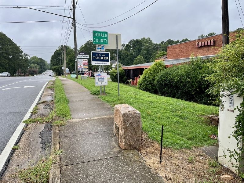
3. marker shown from the right side looking west into Tucker and DeKalb County
2. "Indian Trails in Georgia [1979]" from Digital Library of Georgia.
In Georgia, the oldest trails were those that crossed the piedmont, the same paths later used most often by white traders. The Indians who thrived in the many river valleys utilized trails that led all over the Southeast. After the establishment of French, Spanish and English colonies in the 17th century, the Indian trails of Georgia became important routes for deerskin trade and competition between the European settlements.(Submitted on July 24, 2026, by Tracy Andersen Roberts of Atlanta, Georgia.)
3. "Native American Trails of DeKalb County" by DeKalb History Center. (Submitted on July 24, 2026, by Tracy Andersen Roberts of Atlanta, Georgia.)
4. Hightower Trail and other Native American trails of DeKalb County, a 1951 report by Carl T. Hudgins.
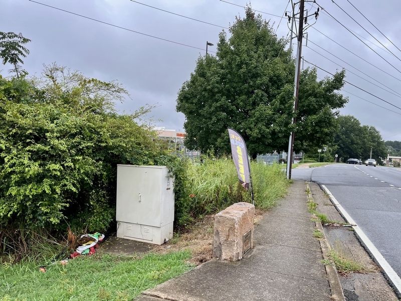
Carl T. Hudgins completed a report on the history of Native American trails in DeKalb County on January 22, 1951 which is among the archives at DeKalb History Center in Decatur, Georgia. He begins his paper by explaining(Submitted on July 24, 2026, by Tracy Andersen Roberts of Atlanta, Georgia.)the problems of telling the history, calling it “fragmentary, obtainable a little here and a little there.” The written history of the trails came from people who lived long after the Native Americans were forcibly removed and long after the first white settlers had died.Photographed by Tracy Andersen Roberts, July 24, 20264. marker shown from the left side looking east into Norcross and Gwinnett County
August 9, 2026
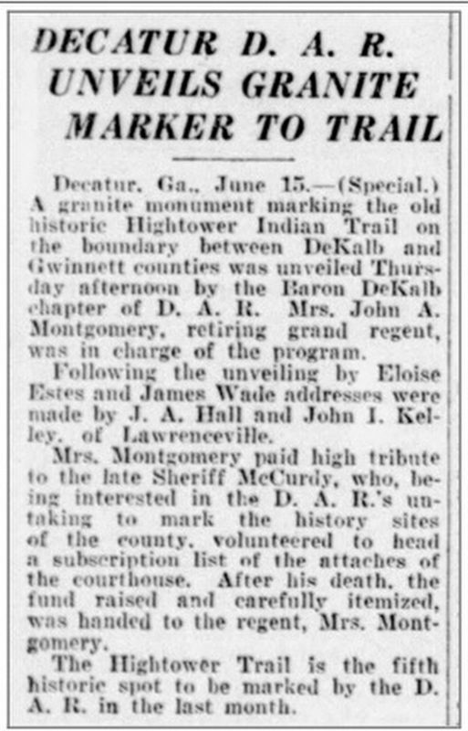
5. The Atlanta Constitution, Sat, 16 Jun 1928
DECATUR D. A. R.
UNVEILS GRANITE
MARKER TO TRAIL
Decatur. Ga., June 15 .- (Special.)
A granite monument marking the old historic Hightower Indian Trail on the boundary between DeKalb and Gwinnett counties was unveiled Thursday afternoon by the Baron DeKalb chapter of D. A. R.
Mrs. John A. Montgomery, retiring grand regent, was in charge of the program.
Following the unveiling by Eloise Estes and James Wade, addresses were made by J. A. Hall and John I. Kelley of Lawrenceville.
Mrs. Montgomery paid high tribute to the .ate Sheriff McCurdy, who, being interested in the D. A. R.'s undertaking to mark the history sites of the county. volunteered to head a subscription list of the attaches of the courthouse.
After his death, the fund raised and carefully itemized, was handed to the regent, Mrs. Montgomery.
The Hightower Trail is the fifth historie spot to be marked by the D. A. R. in the last month.
Credits. This page was last revised on August 20, 2026. It was originally submitted on July 24, 2026, by Tracy Andersen Roberts of Atlanta, Georgia. This page has been viewed 36 times since then. Photos: 1, 2, 3, 4. submitted on July 24, 2026, by Tracy Andersen Roberts of Atlanta, Georgia. 5. submitted on August 9, 2026, by Tracy Andersen Roberts of Atlanta, Georgia. • Bernard Fisher was the editor who published this page.
