Canal Park in Duluth in Saint Louis County, Minnesota — The American Midwest (Upper Plains)
Lake Place Image Wall
Mosaic images based on photographs from Duluth's waterfront history
Photographed by Cosmos Mariner, June 25, 2024
1. Lake Place Image Wall Marker (panel 1)
[panel 1]
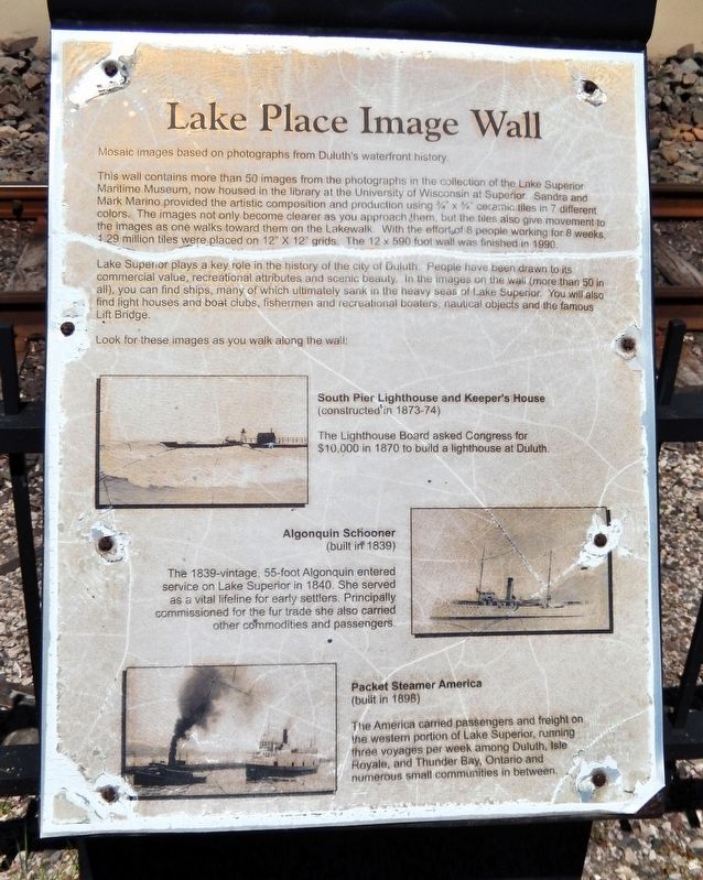
This wall contains more than 50 images from the photographs in the collection of the Lake Superior Maritime Museum, now housed in the library at the University of Wisconsin at Superior. Sandra and Mark Marino provided the artistic composition and production using ¾” x ¾” ceramic tiles in 7 different colors. The images not only become clearer as you approach them, but the tiles also give movement to the images as one walks toward them on the Lakewalk. With the effort of 8 people working for 8 weeks, 1.29 million tiles were placed on 12" x 12" grids. The 12 x 590 foot wall was finished in 1990.
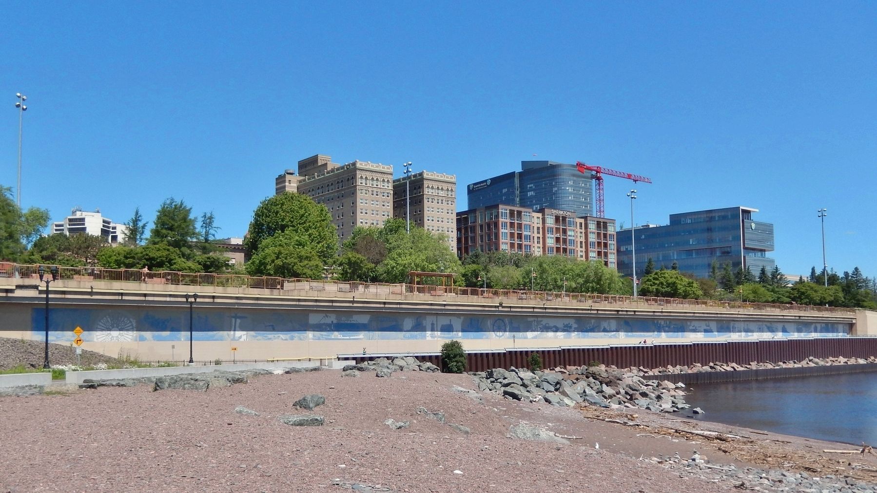
Lake Superior plays a key role in the history of the city of Duluth. People have been drawn to its commercial value, recreational attributes and scenic beauty. In the images on the wall (more than 50 in all), you can find ships, many of which ultimately sank in the heavy seas of Lake Superior. You will also find light houses and boat clubs, fishermen and recreational boaters, nautical objects and the famous Lift Bridge.
Look for these images as you walk along the wall:
South Pier Lighthouse and Keeper's House
(constructed in
this page online
The Lighthouse Board asked Congress for $10,000 in 1870 to build a lighthouse at Duluth.
Algonquin Schooner
(built in 1839)
The 1839-vintage, 55-foot Algonquin entered service on Lake Superior in 1840. She served as a vital lifeline for early settlers. Principally commissioned for the fur trade she also carried other commodities and passengers.
Packet Steamer America
(built in 1898)
The America carried passengers and freight on the western portion of Lake Superior, running three voyages per week among Duluth, Isle Royale, and Thunder Bay, Ontario and numerous small communities in between.
[panel 2]
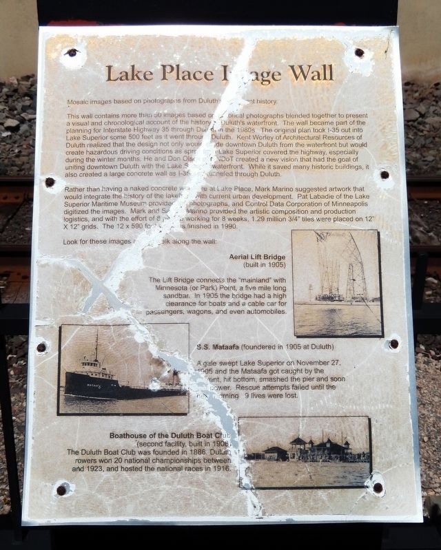
This wall contains more than 50 images based on historical photographs blended together to present a visual and chronological account of the history of Duluth's waterfront. The wall became part of the planning for interstate Highway 35 through Duluth in the 1980s. The original plan took I-35 out into Lake Superior some 500 feet as it went through Duluth. Kent Worley of Architectural Resources of Duluth realized that the design not only would divide downtown Duluth from the waterfront but would create hazardous driving conditions as spray
Photographed by Cosmos Mariner, June 25, 2024
2. Lake Place Image Wall Marker (panel 2)
Rather than having a naked concrete wall here at Lake Place, Mark Marino suggested artwork that would integrate the history of the lakefront with current urban development. Pat Labadie of the Lake Superior Maritime Museum provided the photographs, and Control Data Corporation of Minneapolis digitized the images. Mark and Sandra Marino provided the artistic composition and production logistics, and with the effort of 8 people working for 8 weeks, 1.29 million ¾" tiles were placed on 12" x 12" grids. The 12 x 590 foot wall was finished in 1990.
Look for these images as you walk along the wall:
Aerial Lift Bridge
(built in 1905)The Lift Bridge connects the “mainland” with Minnesota (or Park) Point, a five mile long sandbar. In 1905 the bridge had a high clearance for boats and a cable car for passengers, wagons, and even automobiles.
Photographed by Cosmos Mariner, June 25, 2024
3. Lake Place Image Wall Marker (panel 1)
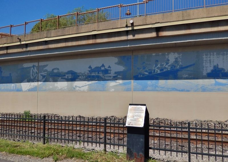
The elevated portion of Monarch Highway (Interstate 35) is in the background.
S.S. Mataafa
(foundered in 1905 at Duluth)
A gale swept Lake Superior on November 27, 1905 and the Mataafa got caught by the current, hit bottom, smashed the pier and soon lost power. Rescue attempts failed until the next morning. 9 lives were lost.
Boathouse of the Duluth Boat Club
(second facility, built in 1906)The Duluth Boat Club was founded in 1886. Duluth rowers won 20 national championships by 1923, and hosted the national races in 1916.
Topics. This historical marker is listed in these topic lists: Industry & Commerce • Roads & Vehicles • Settlements & Settlers • Waterways & Vessels.
Location. 46° 47.309′ N, 92° 5.647′ W. Marker is in Duluth, Minnesota, in Saint Louis County. It is in Canal Park. It can be reached from the intersection of Canal Park Drive and West Railroad Street, on the right when traveling north. The marker is located along the Lake Walk Trail, about 300 meters northeast of the Lake Place trailhead and parking lot. Touch for map. Marker is at or near this postal address: 250 Canal Park Drive, Duluth MN 55802, United States of America. Touch for directions.

Regionally,

Photographed by Cosmos Mariner, June 25, 2024
4. Lake Place Image Wall Marker (panel 2)
The elevated portion of Monarch Highway (Interstate 35) is in the background.
Other nearby markers. At least 8 other markers are within walking distance of this marker: Endion Station (about 700 feet away, measured in a direct line); Clayton Jackson McGhie Memorial (about 800 feet away); Lynching in America / Lynching in Duluth (about 800 feet away); USS Duluth LPD-6 (approx. 0.2 miles away); Man, Child & Gull (approx. 0.3 miles away); Duluth Legacy (approx. 0.3 miles away); Spirit of Lake Superior (approx. 0.4 miles away); Duluth's Ten Commandments Monument (approx. 0.4 miles away). Touch for a list and map of all markers in Duluth.
Photographed by Cosmos Mariner, June 25, 2024
5. Lake Place Image Wall
The Lake Walk Trail parallels the Lake Walk Image Wall heading northeast from Canal Park. The elevated portion of Monarch Highway (Interstate 35) is beyond the wall.

Photographed by Cosmos Mariner, June 25, 2024
6. South Pier Lighthouse and Keeper's House Mosaic

Photographed by Cosmos Mariner, June 25, 2024
7. S.S. Mataafa Mosaic

Photographed by Cosmos Mariner, June 25, 2024
8. Aerial Lift Bridge Mosaic
Credits. This page was last revised on July 26, 2026. It was originally submitted on July 26, 2026, by Cosmos Mariner of Cape Canaveral, Florida. This page has been viewed 16 times since then. Photos: 1, 2, 3, 4, 5, 6, 7, 8. submitted on July 26, 2026, by Cosmos Mariner of Cape Canaveral, Florida.
