Kelleys Island in Erie County, Ohio — The American Midwest (Great Lakes)
Excavation
Photographed by Craig Doda, July 4, 2026
1. Excavation Marker
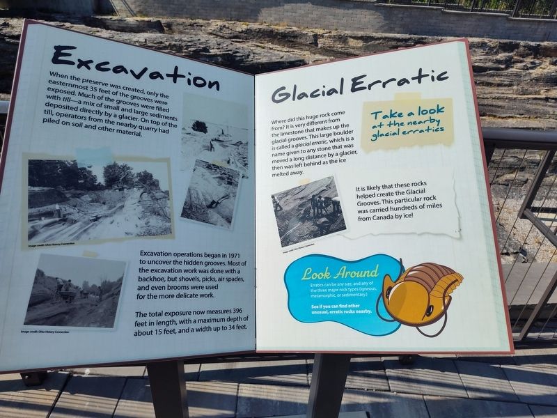
When the preserve was created, only the easternmost 35 feet of the grooves were exposed. Much of the grooves were filled with till—a mix of small and large sediments deposited directly by a glacier. On top of the till, operators from the nearby quarry had piled on soil and other material.
Excavation operations began in 1971 to uncover the hidden grooves. Most of the excavation work was done with a backhoe, but shovels, picks, air spades, and even brooms were used for the more delicate work.
The total exposure now measures 396 feet in length, with a maximum depth of about 15 feet, and a width up to 34 feet.
Glacial Erratic
Where did this huge rock come from? It is very different from the limestone that makes up the glacial grooves. This large boulder is called a glacial erratic, which is a name given to any stone that was moved a long distance by a glacier, then was left behind as the ice melted away.
Take a look at the nearby glacial erratics
It is likely that these rocks helped create the Glacial Grooves. This particular rock was carried hundreds of miles from Canada by ice!
Look Around
Erratics can
this page online
See if you can find other unusual, erratic rocks nearby.
Topics. This historical marker is listed in these topic lists: Anthropology & Archaeology • Natural Features. A significant historical year for this entry is 1971.
Location. 41° 36.965′ N, 82° 42.447′ W. Marker is on Kelleys Island, Ohio, in Erie County. It is at the intersection of Division Street and Titus Road, on the right when traveling south on Division Street. Touch for map. Marker is at or near this postal address: 112 Titus Road, Kelleys Island OH 43438, United States of America. Touch for directions.

Regionally, this marker is on the Lake Erie Shore and in the Western Reserve. It is also in the American Midwest and in the Corn Belt. Globally, it is in North America, on the Great Lakes, in the Western Hemisphere, in the Western World, and in the Anglosphere. Historically, it finds itself in what was once the Haudenosaunee (Iroquois) Confederacy, the territory of the Mississippian Culture, and the Northwest Territory.
Other nearby markers. At least 8 other markers
Photographed by Craig Doda, July 4, 2026
2. Excavation Marker
Another marker is no longer nearby. Glacial Grooves State Memorial (was about 300 feet away but has been permanently removed).
Credits. This page was last revised on August 1, 2026. It was originally submitted on July 27, 2026, by Craig Doda of Napoleon, Ohio. This page has been viewed 12 times since then. Photos: 1, 2. submitted on July 27, 2026, by Craig Doda of Napoleon, Ohio. • Andrew Ruppenstein was the editor who published this page.
