Near Ninety Six in Greenwood County, South Carolina — The American South (South Atlantic)
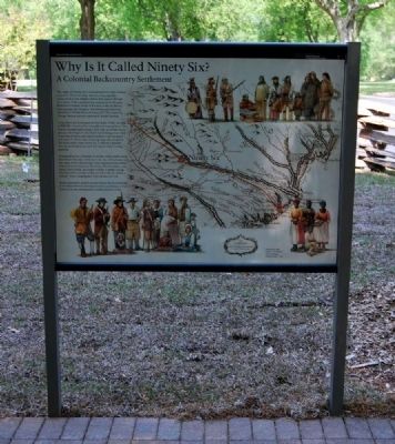
Why Is It Called Ninety Six?
A Colonial Backcountry Settlement
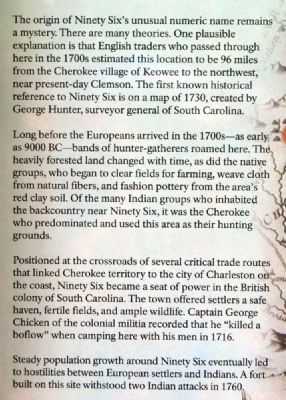
The origin of Ninety Six's unusual numeric name remains a mystery. There are many theories. One plausible explanation is that English traders who passed through here in the 1700s estimated this location to be 96 miles from the Cherokee village of Keowee to the northwest, near present-day Clemson. The first known historical reference to Ninety Six is on a map of 1730, created by George Hunter, surveyor general of South Carolina.
Long before the Europeans arrived in the 1700s -- as early as 900 B.C. -- bands of hunter-gatherers roamed here. The heavily forested land changed with time, as did the native groups, who began to clear fields for farming, weave cloth from natural fibers, and fashion pottery from the area's red clay soil. Of the many Indian groups who inhabited the backcountry near Ninety Six, it was the Cherokee who predominated and used this area as their hunting grounds.
Positioned at the crossroads of several critical trade routes that linked Cherokee territory to the city of Charleston on the coast, Ninety Six became a seat of power in the British colony of South Carolina. The town offered settlers a safe haven, fertile fields, and ample wildlife. Captain George Chicken of the colonial militia recorded that he "killed a boflow" when camping here with his men in 1716.
Steady population growth around Ninety Six eventually led to hostilities between European settlers and Indians. A fort built on this site withstood Indian attacks in 1760.
Erected 2009 by National Park Service.
Topics. This historical marker is listed in these topic lists: Colonial Era • Native Americans • Notable Places • Settlements & Settlers. A significant historical year for this entry is 1730.
Location. 34° 8.813′ N, 82° 1.399′ W. Marker is near Ninety Six, South Carolina, in Greenwood County. Marker can be reached from South Cambridge Street (State Highway 248) 1.2 miles south of Johnston Road (State Highway S-24-72), on the left when traveling south. Marker is at the start of a walking trail at a rest area outside the Ninety Six National Historic Site Visitor Center. Touch for map. Marker is at or near this postal address: 1103 Hwy 248 South, Ninety Six SC 29666, United States of America. Touch for directions.
Other nearby markers. At least 10 other markers are within walking distance of this marker. Ninety Six in the American Revolution (here, next to this marker); The Siege of Ninety Six (here, next to this marker); Ninety Six National Historic Site (a few steps from this marker); Logan Log House (within shouting distance of this marker); Walking Tour of the Park (within shouting distance of this marker); a different marker also named Logan Log House (within shouting distance of this marker); 96 (about 300 feet away, measured in a direct line); Monument to James Birmingham (about 400 feet away); James Birmingham (about 400 feet away); Cherokee (about 400 feet away). Touch for a list and map of all markers in Ninety Six.
Also see . . .
1. Ninety Six, South Carolina. Ninety Six is a town in Greenwood County, South Carolina, United States. (Submitted on May 14, 2010, by Brian Scott of Anderson, South Carolina.)
2. Keowee. Keowee was a Cherokee town in the north of present-day South Carolina. (Submitted on May 14, 2010, by Brian Scott of Anderson, South Carolina.)
Credits. This page was last revised on November 20, 2020. It was originally submitted on May 14, 2010, by Brian Scott of Anderson, South Carolina. This page has been viewed 1,509 times since then and 106 times this year. Photos: 1, 2. submitted on May 14, 2010, by Brian Scott of Anderson, South Carolina.

