Monroe Township near West Liberty in Logan County, Ohio — The American Midwest (Great Lakes)
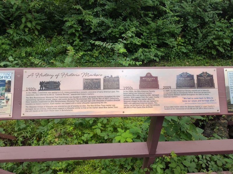
A History of Historic Markers
Photographed by Craig Doda, July 11, 2026
1. A History of Historic Markers Marker
1920s
In the 1920s, a sentiment was applied to U.S. history promoting a romantic veneration of early America's past. This movement, now referred to as "Colonial Revival," popularized historic markers.
The Ohio Revolutionary Memorial Trail Commission was founded in 1929 to designate locations throughout the state representing significant people, places, and events during the Revolutionary War and the War of 1812. Collectively, these locations established an Ohio Revolutionary Memorial Trail, and oval signs with silhouettes of soldiers directed travelers to historic markers. Each marker was topped with a metal silhouette representing the site.
The Shawnee Village of Mekoche was selected as one of seventy-six sites. The Mac-O-Chee Town marker was damaged, but an existing 1930s photo suggests a silhouette similar to that on the marker about Blue Jacket Town that still stands on the Court House lawn in Bellefontaine.
Ohio Revolutionary Memorial Trail
Mac-O-Chee Town
Here was fought the first of the major engagements of Logan's 1786 campaign, in which eight Shawnee towns were destroyed and chief Moluntha killed. Kenton
this page online
Blue Jacket Town
Here lived the famous Shawnee chief who led the "Seven Nations" in their de- feat at Fallen Timbers. He later was prominent in the making of the famous Treaty of Greeneville.
1950s
In the 1950s, the Ohio Historical Society began adding new historical markers throughout Ohio and replacing older, damaged markers. With support from the Logan County Historical Society, the marker about the Shawnee villages on this site was replaced in 2001 with additional historical details. This marker can be found on the road that connects SR 245 to Piatt Castle Mac-A-Cheek. Mackachack Town
Nearby stood the Shawnee village of Mackachack or Mac-A-Cheek. This village was the first of the Shawnee towns to be attacked by Gen. Benjamin Logan's mounted Kentucky militia in the fall of 1786. In all the American forces destroyed eight Shawnee towns in the Mac-O- Chee Valley. Simon Kenton was forced to run one of his nine gauntlets at Mackachack while a captive of the Shawnee in 1778.
2009
In 2009, the Ohio Historical Society reached out to federally recognized tribes to incorporate Native American perspectives.
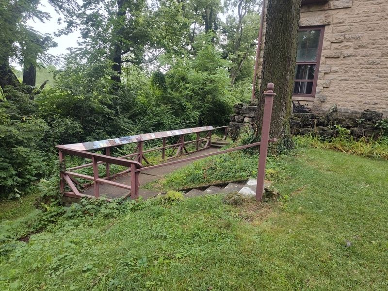
Photographed by Craig Doda, July 11, 2026
2. A History of Historic Markers Marker
"We had to come back to Ohio to keep our values and heritage alive."
Chief Glenna Wallace, Eastern Shawnee Tribe of Oklahoma
A two-sided marker about the Shawnee Nation in Logan County is located at the intersection of US 68 and CR 189 in West Liberty.
Shawnee Nation In Logan County
From the 1770s until 1832, the Logan County area was the homeland to much of the Shawnee Nation. Ten villages known as the Upper Mad River towns included the homes of influential leaders Moluntha, Black Hoof, and Blue Jacket. The West Liberty area contained three villages: Moluntha's Town, Wapakoneta, and Mackachack. To the northeast stood Wapakoneta, the Shawnee's political center and site of several intertribal councils. To the north sat Blue Jacket's Town, Kispoktha Town, and Reed Town. To the west were Pigeon Town and Stony Creek, site of one of Tecumseh's first pan-Indian confederacy councils. From 1817 to 1832, many Shawnees were relocated to Indian Territory, which in 1907 became the state of Oklahoma. These Shawnees are now the Eastern Shawnee of Oklahoma.
Erected by Piatt

Photographed by Craig Doda, July 11, 2026
3. A History of Historic Markers Marker
Topics and series. This historical marker is listed in these topic lists: Colonial Era • Indigenous Peoples and Communities • War of 1812. In addition, it is included in the America 250: Ohio Commission series list. A significant historical year for this entry is 1929.
Location. 40° 15.062′ N, 83° 43.622′ W. Marker is near West Liberty, Ohio, in Logan County. It is in Monroe Township. It is at the intersection of Local Road 47 and State Route 245, on the right when traveling north on Local Road 47. Touch for map. Marker is at or near this postal address: 10051 Township Rd 47, West Liberty OH 43357, United States of America. Touch for directions.

Regionally, this marker is in the Till Plains. It is also in the American Midwest and in the Corn Belt. Globally, it is in North America, the Western Hemisphere, the Western World, and the Anglosphere. Historically, it finds itself in what was once the Viceroyalty of New France, the Haudenosaunee (Iroquois) Confederacy, the territory of the Mississippian Culture, and the Northwest Territory.
Other nearby markers. At least 8 other markers are within walking distance of this marker: Hopewell Ceremonial Earthworks (here, next to this marker); Finding the Balance Between History & Legacy (here, next to this marker); How the Mekoche Were Remembered (here, next to this marker); Why aren't we standing in a Shawnee village? (here, next to this marker); Aftermath of Logan’s Raid (here, next to this marker); Great Council State Park (here, next to this marker); Industry on the Macacheek (here, next to this marker); Past Shawnee Villages (here, next to this marker). Touch for a list and map of all markers in West Liberty.
Credits. This page was last revised on August 7, 2026. It was originally submitted on July 30, 2026, by Craig Doda of Napoleon, Ohio. This page has been viewed 18 times since then. Photos: 1, 2, 3. submitted on July 30, 2026, by Craig Doda of Napoleon, Ohio. • Devry Becker Jones was the editor who published this page.
