South-East Inner City in Dublin in County Dublin, Leinster, Ireland — Mid-East (and Dublin)
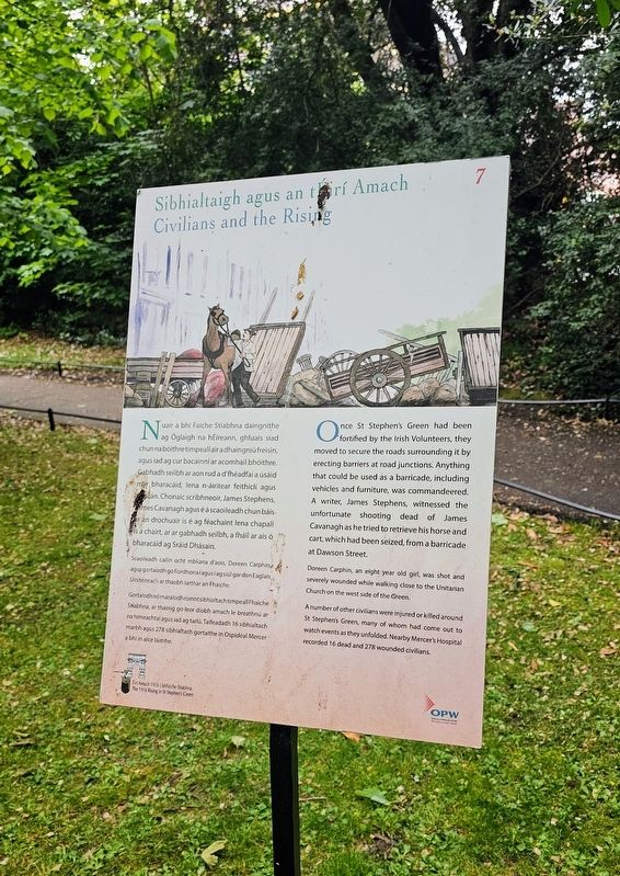
Sibhialtaigh agus an tÉirí Amach
⎯⎯⎯
Civilians and the Rising
| — | Éirí Amach 1916 i bhFaiche Stiabhna / The 1916 Rising in St Stephen’s Green | — |
Photographed by Ian Lefkowitz, May 18, 2026
1. Sibhialtaigh agus an tÉirí Amach / Civilians and the Rising Marker

Nuair a bhí Faiche Stiabhna daingnithe ag Óglaigh na hÉireann, ghluais siad chun na bóithre timpeall air a dhaingniú freisin, agus iad ag cur bacainní ar acomhail bhóithre. Gabhadh seilbh ar aon rud a d’fhéadfaí a úsáid mar bharacáid, lena n-áirítear feithiclí agus troscán. Chonaic scríbhneoir, James Stephens, James Cavanagh agus é á scaoileadh chun báis ar an drochuair is é ag féachaint lena chapall is a chairt, ar ar gabhadh seilbh, a fháil ar ais ó bharacáid ag Sráid Dhásain.
Scaoileadh cailín ocht mbliana d’aois, Doreen Carphin, agus gortaíodh go fíordhona í agus í ag siúl gar don Eaglais Úinitéireach ar thaobh iarthar an Fhaiche.
Gortaíodh nó maraíodh roinnt sibhialtach timpeall Fhaiche Stiabhna, ar tháinig go leor díobh amach le breathnú ar na himeachtaí agus iad ag tarlú. Taifeadadh 16 sibhialtach marbh agus 278 sibhialtach gortaithe in Ospidéal Mercer a bhí in aice láimhe.
Once St Stephen’s Green had been fortified by the Irish Volunteers, they moved to secure the roads surrounding it by erecting barriers at road junctions. Anything that could be used as a barricade, including vehicles and
this page online
Doreen Carphin, an eight year old girl, was shot and severely wounded while walking close to the Unitarian Church on the west side of the Green.
A number of other civilians were injured or killed around St Stephen’s Green, many of whom had come out to watch events as they unfolded. Nearby Mercer’s Hospital recorded 16 dead and 278 wounded civilians.
Erected 2016 by The Office of Public Works. (Marker Number 7.)
Topics and series. This historical marker is listed in these topic lists: Parks & Recreational Areas • Wars, Non-US. In addition, it is included in the Ireland, Dublin: The 1916 Rising in St Stephen’s Green / Éirí Amach 1916 i bhFaiche Stiabhna series list. A significant historical date for this entry is April 24, 1916.
Location. 53° 20.281′ N, 6° 15.386′ W. Marker is in Dublin, Leinster, in County Dublin. It is in South-East Inner City. It can be reached from Saint Stephen's Green south of Merrion Row, on the left when
Photographed by Ian Lefkowitz, May 18, 2026
2. Sibhialtaigh agus an tÉirí Amach / Civilians and the Rising Marker
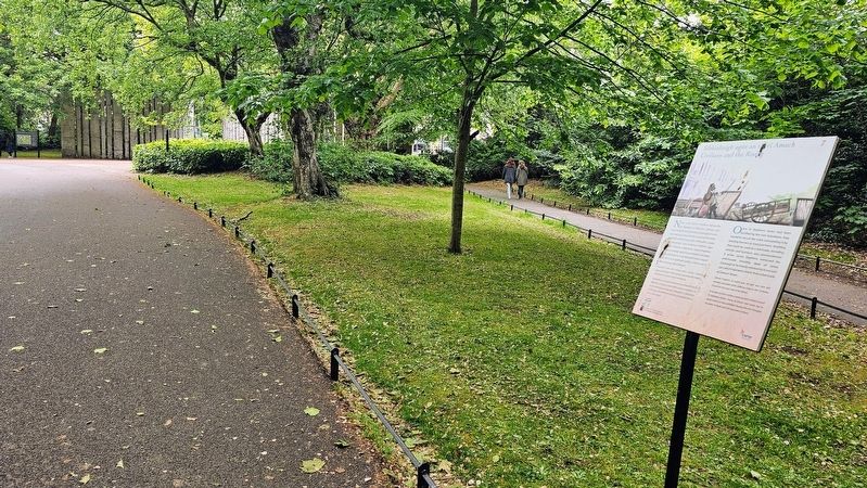
The Wolfe Tone monument can be seen in the distance for positional reference.

Regionally, this marker is in the Ancient East. Globally, it is on the Atlantic Ocean, in the North Atlantic Region, in Europe, on the Island of Ireland, on the Celtic Fringe, in the European Union, in Atlantic Europe, on one of the British Isles, in the Western World, and in the Anglosphere.
Other nearby markers. At least 8 other markers are within walking distance of this marker: Páirc Fhaiche Stiabhna / Saint Stephen's Green Park (within shouting distance of this marker); Óstán Shelbourne / The Shelbourne Hotel (within shouting distance of this marker); Foireann Pháirc Fhaiche Stiabhna / Staff of St Stephen's Green Park (about 90 meters away, measured in a direct line); Teach Samhraidh / The Summer House (about 120 meters away); The Huguenot Cemetery (about 120 meters away); Thomas M. Kettle (about 120 meters away); Sir Richard Griffith (about 150 meters away); Haslam Memorial Seat (about 150 meters away). Touch for a list and map of all markers in Dublin.
Also see . . . 1916 Exhibition (St. Stephen's Green Park). (Submitted on July 30, 2026, by Ian Lefkowitz of New York, New York.)
Credits. This page was last revised on July 30, 2026. It was originally submitted on July 30, 2026, by Ian Lefkowitz of New York, New York. This page has been viewed 12 times since then. Photos: 1, 2. submitted on July 30, 2026, by Ian Lefkowitz of New York, New York. • Andrew Ruppenstein was the editor who published this page.
