Belair-Parkside in Baltimore, Maryland — The American Northeast (Mid-Atlantic)
The Stone Lodge & The Heritage Trail
| — | Heritage Trail of Herring Run Park | — |
Photographed by Mark P. Brock-Cancellieri, July 4, 2026
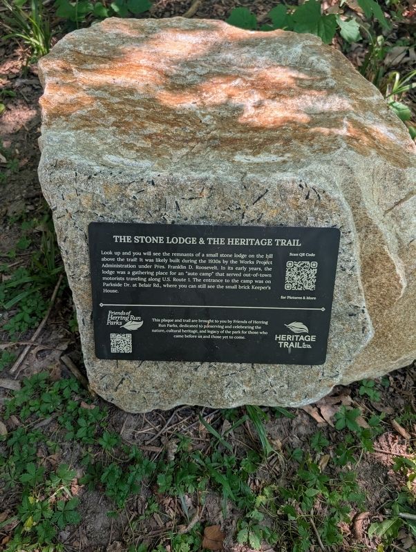
1. The Stone Lodge & The Heritage Trail Marker
This plaque and trail are brought to you by Friends of Herring Run Parks, dedicated to preserving and celebrating the nature, cultural heritage, and legacy of the park for those who came before us and those yet to come.
Erected 2024 by Friends of Herring Run Parks.
Topics and series. This historical marker is listed in these topic lists: Parks & Recreational Areas • Roads & Vehicles. In addition, it is included in the Works Progress Administration (WPA) projects series list.
Location. 39° 19.659′ N, 76° 34.08′ W. Marker is in Baltimore, Maryland. It is in Belair-Parkside. It can be reached from Parkside Drive. The
this page online

Regionally, this marker is in Central Maryland. It is also in the American Mid-Atlantic, in the Chesapeake Bay Region, and on the Eastern Seaboard. Globally, it is in the North Atlantic Region, North America, the Western Hemisphere, the Western World, and the Anglosphere. Historically, it finds itself in what was once one of the original Thirteen Colonies and also the Antebellum South.
Other nearby markers. At least 8 other markers are within walking distance of this marker: Colored Citizen's League Holds Jubilee! (about 600 feet away, measured in a direct line); World War I Memorial (about 700 feet away); 11,000 Year Old Campsite Along Heritage Trail (approx. 0.2 miles away); Estates Divide Creating Herring Run Park (approx. 0.2 miles away); A Champion: a Survivor of Dutch Elm Disease (approx. 0.3 miles away); Emeline Jones: Renowned Chef of the 1800's (approx. 0.3 miles away); Furley Hall (approx. half a mile away); Morgan Park & Recreation During Segregation
Photographed by Mark P. Brock-Cancellieri, August 5, 2026
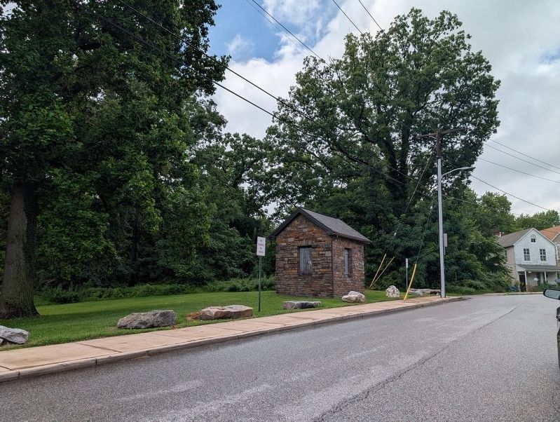
2. the small brick Keeper's House at Parkside Dr. and Belair Rd.
Another marker is no longer nearby. Eutaw Manor (was approx. 0.3 miles away but has been permanently removed).
More about this marker. A link for information including a map of the whole Heritage Trail from the sponsoring organization: https://www.friendsofherringrun.org/heritage-trail-at-herring-run-park.html
Photographed by Mark P. Brock-Cancellieri, September 18, 2026
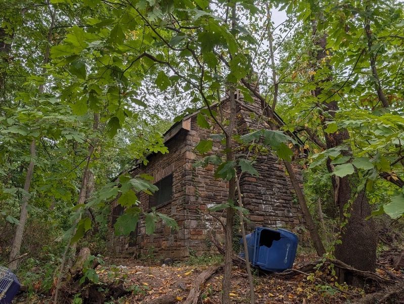
3. The Stone Lodge remnants
Credits. This page was last revised on September 20, 2026. It was originally submitted on August 2, 2026, by Mark P. Brock-Cancellieri of Baltimore, Maryland. This page has been viewed 22 times since then. Photos: 1. submitted on August 2, 2026, by Mark P. Brock-Cancellieri of Baltimore, Maryland. 2. submitted on August 6, 2026, by Mark P. Brock-Cancellieri of Baltimore, Maryland. 3. submitted on September 20, 2026, by Mark P. Brock-Cancellieri of Baltimore, Maryland. • Andrew Ruppenstein was the editor who published this page.
