Lusby in Calvert County, Maryland — The American Northeast (Mid-Atlantic)
Cove Point Beach
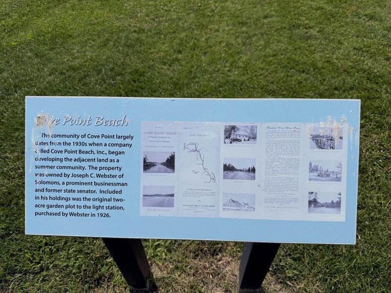
The community of Cove Point largely dates from the 1930s when a company called Cove Point Beach, Inc., began developing the adjacent land as a summer community. The property was owned by Joseph C. Webster of Solomons, a prominent businessman and former state senator. Included in his holdings was the original two-acre garden plot to the light station, purchased by Webster in 1926.
Topics and series. This historical marker is listed in these topic lists: Industry & Commerce • Parks & Recreational Areas • Settlements & Settlers • Waterways & Vessels. In addition, it is included in the Lighthouses series list. A significant historical year for this entry is 1926.
Location. 38° 23.161′ N, 76° 22.936′ W. Marker is in Lusby, Maryland, in Calvert County. It is on Lighthouse Boulevard east of Hemlock Drive, on the right when traveling east. Touch for map. Marker is at or near this postal address: 3500 Lighthouse Blvd, Lusby MD 20657, United States of America. Touch for directions.

Regionally, this marker is in Southern Maryland. It is also in the American South, specifically in the Upper South, in the Mid-Atlantic,
this page online
Other nearby markers. At least 8 other markers are within walking distance of this marker: Enlisted Quarters (a few steps from this marker); Maritime Exchange Tower (within shouting distance of this marker); Keeper's Residence (within shouting distance of this marker); Generator/Fog Signal Building (within shouting distance of this marker); Calvert Cliffs / Cove Point LNG Platform / Chesapeake Bay (within shouting distance of this marker); a different marker also named Generator/Fog Signal Building (within shouting distance of this marker); Cove Point in World War II (within shouting distance of this marker); Lighthouse (within shouting distance of this marker). Touch for a list and map of all markers in Lusby.
Credits. This page was last revised on August 2, 2026. It was originally submitted on August 2, 2026, by Devry Becker Jones of Washington, District of Columbia. This page has been viewed 13 times since then. Photos: 1, 2. submitted on August 2, 2026, by Devry Becker Jones of Washington, District of Columbia.
