Kincardine in Bruce County, Ontario — Central Canada (North America)
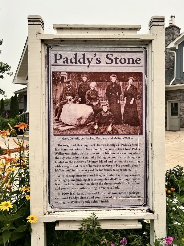
Paddy’s Stone
Photographed by Tim Boyd, July 16, 2026
1. Paddy’s Stone Marker
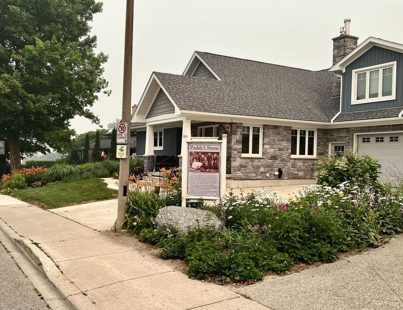
With its conglomerate of rock fragments that has the appearance of a huge plum pudding, it is commonly called "pudding stone". It is not, in fact, uncommon along the shores north of Kincardine and you will see another sitting in Victoria Park.
In 1999 Jack Ross, a retired Canadian government geologist examined Paddy's Stone and you can read his determination by visiting the Walker Family exhibit inside.
Topics. This historical marker is listed in these topic lists: Natural Features • Science & Medicine. A significant historical year for this entry is 1999.
Location. 44° 10.652′ N, 81° 38.279′ W. Marker is in Kincardine, Ontario, in Bruce County. It is at the intersection
this page online

Regionally, this marker is in Georgian Bay Country and in Southwestern Ontario. It is also in Central Canada. Globally, it is in North America, on the Great Lakes, in the Western Hemisphere, in the Western World, and in the Anglosphere. Historically, it finds itself in what was once a British colony, the Viceroyalty of New France, the Haudenosaunee (Iroquois) Confederacy, and Rupert’s Land.
Other nearby markers. At least 7 other markers are within 18 kilometers of this marker, measured as the crow flies: Lighthouses of the Bruce Coast (within shouting distance of this marker); The Kincardine Lighthouse (within shouting distance of this marker); The Phantom Piper (within shouting distance of this marker); The Salt Block (about 150 meters away, measured in a direct line); Sergeant Charles William Mann (about 180 meters away); Point Clark Lighthouse / Phare de la Pointe Clark (approx. 15 kilometers
Photographed by Tim Boyd, July 16, 2026
2. Paddy’s Stone Marker
Credits. This page was last revised on August 3, 2026. It was originally submitted on August 3, 2026, by Tim Boyd of Hamilton, Ontario. This page has been viewed 7 times since then. Photos: 1, 2. submitted on August 3, 2026, by Tim Boyd of Hamilton, Ontario. • Andrew Ruppenstein was the editor who published this page.
