Lexington, Virginia — The American South (Mid-Atlantic)
Original African American Cemetery
Photographed by Kathy Walker, October 19, 2009
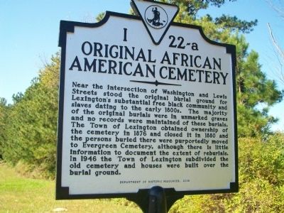
1. Original African American Cemetery Marker
Near the intersection of Washington and Lewis Streets stood the original burial ground for Lexington's substantial free black community and slaves dating to the early 1800's. The majority of the original burials were in unmarked graves and no records were maintained of these burials. The Town of Lexington obtained ownership of the cemetery in 1876 and closed itin 1880 and the persons buried there were purportedly moved to the Evergreen Cemetery, although there is little information to document the extent of reburials. In 1946 the Town Lexington subdivided the old cemetery and houses were built over the burial ground.
Erected 2008 by Department of Historic Resources. (Marker Number I-22-a.)
Topics and series. This historical marker is listed in these topic lists: African Americans • Cemeteries & Burial Sites. In addition, it is included in the Virginia Department of Historic Resources (DHR) series list. A significant historical year for this entry is 1876.
Location. 37° 46.794′ N, 79° 26.037′ W. Marker is in Lexington, Virginia. It is on New Market Place just south of Central Road, on the left when traveling south.
this page online

Regionally, this marker is in the Shenandoah Valley. It is also in the American South and specifically in the Upper South. Globally, it is in North America, the Western Hemisphere, the Western World, and the Anglosphere. Historically, it finds itself in what was once the territory of the Mississippian Culture, one of the original Thirteen Colonies, one of the Confederate States of America, and the Antebellum South.
Other nearby markers. At least 8 other markers are within walking distance of this marker: Lylburn Downing School (approx. 0.4 miles away); Lexington (approx. half a mile away); Lexington and the Green Book (approx. half a mile away); The Sloan House, ca. 1844-45 (approx. half a mile away); Gen. Samuel Houston (approx. half a mile away); Ruth McCulloch (approx. half a mile away); Campbell House, ca. 1845 (approx. half a mile away); Phil "Old Dixie" Nunn (approx. half a mile away). Touch for a list and map of all markers in Lexington.
Another marker is no longer nearby.
Photographed by Bill Coughlin, August 21, 2012
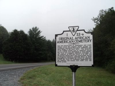
2. Original African American Cemetery Marker
Photographed by Kathy Walker, October 19, 2009
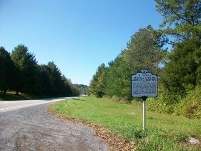
3. Original African American Cemetery Marker
Credits. This page was last revised on August 3, 2026. It was originally submitted on October 29, 2009, by Kathy Walker of Stafford, Virginia. This page has been viewed 2,134 times since then and 61 times this year. Last updated on August 3, 2026, by Stephen Escalera of Roanoke, Virginia. Photos: 1. submitted on October 29, 2009, by Kathy Walker of Stafford, Virginia. 2. submitted on August 21, 2012, by Bill Coughlin of Woodland Park, New Jersey. 3. submitted on October 29, 2009, by Kathy Walker of Stafford, Virginia. • Devry Becker Jones was the editor who published this page.
