Westchester Township in Porter in Porter County, Indiana — The American Midwest (Great Lakes)
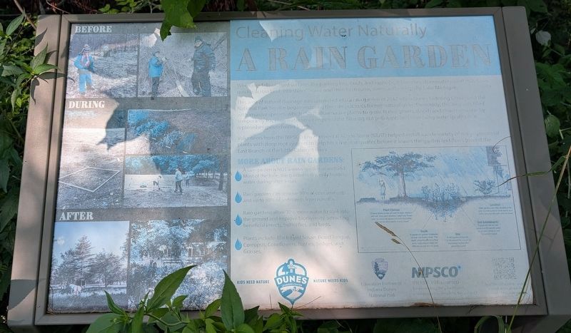
A Rain Garden
Cleaning Water Naturally
Photographed by Daniel Barriball, July 19, 2026
1. A Rain Garden Marker
When rain falls on hard surfaces like parking lots, roads, and rooftops, it becomes stormwater runoff that flows quickly across land, into storm drains, and then to streams, rivers, and eventually Lake Michigan.
This area of natural drainage was converted into a rain garden in 2017 when Dunes Learning Center and the National Park Service began restoring this campus to its former natural glory. Previously, this area was filled with invasive species, which didn't allow native plants to grow. Native plants absorb and clean rainwater by temporarily trapping water so it can percolate, filtering out pollutants and improving water quality as it replenishes groundwater levels.
Volunteers from the NIPSCO Environmental Action Team (NEAT) helped install a wide variety of native perennial plants with deep root systems to help filter the stormwater before it leaves the garden and flows toward the East Branch of the Little Calumet River.
More About Rain Gardens:
A rain garden is not a water garden or wetland. Most of the time, the garden is dry, only holding water during/after a rain.
Rain gardens can remove 90% of contaminants
this page online
Rain gardens allow 30% more water to soak into the ground and improve biodiversity, attracting beneficial insects, butterflies, and birds.
Plants include: Black-Eyed Susan, Beard Tongue, Coreopsis, Coneflowers, Rushes, Sedges, and Grasses.
[Captions:]
Plant Choices
Choose Plants based on need for light, moisture and soil. Vary plant structure, height and flower color for seasonal appeal and butterfly habitat. The use of native plants is encouraged.
Depth
A typical rain garden is between six and nine inches deep. This depth, proportionate to surface area, helps ensure water will infiltrate quickly and not pond.
Size
A rain garden is typically 7 to 20 percent the size of the impervious surface that generates runoff.
Soil Amendments
A good soil mix for rain gardens is 50 percent sand, 30 percent compost, and 20 percent topsoil.
Location
Rain gardens are often located at the end of a roof gutter or drain spout, as a buffer between the lawn and the street.
Erected by Dunes Learning Center, Indiana Dunes National Park, NIPSCO.
Topics. This historical marker is listed
Photographed by Daniel Barriball, July 19, 2026
2. A Rain Garden Marker in context
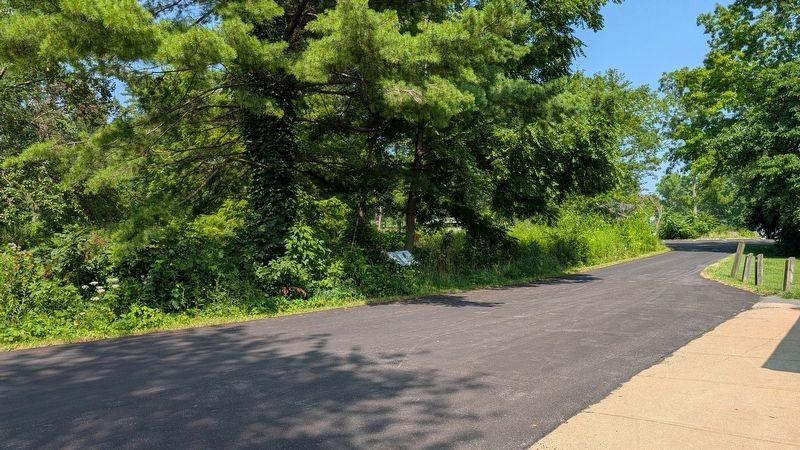
Location. 41° 37.538′ N, 87° 6.098′ W. Marker is in Porter, Indiana, in Porter County. It is in Westchester Township. It can be reached from Howe Road south of West Oak Hill Road, on the right when traveling south. This marker stands on the campus of the Dunes Learning Center within Indiana Dunes National Park. Touch for map. Marker is at or near this postal address: 700 Howe Rd, Chesterton IN 46304, United States of America. Touch for directions.

Regionally, this marker is in Northwest Indiana, specifically on the Indiana Dunes and Lake Michigan Shore, and in the Calumet Region. It is also in the American Midwest and in the Corn Belt. Globally, it is in North America, on the Great Lakes, in the Western Hemisphere, in the Western World, and in the Anglosphere. Historically, it finds itself in what was once the territory of the Mississippian Culture and also the Northwest Territory.
Other nearby markers. At least 8 other markers are within 3 miles of this marker, measured as the crow flies: The Calumet Region, 1822-1835 (approx. 0.4 miles away); Chellberg Farm and the Swedish Community (approx. 0.6 miles away); Cowles Bog (approx. 1½ miles away); Legacy of Steel (approx. 1.6 miles away); Porter War Memorial (approx. 1.7 miles away); In Memory of Joseph Bailly (approx. 1.8 miles away); Dunes Hi-Way (approx. 2.3 miles away); Iron Brigade (approx. 2.4 miles away). Touch for a list and map of all markers in Porter.
Other markers no longer nearby. The Bailly Homestead (was approx. 0.4 miles away but has been confirmed missing); Highways of the Past (was approx. 0.4 miles away but has been confirmed missing).
More about this marker. The Dunes Learning Center is the official outdoor school of Indiana Dunes National Park. Please note: This marker is located within a restricted area of the park. It is not usually open to the public. It may be visited only during public programs.
Also see . . . History and Background of Dunes Learning Center. Official website (Submitted on August 3, 2026, by Daniel Barriball of Chesterton, Indiana.)
Credits. This page was last revised on August 3, 2026. It was originally submitted on August 2, 2026, by Daniel Barriball of Chesterton, Indiana. This page has been viewed 20 times since then. Last updated on August 3, 2026, by Daniel Barriball of Chesterton, Indiana. Photos: 1. submitted on August 2, 2026, by Daniel Barriball of Chesterton, Indiana. 2. submitted on August 3, 2026, by Daniel Barriball of Chesterton, Indiana. • Devry Becker Jones was the editor who published this page.
