Appomattox in Appomattox County, Virginia — The American South (Mid-Atlantic)
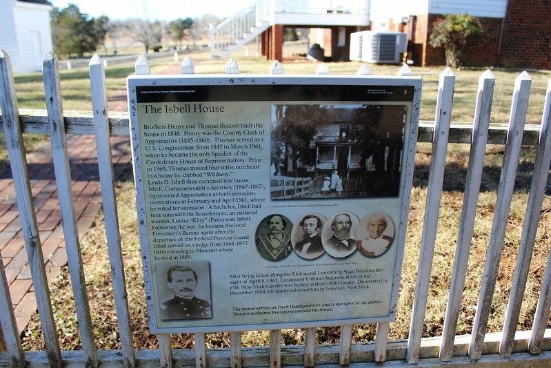
The Isbell House
| — | Appomattox Court House National Historical Park | — |
Photographed by Evan Dwyer, December 20, 2025
1. The Isbell House Marker
After being killed along the Richmond-Lynchburg Stage Road on the night of April 8, 1865, Lieutenant Colonel Augustus Root of the 15th New York Cavalry was buried in front of the house. Disinterred in December 1865, his family reburied him in Syracuse, New York.
The house serves as Park Headquarters and is not open to the public. You are welcome to explore outside the house.
Captions
Lower Left: Lieutenant Colonel Augustus Root
Upper Right: Unidentifed children in front of the Isbell House circa 1901.
Middle Right: Left to Right: Henry Bocock, Thomas Bocock, Lewis Daniel Isbell, Louisa "Kitty" Isbell
Erected by National
this page online
Topics. This historical marker is listed in these topic lists: African Americans • Cemeteries & Burial Sites • War, US Civil. A significant historical month for this entry is March 1861.
Location. 37° 22.591′ N, 78° 47.68′ W. Marker is in Appomattox, Virginia, in Appomattox County. It can be reached from George Peers Drive (at milepost 0.2) north of Old Courthouse Road (Virginia Route 24), on the left when traveling north. Marker is on the east fence of the Isbell House by the parking area for the Park Rangers that use the building. The trace of Bocock Drive, which is part of the park's walking trail system, is directly adjacent. George Peers Drive is the nearest named automobile-accessible roadway. Touch for map. Marker is at or near this postal address: 241 Bocock Ln, Appomattox VA 24522, United States of America. Touch for directions.

Regionally, this marker is in the Piedmont and in Central Virginia. It is also in the American South and specifically in the Upper South. Globally, it is in North America, the Western Hemisphere, the Western World, and the Anglosphere. Historically,

Photographed by Tom Bosse, July 4, 2026
2. The Isbell House Marker
Other nearby markers. At least 8 other markers are within walking distance of this marker: "Now I see the white flag earnestly borne…" (about 300 feet away, measured in a direct line); The Robinson Family (about 500 feet away); The Kelley Family (about 500 feet away); a different marker also named The Isbell House (about 500 feet away); Anticipating Freedom (about 500 feet away); Appomattox Court House (about 500 feet away); The Surrender Ceremony (about 500 feet away); Final Combat (about 600 feet away). Touch for a list and map of all markers in Appomattox.
Other markers no longer nearby. County Jail (was about 400 feet away but has been confirmed missing); April 1865 (was about 500 feet away but has been permanently removed).
Related marker. Click here for another marker that is related to this marker. The linked marker is a near duplicate of this one, but on the main visitor pedestrian path to the west.

Photographed by Tom Bosse, July 4, 2026
3. The Isbell House (Back)
Photographed by Evan Dwyer, December 20, 2025
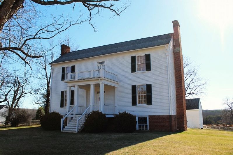
4. The Isbell House
Front elevation view.
Credits. This page was last revised on August 5, 2026. It was originally submitted on August 4, 2026, by Evan Dwyer of Richmond, Virginia. This page has been viewed 24 times since then. Photos: 1. submitted on August 4, 2026, by Evan Dwyer of Richmond, Virginia. 2, 3. submitted on July 27, 2026, by Tom Bosse of Jefferson City, Tennessee. 4. submitted on August 4, 2026, by Evan Dwyer of Richmond, Virginia.
