Bold Point Park in East Providence in Providence County, Rhode Island — The American Northeast (New England)
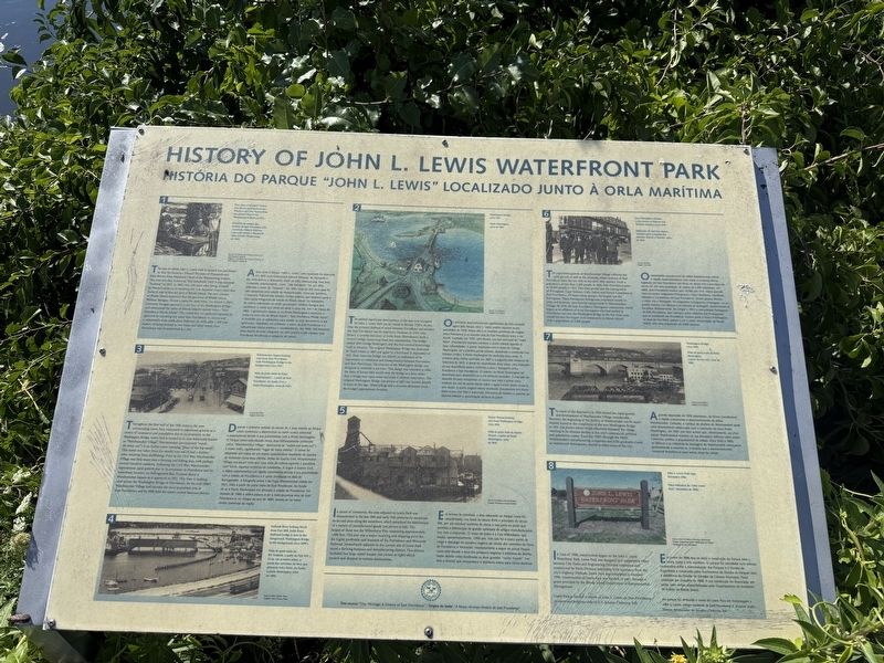
History of John L. Lewis Waterfront Park
Photographed by G.W.Bartlett, August 5, 2026
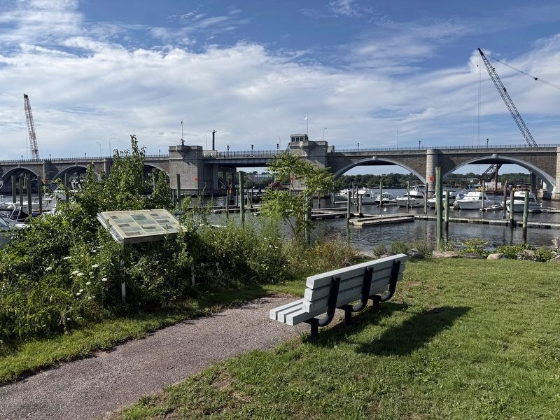
1. History of John L. Lewis Waterfront Park Marker
1. The area in which John L. Lewis Park is located was purchased in 1641 by Governor Edward Winslow of Plymouth and John Brown from Massasoit, Chief of the Wampanoag Indians. This area was first known as "Old Rehoboth" until being renamed "Seekonk" in 1812. In 1861, over 220 years after being claimed by Massachusetts as its territory, the U.S. Supreme Court ruled that Seekonk was to become part of Rhode Island. The new citizens of Rhode Island requested that the governor of Rhode Island, William Sprague, choose a name for their town. On March 1, 1862, Governor Sprague appeared at the foot of the Washington Briedge and announced the name of Rode Island's newest town -- "East Providence, Rhode Island". The crowd that was gathered signaled its approval by repeating the name East Providence in unison and a community wide celebration followed. In 1958, after a 300 year history of being located in two states and three towns, East Providence was incorporated as a city.
2. The earliest significant development of the area now occupied by John L. Lewis Park can be traced to the late 1700's. At this time the primary method of
this page online
3. Throughout the first half of the 19th century, the area surrounding Lewis Park continued to experience growth as a center of commerce and population due to its proximity to the Washington
Photographed by G.W.Bartlett, August 5, 2026
2. History of John L. Lewis Waterfront Park Marker
4. (No narrative text - see image captions)
5. In terms of commerce, the area adjacent to Lewis Park was characterized in the late 18th and early 19th centuries by numerous docs and piers along the waterfront, which permitted the distribution of a variety of manufactured goods (see picture at left). The largest
Photographed by G.W.Bartlett, August 14, 2026
3. History of John L. Lewis Waterfront Park Marker
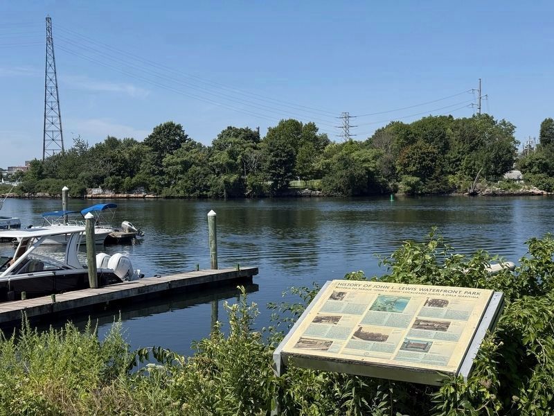
View across the Seekonk River to the historical west abutments of the railroad and original Washington bridges.
6. The population growth of Watchemoket Village reflected the rapid growth as well as the changing ethnic makeup of East Providence from the late 19th to the early 20th century. From a population of less than 2,200 people in 1865, East Providence grew to 18,584 people in 1915. This time period saw the immigration of Portuguese, Cape Verdean, Irish, Italian and French Canadians to East Providence. Of these ethnic groups, the largest was the Portuguese. These Portuguese immigrants, employed mostly in mills and factories, were heavily concentrated in Watchemoket Village. By 1910, the East Providence Portuguese community, which began as an offshoot of those Portuguese who had settled in Providence just over the Washington Bridge in the Fox Point area, would become the largest such community in Rhode Island with a population of 5,500 people.
7. The onset of the depression in 1930 slowed the rapid growth and development of Watchmoket Village considerably. However, the beginning of the decline of Watchemoket can be more directly traced to the completion of the new Washington Bridge in 1931 (see picture above) which effectively bypassed the village, resulting in its ultimate demise as the city's commercial, political and population center. From the 1940's through the 1960's Watchemoket;'s manufacturing companies and mills gradually closed as commercial development moved to other areas of the city.
8. In June of 1996, construction began on the John L. Lewis Waterfront Park. Lewis Park was designed in a cooperative effort between City Parks and Engineering Division employees and constructed by Parks Division employees with assistance from the city's Highway Division. Lewis Park was completed in October 1996. Construction of Lewis Park was funded, in part, through a grant provided by the Rhode Island Department of Environmental Management.
Lewis Park is named in honor of John L. Lewis, an East Providence resident and longtime aide to U.S. Senator Claiborne Pell.
Source: "Our Heritage: A History of East Providence"
(image captions)
1. Depiction of purchase of East Providence land by Governor Winslow and John Brown from Massasoit, Chief of the Wampanoag Indians in 1641. (Source: "Providence The Southern Gateway to New England", page 18)
2. Washington Bridge circa 1831. (Source: Len Erikson)
3. Watchemoket Square looking west from East Providence with Washington Bridge in the background circa 1921. (Source: Jess Welt)
4. Seekonk River looking north from Fort Hill. India Point Railroad bridge is seen in the foreground, Washington Bridge in the background, circa 1890's. (Source: John's Barber Shop)
5. Oyster Houses looking east from Washington Bridge, circa 1910. (Source: Providence Journal Bulletin)
6. East Providence citizens at the corner of Warren and Taunton Avenues, circa 1920. (Source: Jess Welt)
7. Washington Bridge, circa 1950. (Source: Len Erickson)
8. John L. Lewis Park sign, November 1996. (Source: East Providence Planning Department)
Erected by City of East Providence.
Topics. This historical marker is listed in these topic lists: Bridges & Viaducts • Parks & Recreational Areas • Railroads & Streetcars • Waterways & Vessels. A significant historical date for this entry is March 1, 1862.
Location. 41° 49.058′ N, 71° 23.186′ W. Marker is in East Providence, Rhode Island, in Providence County. It is in Bold Point Park. It can be reached from the intersection of Water Street and Mauran Avenue, on the left when traveling north. Touch for map. Marker is at or near this postal address: 1 Pier Rd, East Providence RI 02914, United States of America. Touch for directions.

Regionally, this marker is in Greater Providence and on Narragansett Bay. It is also in the American Northeast, in New England, and on the Eastern Seaboard. Globally, it is in the North Atlantic Region, North America, the Western Hemisphere, the Western World, and the Anglosphere. Historically, it finds itself in what was once one of the original Thirteen Colonies.
Other nearby markers. At least 8 other markers are within walking distance of this marker: Roger Williams Landing 1636 (about 500 feet away, measured in a direct line); Bridging the Seekonk (about 500 feet away); Head of Narragansett Bay / Crossing the Seekonk River (about 500 feet away); West Bank / East Bank / Washington Bridges (about 500 feet away); Washington Bridge (approx. 0.2 miles away); McDowell-Slade Memorial Bridge (approx. 0.2 miles away); Tockwotton and the Indiamen / Sails to Rails 1835: Providence's First Train Station (approx. 0.2 miles away); Four Cannon Fort (approx. ¼ mile away). Touch for a list and map of all markers in East Providence.
Related marker. Click here for another marker that is related to this marker. Bridging the Seekonk
Credits. This page was last revised on September 15, 2026. It was originally submitted on August 5, 2026, by G.W.Bartlett of Hingham, Massachusetts. This page has been viewed 34 times since then. Photos: 1, 2. submitted on August 5, 2026, by G.W.Bartlett of Hingham, Massachusetts. 3. submitted on August 14, 2026, by G.W.Bartlett of Hingham, Massachusetts. • Michael Herrick was the editor who published this page.
Editor’s want-list for this marker. Transcription of the Portuguese text. • Can you help?
