Big Bog State Recreation Area near Waskish in Beltrami County, Minnesota — The American Midwest (Upper Plains)
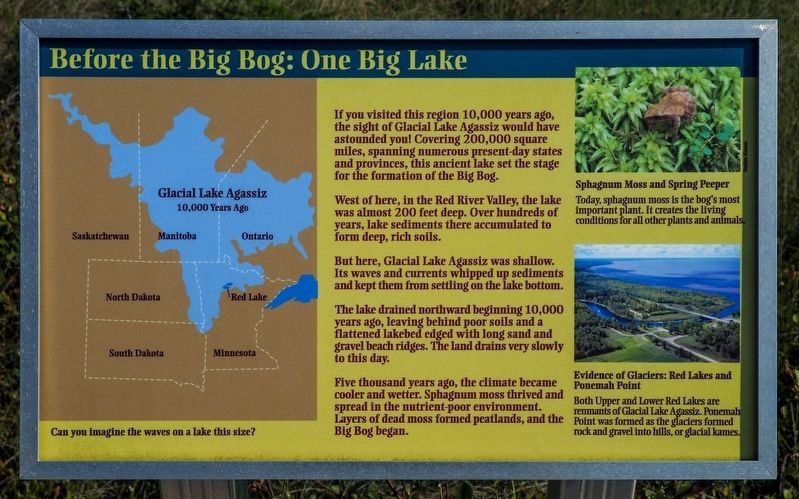
Before the Big Bog: One Big Lake
Photographed by McGhiever, August 31, 2021
1. Before the Big Bog: One Big Lake Marker
Can you imagine the waves on a lake this size?
If you visited this region 10,000 years ago, the sight of Glacial Lake Agassiz would have astounded you! Covering 200,000 square miles, spanning numerous present-day states and provinces, this ancient lake set the stage for the formation of the Big Bog.
West of here, in the Red River Valley, the lake was almost 200 feet deep. Over hundreds of years, lake sediments there accumulated to form deep, rich soils.
But here, Glacial Lake Agassiz was shallow. Its waves and currents whipped up sediments and kept them from settling on the lake bottom.
The lake drained northward beginning 10,000 years ago, leaving behind poor soils and a flattened lakebed edged with long sand and gravel beach ridges. The land drains very slowly to this day.
Five thousand years ago, the climate became cooler and wetter. Sphagnum moss thrived and spread in the nutrient-poor environment. Layers of dead moss formed peatlands, and the Big Bog began.
Sphagnum Moss and Spring Peeper
Today, sphagnum moss is the bog's most important plant. It creates the living conditions for all other plants and animals.
Evidence of Glaciers: Red Lakes and Ponemah Point
Both Upper and Lower Red Lakes are remnants of Glacial Lake Agassiz. Ponemah Point was formed as the glaciers formed rock and gravel into hils, or glacial kames.
Erected by the
this page online
Topics. This historical marker is listed in these topic lists: Environment • Waterways & Vessels.
Location. 48° 18.025′ N, 94° 34.065′ W. Marker is near Waskish, Minnesota, in Beltrami County. It is in the Big Bog State Recreation Area. It can be reached from State Highway 72, on the left when traveling north. The marker is in the northern unit of Big Bog State Recreation Area (fee area) at the end of the Bog Boardwalk trail. Touch for map. Marker is in this post office area: Waskish MN 56685, United States of America. Touch for directions.

Regionally, this marker is in the Northland. It is also in the American Midwest and in the Corn Belt. Globally, it is in North America, the Great North Woods, the Western Hemisphere, the Western World, and the Anglosphere. Historically, it finds itself in what was once Rupert’s Land, the territory of the Mississippian Culture, the Louisiana Purchase, and the Northwest Territory.
Other nearby markers. At least 8 other markers are within 9 miles of this marker, measured as the crow flies:
Photographed by McGhiever, August 31, 2021
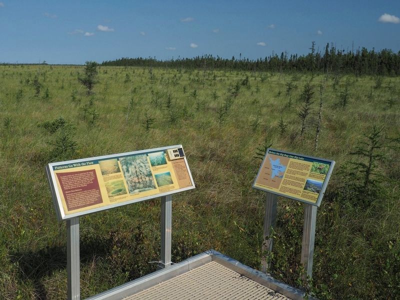
2. Before the Big Bog Marker (right) at the end of the Bog Boardwalk trail
Credits. This page was last revised on August 6, 2026. It was originally submitted on August 6, 2026, by McGhiever of Minneapolis, Minnesota. This page has been viewed 13 times since then. Photos: 1, 2. submitted on August 6, 2026, by McGhiever of Minneapolis, Minnesota.
