Near Fort Peck in McCone County, Montana — The American West (Mountains)
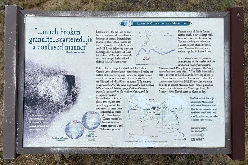
"...much broken grannite...scattered...in a confused manner"
-Meriwether Lewis, May 8, 1805
| — | Lewis & Clark on the Missouri | — |
June 21, 2026
1. "...much broken grannite...scattered...in a confused manner" Marker
Radical climate change has also shaped this landscape. Captain Lewis observed great rounded stones littering the surface of the northern plains that did not appear to have come from any local outcrop. Here at the confluence of the Missouri and Milk Rivers, he noted: "The country on the Lard.side of the river is generally high broken hills, with much broken, grey black and brown grannite scattered on the surface of the earth in a confused manner..." The confusing rocks were glacial erratics, left here by melting glaciers. The most recent of many great continental ice sheets that flowed out of Canada reached its farthest southern extent between 15 and 20 thousand years ago.
In the area around Fort Peck, many of the glacial erratics, like this one, are rounded pink
this page online
North Polar and Greenland ice sheets today
Continental ice sheet 15-20,000 years ago
Globes modified from National Oceanic Atmospheric Administration (NOAA)
Because much of the ice formed farther north, it carried large rocks from as far away as Hudson's Bay. You are standing near where the glaciers stopped advancing south across Montana-the point where melting equaled its forward flow.
Lewis also observed, "...from the appearance of the vallies and the timber on each of the streams [Missouri and Milk] Capt C. supposed that they were about the same size..." The Milk River valley here is as broad as the Missouri River valley although its channel is much smaller. This is less peculiar if you consider that the present Milk River valley was once home to an ancient Missouri River. Before glacial ice diverted it south toward the Mississippi River, the Missouri River flowed north to Hudson's Bay.
Fort Peck is not the first major dam across the Missouri River – not by tens of thousands of years! When the great continental glacier moved down from Canada, a wall of ice blocked the rivers and
June 21, 2026
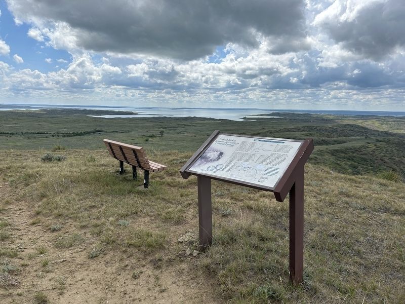
2. "...much broken grannite...scattered...in a confused manner" Marker
Map compiled by Sheila Roberts (2006) from Wayne and others (1991), Lemke and others (1965), Thombury (1965) and Howard (1958).
Excerpts taken from: The Journals of the Lewis & Clark Expedition: Volume Four, April 7- July 27, 1805. Gary E. Moulton, Editor.
Erected by The University of Montana Western, US Army Corps of Engineers Omaha District.
Topics and series. This historical marker is listed in these topic lists: Environment • Exploration • Waterways & Vessels. In addition, it is included in the Lewis & Clark Expedition series list. A significant historical date for this entry is May 8, 1805.
Location. 48° 1.738′ N, 106° 19.179′ W. Marker is near Fort Peck, Montana, in McCone County. It can be reached from L and C Observation Road 0.2 miles north of Fort Peck Tower Hill Road. Located at the Lewis & Clark Milk River Observation Point. Touch for map. Marker is in this post office area: Nashua MT 59248, United States of America. Touch for directions.

Regionally, this marker is in the American Mountain West, in the Lewis & Clark Corridor, on the prairies, on the Great Plains, and specifically
June 21, 2026
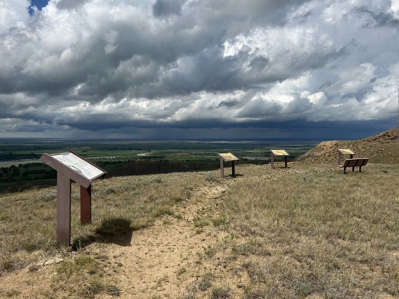
3. "...much broken grannite...scattered...in a confused manner" Marker
The confluence of the Missouri and Milk Rivers can be seen in the distant background.
Other nearby markers. At least 8 other markers are within 4 miles of this marker, measured as the crow flies: "these appearances of cottonwood were quite reviving" (a few steps from this marker); Welcome to the Milk River Observation Point (a few steps from this marker); "we do not wish to see those gentlemen" (a few steps from this marker); a different marker also named Welcome to the Milk River Observation Point (about 500 feet away, measured in a direct line); Fort Peck Spillway (approx. 1.6 miles away); Peculiar White Water Named the Milk River (approx. 3½ miles away); With No Running Water, the Stream was called Big Dry River (approx. 3½ miles away); Summits of High Hills Were Covered with Pine (approx. 3½ miles away). Touch for a list and map of all markers in Fort Peck.
June 21, 2026
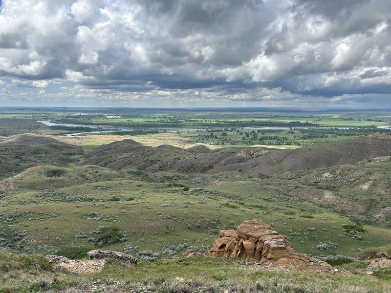
4. Nearby view of the Missouri River and its confluence with the Milk River (right edge)
Credits. This page was last revised on August 8, 2026. It was originally submitted on August 6, 2026. This page has been viewed 22 times since then. Photos: 1, 2, 3. submitted on August 6, 2026. 4. submitted on August 8, 2026.
