
Dublin in County Dublin, Leinster, Ireland — Mid-East (and Dublin)
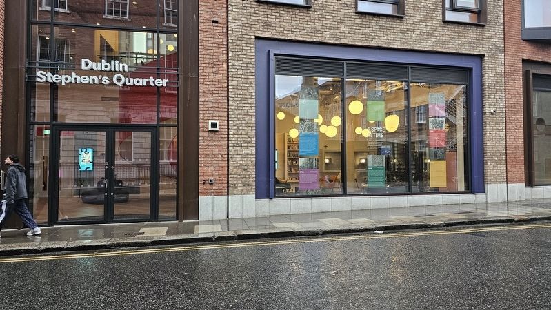
A Space in Time
Photographed by Ian Lefkowitz, May 18, 2026
1. A Space in Time Marker
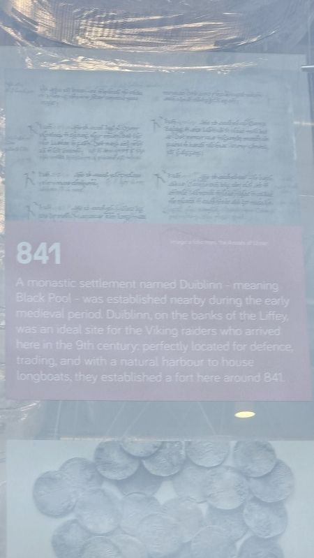
841
A monastic settlement named Duiblinn — meaning Black Pool — was established nearby during the early medieval period. Duiblinn, on the banks of the Liffey, was an ideal site for the Viking raiders who arrived here in the 9th century: perfectly located for defence, trading, and with a natural harbour to house longboats, they established a fort here around 841.
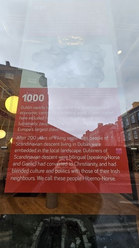
1000
Dublin rapidly became one of the most important economic centres in the Viking world. Goods traded here included hides, furs, iron, salt, and most lucratively: people. In the 11th century, Dublin became Europe’s largest slave market.
After 200 years of Viking settlement, people of Scandinavian descent living in Dublin were embedded in the local landscape. Dubliners of Scandinavian descent were bilingual (speaking Norse and Gaelic) had converted to Christianity, and had blended culture and politics with those of their Irish neighbours. We call these people Hiberno-Norse.
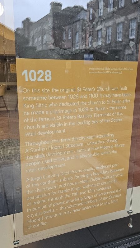
1028
On this site, the
this page online
Throughout this time, the city kept expanding. A Sunken Floored Structure — unearthed during this site’s development — hints at how Hiberno-Norse people used to live, and is also visible within the retail development.
A large Curving Ditch found onsite, enclosed part of the southern suburb, forming a boundary between the churchyard and house plots. Dublin was a crucial possession for Gaelic Kings wishing to control all of Ireland through the 11th and 12th centuries. In pursuit of power, attacking kings often burned the city’s suburbs – the scorched timbers of the Sunken Floored Structure may bear testament to this kind of conflict.
1042
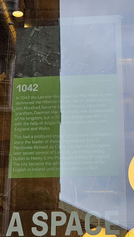
In 1042 the Leinster King Diarmait Mac Máel na mBó dethroned the Hiberno-Norse ruler of Dublin and his son, Murchad, became king of the city. Murchad’s grandson, Diarmait Mac Murchada, was dispossessed
Photographed by Ian Lefkowitz, May 18, 2026
2. A Space in Time: 841
This had a profound impact on Ireland’s colonisation story: the leader of these mercenaries, Earl of Pembroke Richard de Clare — known as Strongbow — later seized control of Leinster, ultimately ceding Dublin to Henry II, the Plantagenet King of England. The city became the administrative centre of the English in Ireland until independence in 1921.
1370
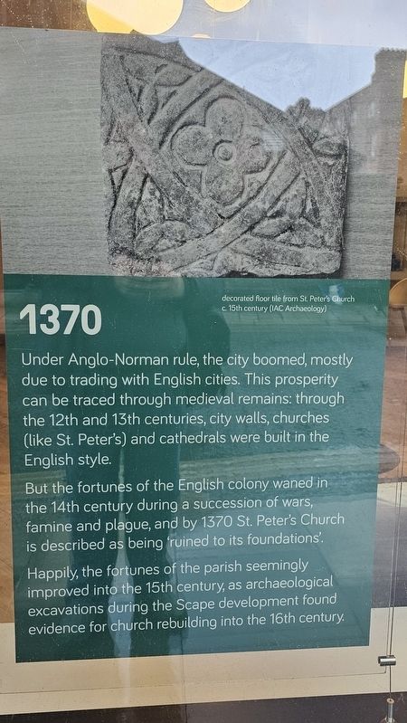
Under Anglo-Norman rule, the city boomed, mostly due to trading with English cities. This prosperity can be traced through medieval remains: through the 12th and 13th centuries, city walls, churches (like St. Peter’s) and cathedrals were built in the English style.
But the fortunes of the English colony waned in the 14th century during a succession of wars, famine and plague, and by 1370 St. Peter’s Church is described as being ‘ruined to its foundations’.
Happily, the fortunes of the parish seemingly improved into the 15th century, as archaeological excavations during the Scape development found evidence for church rebuilding into the 16th century.
1660
In 1539, Henry
Photographed by Ian Lefkowitz, May 18, 2026
3. A Space in Time: 1000
1733
Aungier’s development attracted the rich and affluent, and by the early 18th century the area became the most fashionable suburb of the city.
A lavish theatre sprung up in 1733. For 15 years this New Theatre Royal, or Aungier Street Theatre, produced a rich and varied programme, though the manager of Smock Alley Theatre called the building a ‘very sumptuous but very bad theatre.’ The playhouse closed its doors in 1750, but left behind a clue to its former use: a ‘pit trap’, used to raise actors to the stage, was uncovered during excavations.
This
Photographed by Ian Lefkowitz, May 18, 2026
4. A Space in Time: 1028
1770
The theatre plot was redeveloped in the 1770s to create four Georgian townhouses. Portions of these have been rebuilt into the Longford Street façade. Later elements of Nos 73 and 74 Aungier St also date to this period and these buildings have been refurbished ensuring the Scape development incorporates and celebrates elements spanning the centuries of Dublin’s rich history.
Topics. This historical marker is listed in these topic lists: Anthropology & Archaeology • Entertainment • Religion & Religious Structures • Wars, Non-US. A significant historical year for this entry is 841 CE.
Location. 53° 20.478′ N, 6° 15.991′ W. Marker is in Dublin, Leinster, in County Dublin. It is on Stephen Street Upper east of Ship Street Great, on the right when traveling east. Touch for map. Marker is at or near this postal address: 6 Stephen Street Upper, Dublin, Leinster, Ireland. Touch for directions.

Regionally, this marker is in the Ancient East. Globally, it is on the Atlantic Ocean, in the North Atlantic Region, in Europe, on the Island of Ireland, on the Celtic Fringe, in the European Union, in Atlantic Europe, on one of the British Isles, in the Western World, and in the Anglosphere.
Other nearby markers. At least 8 other markers are within walking distance of this marker: First Pneumatic Tyre Factory (within
Photographed by Ian Lefkowitz, May 18, 2026
5. A Space in Time: 1042
Photographed by Ian Lefkowitz, May 18, 2026
6. A Space in Time: 1370
Credits. This page was last revised on August 28, 2026. It was originally submitted on August 8, 2026, by Ian Lefkowitz of New York, New York. This page has been viewed 14 times since then. Photos: 1, 2, 3, 4, 5, 6. submitted on August 8, 2026, by Ian Lefkowitz of New York, New York. • Andrew Ruppenstein was the editor who published this page.
