
McDowell in Highland County, Virginia — The American South (Mid-Atlantic)
Battle of McDowell
May 8, 1862 • Stonewall Jackson's Valley Campaign
| — | Shenandoah Valley Battlefields Historic District | — |
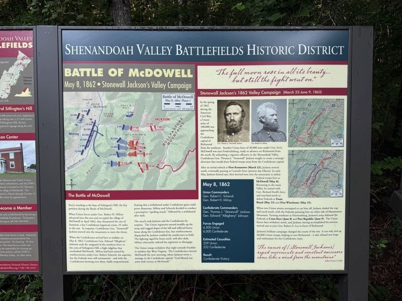
The Battle of McDowell
You're standing at the base of Sitlington's Hill, the key position during the Battle of McDowell.
When Union forces under Gen. Robert H. Milroy advanced into this area and occupied the village of McDowell in April 1862, they threatened the city of Staunton, a key Confederate logistical center, 25 miles to the east. In response, Confederate Gen. "Stonewall" Jackson moved into the mountains to meet the threat.
When the Confederates arrived here at midday on May 8, 1862, confederate Gen. Edward "Allegheny" Johnson took the vanguard of the southern force to the crest of Sitlington's Hill, a high ridgeline that overlooked McDowell. Milroy had been joined by reinforcements under Gen. Robert Schenck, his superior, but the Federals were still outmanned —and with the Confederates looming over them, badly outpositioned.
Fearing that a withdrawal under Confederate guns could prove disastrous, Milroy and Schenck, decided to conduct a preemtive "spoiling attack," followed by a withdrawal after dark.
The attack took Jackson and the Confederates by surprise. The Union regiments moved steadily up the
this page online
The Union troops withdrew that night towards Franklin in modern-day West Virginia. The Confederates entered McDowell the next morning, where Jackson wrote a message to the Confederate capitol, "God bless our arms with victory at McDowell."
"The full moon rose in all its beauty… but still the fight went on."
Stonewall Jackson's 1862 Valley Campaign (March 23-June 9, 1862)
In the spring of 1862 during the American Civil War, a Union army of 100,000 was approaching the Confederate capital Richmond from the southeast. Another Union force of 30,000 men under Gen. Irvin McDowell was near Fredericksburg, ready to advance on Richmond from the north. By unleashing a vigorous offensive in the Shenandoah Valley, Confederate Gen. Thomas J. "Stonewall" Jackson sought to create a strategic diversion that would draw Federal troops away from the Confederate capital.
After
When two Union armies attempted to cut him off, Jackson eluded the trap and raced south, with the Federals pursuing him on either side of Massanutten Mountain. Turning southeast at Harrisonburg, Jackson's army defeated the Federals at Cross Keys (June 8) and Port Republic (June 9). The Union forces then withdrew north, and Jackson, having accomplished his mission, moved east to join Gen. Robert E. Lee in front of Richmond.
Jackson's brilliant campaign changed the course of the war. It not only tied up 60,000 Union troops, helping to save Richmond — it also infused new hope and enthusiasm for the Confederate cause.
"The rumor of [Stonewall Jackson's] rapid movement and constant successes came like a wind from the mountains."
- John Esten Cooke
May 8, 1862
Union Commanders
Gen. Robert C. Schenck • Gen. Robert H. Milroy
Confederate Commanders
Gen. Thomas J. "Stonewall" Jackson • Gen. Edward "Allegheny" Johnson
Forces Engaged
6,500 Union • 6,000 Confederates
Estimated Casualties
259 Union • 532 Confederate
Result:
Confederate Victory
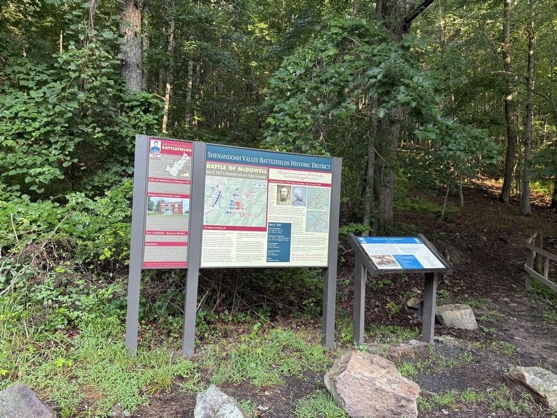
Erected by Shenandoah Valley Battlefields Foundation.
Topics. This historical marker is listed in this topic list: War, US Civil. A significant historical date for this entry is May 8, 1862.
Location. 38° 19.463′ N, 79° 27.954′ W. Marker is in McDowell, Virginia, in Highland County. It is on Highland Turnpike (U.S. 250) east of Bertie Lane, on the left when traveling west. Touch for map. Marker is at or near this postal address: 10561 Highland Turnpike, Mc Dowell VA 24458, United States of America. Touch for directions.

Regionally, this marker is in Virginia’s Shenandoah Valley, in the Alleghany Highlands, and specifically in the Potomac Highlands. It is also in the American South, specifically in the Upper South, in Appalachia, and specifically in Southern Appalachia. Globally, it is in North America, the Western Hemisphere, the Western World, and the Anglosphere. Historically, it finds itself in what was once the territory of the Mississippian Culture, one of the original Thirteen Colonies, one of the Confederate States of America, and the Antebellum South.
Other nearby markers. At least 8 other markers are within walking distance of this marker: Shenandoah Valley Battlefields (here, next to this marker); a different marker also named Battle of McDowell (here, next to this marker); Anthony's Burg (a few steps from this marker); A Road From The Past (a few steps from this marker); Confederates Hold the High Ground (about 500 feet away, measured in a direct line); Two Plans Of Attack (approx. 0.2 miles away); Moving Uphill (approx. ¼ mile away); The Ravines (approx. 0.3 miles away). Touch for a list and map of all markers in McDowell.
Other markers no longer nearby. The Battle of McDowell (was a few steps from this marker but has been replaced with another marker now near it); a different marker also named Battle of McDowell (was a few steps from this marker but has been permanently removed); a different marker also named The Battle of McDowell (was a few steps from this marker but has been permanently removed); a different marker also named Battle of McDowell (was within shouting distance of this marker but has been permanently removed).
Credits. This page was last revised on August 9, 2026. It was originally submitted on August 9, 2026, by Devry Becker Jones of Washington, District of Columbia. This page has been viewed 11 times since then. Photos: 1, 2. submitted on August 9, 2026, by Devry Becker Jones of Washington, District of Columbia.
