Zigler in Pendleton County, West Virginia — The American South (Appalachia)
Johann Zacharias Rexrode, Jr.
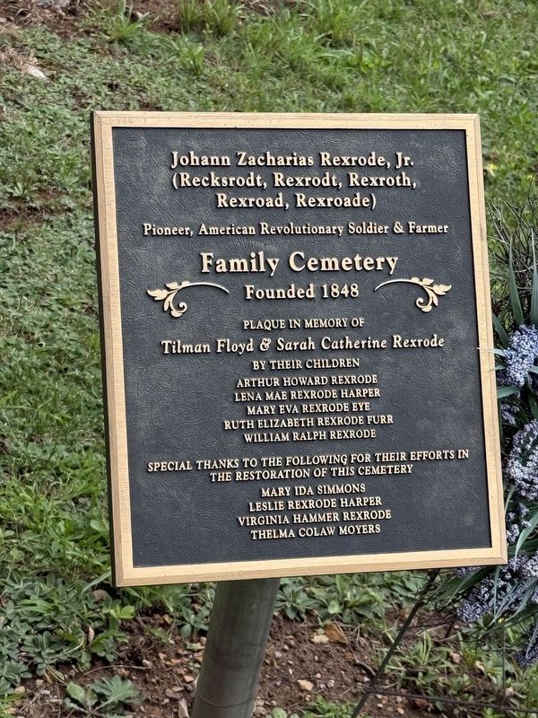
(Recksrodt, Rexrodt, Rexroth, Rexroad, Rexroade)
Pioneer, American Revolutionary Soldier & Farmer
Family Cemetery
Founded 1848
Plaque in memory of
Tilman Floyd & Sarah Catherine Rexroad
by their children
Arthur Howard Rexrode • Lena Mae Rexrode Harper • Mary Eva Rexrode Eye • Ruth Elizabeth Rexrode Furr • William Ralph Rexrode
Special thanks to the following their efforts in the restoration of this cemetery
Mary Ida Simmons • Leslie Rexrode Harper • Virginia Hammer Rexrode • Thelma Colaw Moyers
Erected 2018 by the children of Tilman Floyd & Sarah Cathereine Rexrode.
Topics. This historical marker is listed in these topic lists: Agriculture • Cemeteries & Burial Sites • Settlements & Settlers • War, US Revolutionary. A significant historical year for this entry is 1848.
Location. 38° 34.631′ N, 79° 25.046′ W. Marker is in Zigler, West Virginia, in Pendleton County. It is on U.S. 220 4.8 miles west of Thorn Creek Road, on the right when traveling north. Touch for map. Marker is in this post office area: Franklin WV 26807, United States of America. Touch for directions.

Regionally,
this page online
Other nearby markers. At least 8 other markers are within 7 miles of this marker, measured as the crow flies: Trout Rock Fort (approx. 3.1 miles away); Destruction of Saltpeter Works (approx. 3.1 miles away); Jackson's Prayer Service (approx. 4.8 miles away); Devonian Shale (approx. 5 miles away); Civil War Soldiers Monument (approx. 6.4 miles away); Pendleton County World War I Memorial (approx. 6.4 miles away); Pendleton County Court House (approx. 6.4 miles away); Franklin (approx. 6.4 miles away).
Other markers no longer nearby. Trout Rock (was approx. 3.1 miles away but has been permanently removed); Confederate Prayer Service (was approx. 4.8 miles away but has been reported to have been replaced with another marker now near it); McCoy House (was approx. 6.4 miles away but has been replaced with
Credits. This page was last revised on August 9, 2026. It was originally submitted on August 9, 2026, by Devry Becker Jones of Washington, District of Columbia. This page has been viewed 15 times since then. Photos: 1, 2, 3. submitted on August 9, 2026, by Devry Becker Jones of Washington, District of Columbia.
