Dodge City in Ford County, Kansas — The American Midwest (Upper Plains)
Dodge City's Mexican Village
A city within a city

Photographed by Cosmos Mariner, August 19, 2022
1. Dodge City's Mexican Village Marker
From the beginning of the 20th century until 1955, a small ethnic community grew on the eastern outskirts of Dodge City. Immigrants from Mexico came seeking a better life; most found employment with the railroad. This tiny city within a city was called the “Mexican Village.” It stood less than a mile southeast of this sign.
The first Atchison, Topeka & Santa Fe train arrived in Dodge City in August 1872. As business increased, the company looked to the south to expand its labor force. At the same time, violent political upheaval in Mexico led to a wave of northward emigration. Many men began working for railroads in the region and soon the Santa Fe actively recruited south of the border.
The first laborers were seasonal, working through the summer and returning to Mexico in the winter. In Dodge City, they lived in cramped, temporary quarters — tents or idle boxcars. Later, the Mexican men began to stay year-round, and were eventually followed by their families. The railroad agreed to allow tenants to settle on company land, as long as the head of the household was employed by the Santa Fe. Plots were leased at fifty cents
this page online
The Mexican Village had no real establishment date, no formal founding or declaration proclaiming it an official town. It had no legal name. It was sometimes called “La Colonia,”, “La Yarda,” “Little Mexico,” or just “The Village.” Families lived on railroad property as early as 1903. New villagers came as late as the 1940s. Many residents built their own homes from railroad ties and discarded boxcar sides, or in at least one case, sod. Dirt floors were common, as were outhouses. None of the homes had plumbing; water was available from two community spigots.
Most of their homes are huts built of old crossties. But inside! How clean many of them are! How brave their array of pasteboard saints and blessed candles!Most Village men were employed by the Santa Fe. They serviced locomotives at the roundhouse just west of their homes or repaired track and bridges. During seasonal layoffs, some men and other family members worked in local sugar beet fields. In addition to jobs, residents shared bonds of culture, language, and religion (overwhelmingly Roman Catholic).
—Father John Handly, quoted in the Dodge City Journal, April 29, 1929.
Sometimes they have a little front porch and a few flowers in the front yard, and one usually finds a tiny garden at the rear or side with perhaps a milk goat, a few chickens, and a pig, also an outdoor toilet — all located on one small lot, probably 50 by 100 feet.
—MabelK. Wright, WPA Writers Project, 1935.Courtesy Kansas Heritage Center2. Marker detail: Dodge City Mexican Village 1955By the time this aerial photograph of Dodge City's Mexican Village was taken in August 1955, residents had been notified that they must leave the site. The remaining buildings in the Village were in the trees surrounding the large fuel tank. The structure that had been used as Coronado School was immediately left of the two quonset huts near the right center edge of the photo. The Atchison, Topeka & Santa Fe Railway roundhouse — where many of the Village men worked — was just west of the Village.

The Village was largely a self-sufficient community. The colony had a grocery store, pool hall, dance hall, school, and church. There was no organized system of government, but ordinary citizens stepped forward as leaders. Residents filled in as impromptu doctors, civil servants, real estate agents, and midwives. A few even supplemented their incomes by making coffins. Necessity forced Villagers to take on many roles.
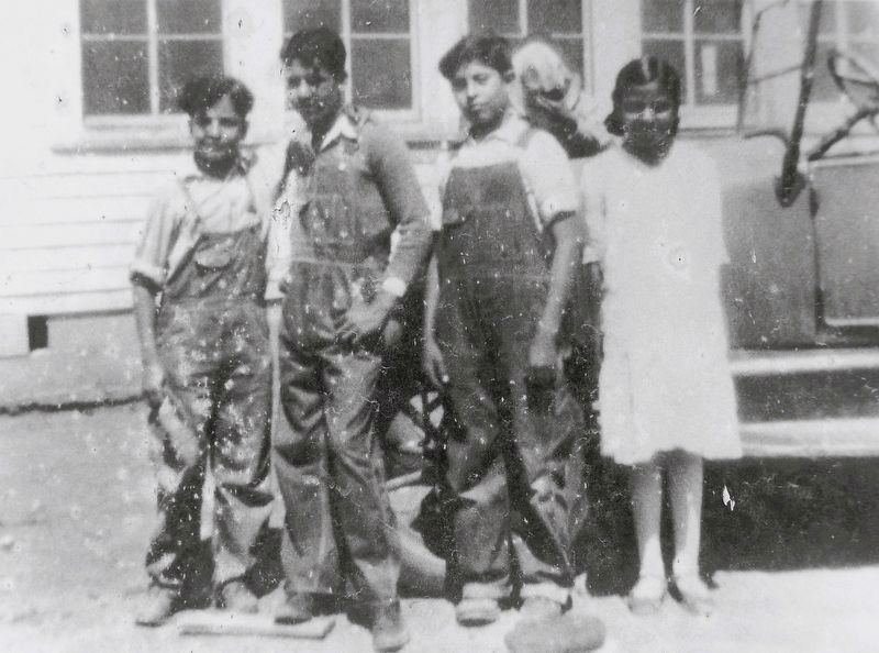
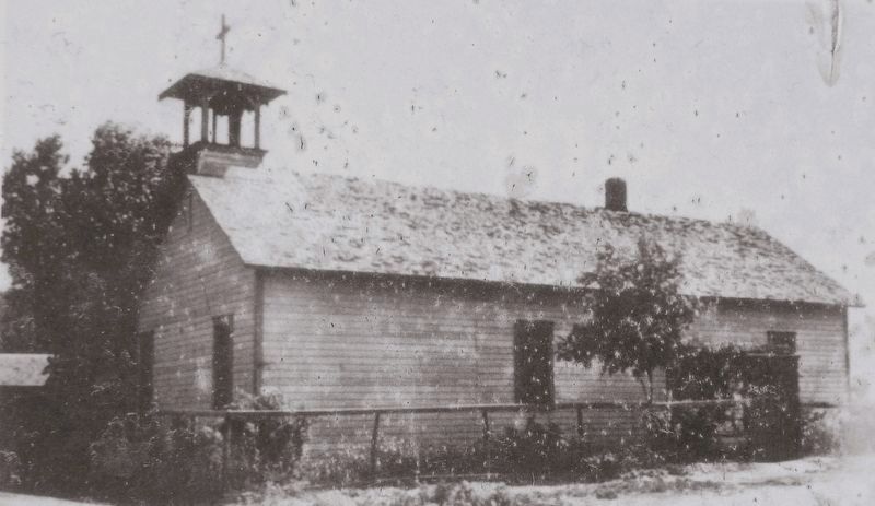
The first school was parochial, held in a frame building financed through the efforts of Father John Handly, then pastor of Sacred Heart Church. The structure, constructed in 1915, also served as the Village church. In 1921, a two-room public school was built. A third room was added in 1926 and three years later students named it Coronado
Courtesy Kansas Heritage Center
3. Marker detail: Students at Coronado School, c. 1930
Students pose by a teacher’s car outside of Coronado School, circa 1930. The Village church doubled as a school until this public school was built in 1921.
Although the Village lay near Dodge City, the two communities were separated by the rail yard and Chestnut Street (now Wyatt Earp Boulevard) — along with cultural differences and racial tensions. Originally home to rowdy young bachelors, the Village gained some of the same notoriety as Dodge in its cattle town days. Most Dodge Citians avoided it and Villagers made few trips to Dodge. When necessary, they walked into town under the busy rail yard through a drainage tunnel. Few residents could afford automobiles.
While the Village was not founded because of racial segregation, its residents were no strangers to racism. Segregation was common in Kansas during the first half of the twentieth century. In Dodge City theaters, Hispanics were allowed to sit only in balconies. Restaurants permitted them to eat only in kitchens or carry out food. It wasn't until 1952 that the Mexican community was allowed to use the city pool.
The
Courtesy Kansas Heritage Center
4. Marker detail: Our Lady of Guadalupe Church
Our Lady of Guadalupe Church, built in 1915 with encouragement from Father John Mark Handly, served the Mexican Village. It was replaced by a new edifice on Avenue J in 1950.
For more than five decades, several generations called the Village home. At its peak the community's population reached over 300. Dodge City has since grown to encompass the site where the Village stood, but its saga still remains an important part of local history and heritage.
Erected 2007.
Topics. This historical marker is listed in these topic lists: Hispanic Americans • Immigration • Railroads & Streetcars • Settlements & Settlers. A significant historical year for this entry is 1903.
Location. 37° 45.138′ N, 100° 0.874′ W.
Photographed by Cosmos Mariner, August 18, 2022
5. Dodge City's Mexican Village Marker
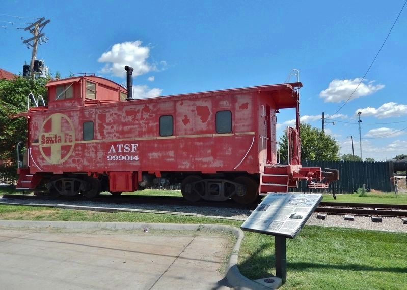
The marker is near the Atchison, Topeka and Santa Fe Caboose 999014 exhibit.

Regionally, this marker is in the American Midwest, in the Corn Belt, on the prairies, on the Great Plains, on the Southern Plains, on the High Plains, and on the Santa Fe Trail Corridor. Globally, it is in North America, the Western Hemisphere, the Western World, and the Anglosphere. Historically, it finds itself in what was once the Comanchería, the Dust Bowl, the Louisiana Purchase, and the Republic of Texas.
Other nearby markers. At least 8 other markers are within walking distance of this marker: Don Steele (about 400 feet away, measured in a direct line); Dennis Hopper (about 500 feet away); Fred Harvey (about 500 feet away); Santa Fe Depot (about 500 feet away); Wyatt Earp (about 700 feet away); General Grenville Dodge (about
Photographed by Cosmos Mariner, August 19, 2022
6. Dodge City's Mexican Village Marker
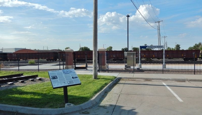
The marker overlooks active Dodge City Station railroad tracks to the south.
Also see . . . Mexican Village, Dodge City, Kansas (Wikipedia).
Excerpt: The village originally consisted of shack homes that were located just east of the Santa Fe Depot. Most of the structures were made of railroad ties and discarded railroad car sidings. Some were sod homes, while others were framed and finished with adobe and straw. It is estimated there were ten homes on this site. When those were full, the remaining families lived in tents or built shacks along the railway. There were only two entrances and exits to the community - to the south, Fort Dodge Road and to the north, "el puente". El puente, as dubbed by residents, were two six-foot-high tunnels under a railroad track that served as a drainage ditch. While the tunnel kept them safe from going over the tracks, the system would fill with water. It also served as makeshift playground for kids in the summer to escape the heat.(Submitted on August 10, 2026, by Cosmos Mariner of Cape Canaveral, Florida.)In 2007, a historical marker at 207 E. Wyatt
Earp Blvd., recognizing the village, was dedicated. The celebration reunited former residents and featured a performance by former residents, Delores, Josephine, Carole, and Manuela Torrez. Speakers included former mayor, Louis Sanchez.
Credits. This page was last revised on August 11, 2026. It was originally submitted on August 9, 2026, by Cosmos Mariner of Cape Canaveral, Florida. This page has been viewed 19 times since then. Photos: 1, 2, 3, 4, 5, 6. submitted on August 9, 2026, by Cosmos Mariner of Cape Canaveral, Florida.
