Grottoes in Augusta County, Virginia — The American South (Mid-Atlantic)
Civil War Tourism Attraction
Soldiers Visit Weyers Cave
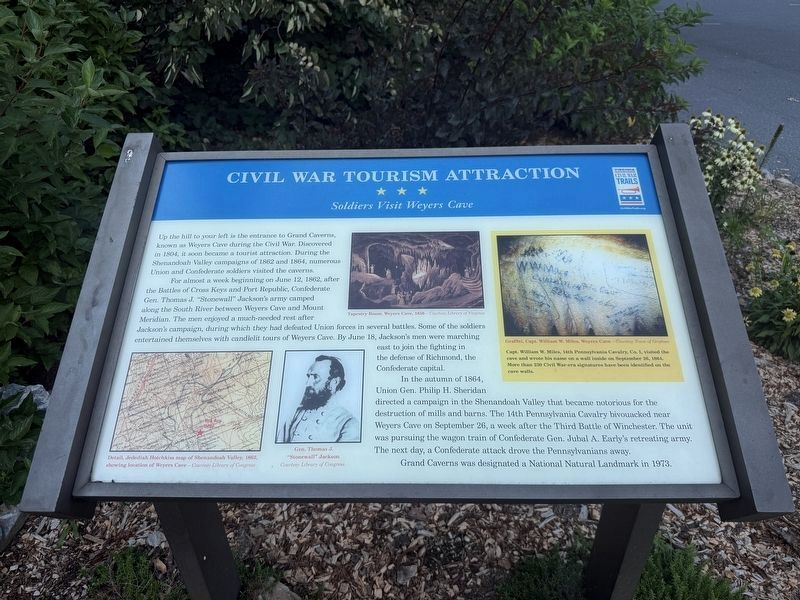
Up the hill to your left is the entrance to Grand Caverns, known as Weyers Cave during the Civil War. Discovered in 1804, it soon became a tourist attraction. During the Shenandoah Valley campaigns of 1862 and 1864, numerous Union and Confederate soldiers visited the caverns.
For almost a week beginning on June 12, 1862, after the Battles of Cross Keys and Port Republic, Confederate Gen. Thomas J. "Stonewall" Jackson's army camped along the South River between Weyers Cave and Mount Meridian. The men enjoyed a much-needed rest after Jackson's campaign, during which they had defeated Union forces in several battles. Some of the soldiers entertained themselves with candlelit tours of Weyers Cave. By June 18, Jackson's men were marching east to join the fighting in the defense of Richmond, the Confederate capital.
In the autumn of 1864, Union Gen. Philip H. Sheridan directed a campaign in the Shenandoah Valley that became notorious for the destruction of mills and barns. The 14th Pennsylvania Cavalry bivouacked near Weyers Cave on September 26, a week after the Third Battle of Winchester. The unit was pursuing the wagon
this page online
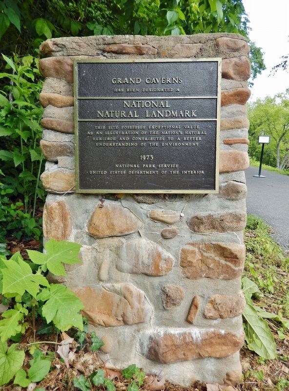
Grand Caverns was designated a National Natural Landmark in 1973.
[Captions:]
Detail, Jedediah Hotchkiss map of Shenandoah Valley, 1862, showing location of Weyers Cave — Courtesy Library of Congress
Gen. Thomas J. "Stonewall" Jackson Courtesy Library of Congress
Tapestry Room, Weyers Cave, 1856 — Courtesy Library of Virginia
Graffiti, Capt. William W. Miles, Weyers Cave — Courtesy Town of Grottoes
Capt. William W. Miles, 14th Pennsylvania Cavalry, Co. I, visited the cave and wrote his name on a wall inside on September 26, 1864. More than 230 Civil War-era signatures have been identified on the cave walls.
Erected by Virginia Civil War Trails.
Topics and series. This historical marker is listed in these topic lists: Natural Features • War, US Civil. In addition, it is included in the National Natural Landmarks, and the Virginia Civil War Trails series lists. A significant historical date for this entry is June 12, 1862.
Location. 38° 15.542′ N, 78° 50.08′ W. Marker is in Grottoes, Virginia, in
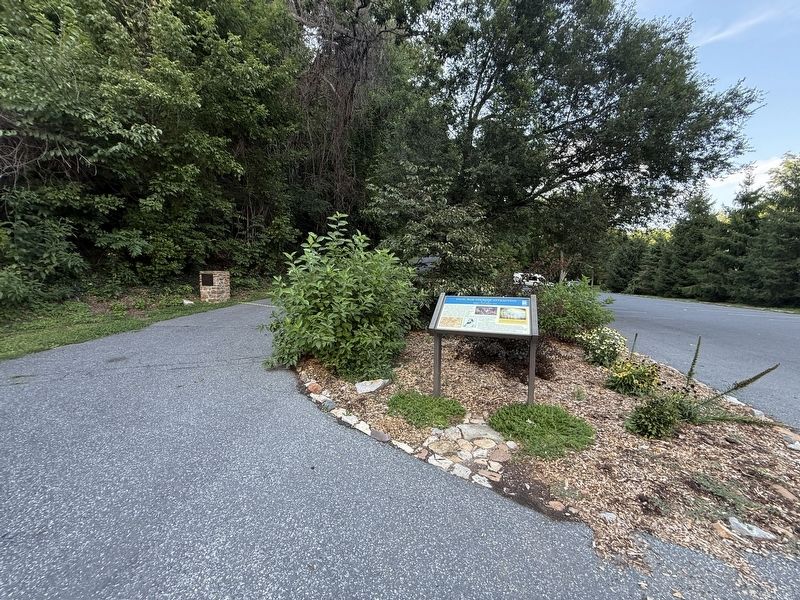

Regionally, this marker is in the Shenandoah Valley. It is also in the American South and specifically in the Upper South. Globally, it is in North America, the Western Hemisphere, the Western World, and the Anglosphere. Historically, it finds itself in what was once the territory of the Mississippian Culture, one of the original Thirteen Colonies, one of the Confederate States of America, and the Antebellum South.
Other nearby markers. At least 8 other markers are within walking distance of this marker: Honoring Their Sacrifice (a few steps from this marker); Augusta Memorial (a few steps from this marker); The Blue Ridge in Augusta County Before Shenandoah National Park (a few steps from this marker); Grand Caverns Inn (within shouting distance of this marker); The Gladys E. Kellow Garden (within shouting distance of this marker); George Caleb Bingham (approx. half
Photographed by Cosmos Mariner, May 12, 2024
3. Grand Caverns Marker
Another marker is no longer nearby. Civil War Tourism Attraction (was a few steps from this marker but has been replaced with another marker now near it).
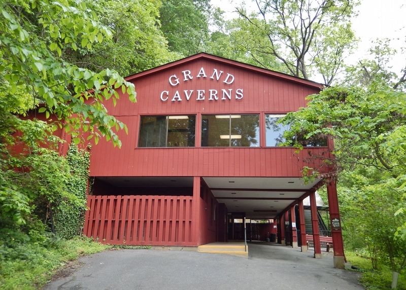
Photographed by Cosmos Mariner, May 12, 2024
4. Grand Caverns Museum and Caverns Entrance
0.1 mile uphill from the marker.
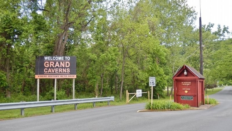
Photographed by Cosmos Mariner, May 12, 2024
5. Grand Caverns Park Entrance
Grand Caverns Drive at Dogwood Avenue (South River Road)
Credits. This page was last revised on August 10, 2026. It was originally submitted on August 10, 2026, by Devry Becker Jones of Washington, District of Columbia. This page has been viewed 25 times since then. Photos: 1, 2. submitted on August 10, 2026, by Devry Becker Jones of Washington, District of Columbia. 3, 4, 5. submitted on May 25, 2024, by Cosmos Mariner of Cape Canaveral, Florida.
