Maywood in Burnaby in Metro Vancouver, British Columbia — Canada’s West Coast (North America)
Bright Waters
Photographed by Bradley Owen, August 9, 2026
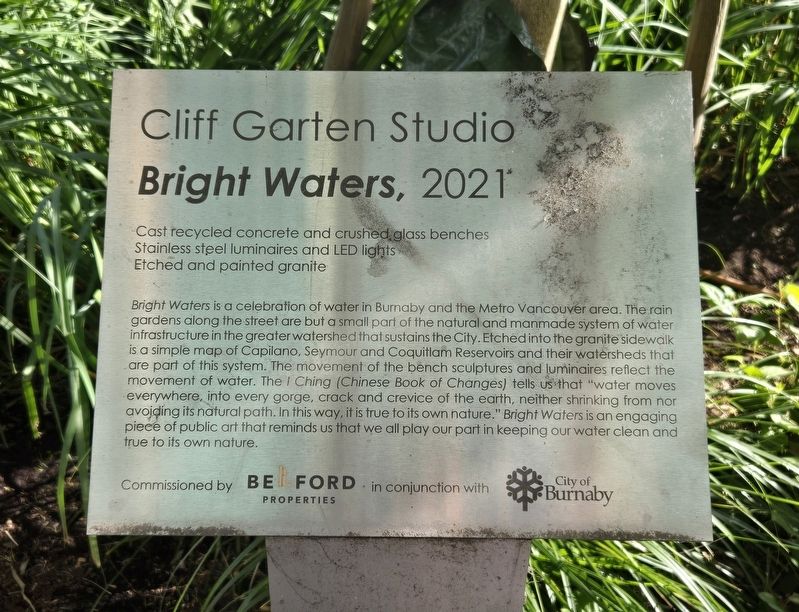
1. Bright Waters Marker
Cliff Garten Studio
Bright Waters, 2021
Cast recycled concrete and crushed glass benches
Stainless steel luminaires and LED lights
Etched and painted granite
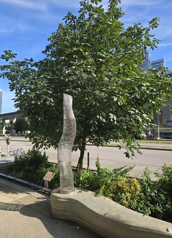
Bright Waters is a celebration of water in Burnaby and the Metro Vancouver area. The rain gardens along the street are but a small part of the natural and manmade system of water infrastructure in the greater watershed that sustains the City. Etched into the granite sidewalk is a simple map of Capilano, Seymour and Coquitlam Reservoirs and their watersheds that are part of this system. The movement of the bench sculptures and luminaires reflect the movement of water. The I Ching (Chinese Book of Changes) tells us that "water moves everywhere, into every gorge, crack and crevice of the earth, neither shrinking from nor avoiding its natural path. In this way, it is true to its own nature." Bright Waters is an engaging piece of public art that reminds us that we all play our part in keeping our water clean and true to its own nature.
Erected by Belford Properties and the City of Burnaby, British Colombia.
Topics. This historical marker is listed
this page online
Location. 49° 13.549′ N, 123° 0.287′ W. Marker is in Burnaby, British Columbia, in Metro Vancouver. It is in Maywood. It is on Beresford Street east of Silver Avenue, on the right when traveling south. Touch for map. Marker is at or near this postal address: 4438 Beresford Street, Burnaby BC V5H 2Y4, Canada. Touch for directions.

Regionally, this marker is on the Lower Mainland and in Coast & Mountains. Globally, it is in North America, in the Cascade Range, in the Inside Passage, on the Ring of Fire, on the Pacific Rim, in the Western Hemisphere, in the Western World, and in the Anglosphere. Historically, it finds itself in what was once a British colony.
Other nearby markers. At least 8 other markers are within 8 kilometers of this marker, measured as the crow flies: South Burnaby Cenotaph (approx. 0.8 kilometers away); Jubilee Grove (approx. one kilometer away); Central Park Bandstand (approx. 1.2 kilometers away); Variety Park Playground (approx. 1.2 kilometers away); Central Park
Photographed by Bradley Owen, August 9, 2026
2. Bright Waters Marker

Photographed by Bradley Owen, August 9, 2026
3. Seymour Watershed Map Etched into the Sidewalk
Credits. This page was last revised on August 10, 2026. It was originally submitted on August 10, 2026, by Bradley Owen of Morgantown, West Virginia. This page has been viewed 9 times since then. Photos: 1, 2, 3. submitted on August 10, 2026, by Bradley Owen of Morgantown, West Virginia.
