Yonge-Bay Corridor in Toronto, Ontario — Central Canada (North America)
Freedom Arches
⎯⎯⎯
Les Arches de la Liberté

Photographed by J.T. Lambrou, August 4, 2026
1. Freedom Arches / Les Arches de la Liberté Marker

The Citizens of Toronto dedicate these arches to the millions who struggled including Canadians, to gain and defend freedom and to the tens of millions who suffered and died for the lack of it. May all that we do be worthy of them.
Only in freedom can the Human Spirit soar.
Against the Human drive for freedom nothing can long succeed. This plaque is mounted on a slab of the Berlin Wall.
Les citoyens de Toronto dédient ces arches aux millions de personnes, parmi lesquelles des Canadiennes et Canadiens, qui ont lutte pour gagner et pour défendre la liberté, et aux dizaines de millions qui ont souffert et sont morts à cause du manque de liberté. Que tout ce que l'on fasse soit digne d'eux.
L'esprit humain ne peut s'élever que lorsqu'il est libre.
Rien de ne peut resister longtemps à la soit de liberté chez l'être humain. Le socle sur lequel repose cette plaque contient du béton provenant du Mur de Berlin.
Erected 1989.
Topics and series. This memorial is listed in these topic lists: Government & Politics • Man-Made Features •
this page online
Location. 43° 39.128′ N, 79° 22.988′ W. Memorial is in Toronto, Ontario. It is in Yonge-Bay Corridor. It is on Queen Street West near Bay Street, on the right when traveling west. The marker is located in Nathan Phillips Square. Touch for map. Memorial is at or near this postal address: 100 Queen Street West, Toronto ON M5H 2M9, Canada. Touch for directions.

Regionally, this memorial is in Greater Toronto and on the Golden Horseshoe. It is also in Central Canada. Globally, it is in North America, on the Great Lakes, in the Western Hemisphere, in the Western World, and in the Anglosphere. Historically, it finds itself in what was once a British colony, the Viceroyalty of New France, the Haudenosaunee (Iroquois) Confederacy, and Rupert’s Land.
Other nearby markers. At least 8 other markers are within walking distance of this marker: Old City Hall / Ancien hôtel de ville (about 90 meters away, measured in a direct line); Old City Hall Cenotaph (about 120 meters away); R. C. Harris (about 150 meters away);

Photographed by J.T. Lambrou, August 4, 2026
2. Freedom Arches / Les Arches de la Liberté Marker
Also see . . . The Berlin Wall in Toronto. Excerpt:
Did you know there is a piece of the Berlin Wall in the heart of Toronto? After November 9, 1989, when the Berlin Wall fell, the arches over the skating rink and pond in Nathan Phillips Square were named The Freedom Arches. They had originally been installed for aesthetic purposes and as tracks for lighting. A piece of the Berlin Wall was embedded in a concrete slab on the south side of the centre arch.(Submitted on August 11, 2026, by J.T. Lambrou of New Boston, Michigan.)
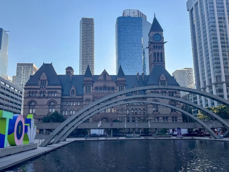
Photographed by J.T. Lambrou, August 4, 2026
3. Freedom Arches / Les Arches de la Liberté Marker
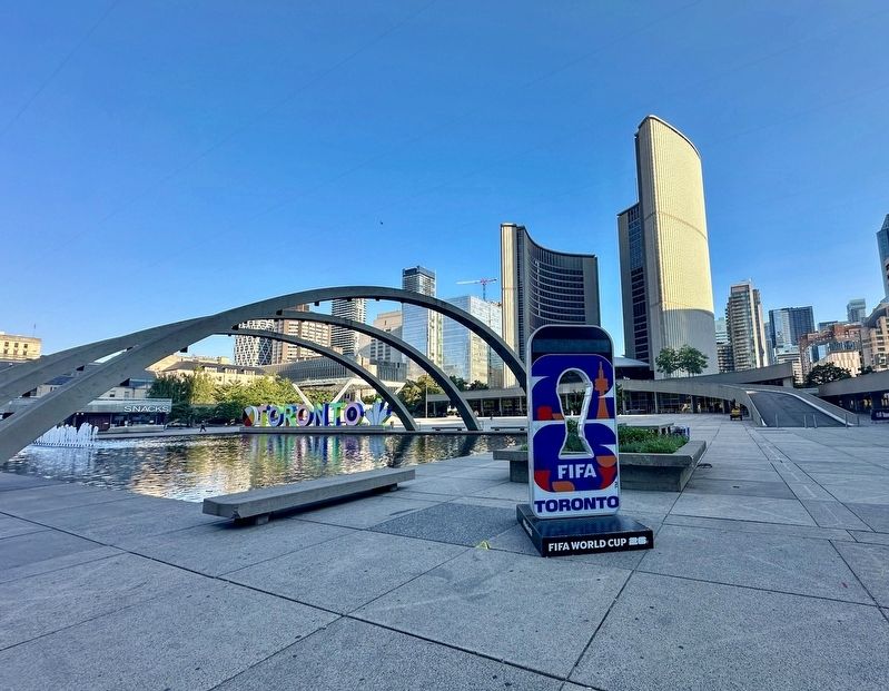
Photographed by J.T. Lambrou, August 4, 2026
4. Freedom Arches / Les Arches de la Liberté Marker
Credits. This page was last revised on August 15, 2026. It was originally submitted on August 11, 2026, by J.T. Lambrou of New Boston, Michigan. This page has been viewed 25 times since then. Photos: 1, 2, 3, 4. submitted on August 11, 2026, by J.T. Lambrou of New Boston, Michigan. • Andrew Ruppenstein was the editor who published this page.
