Alcova in Natrona County, Wyoming — The American West (Mountains)
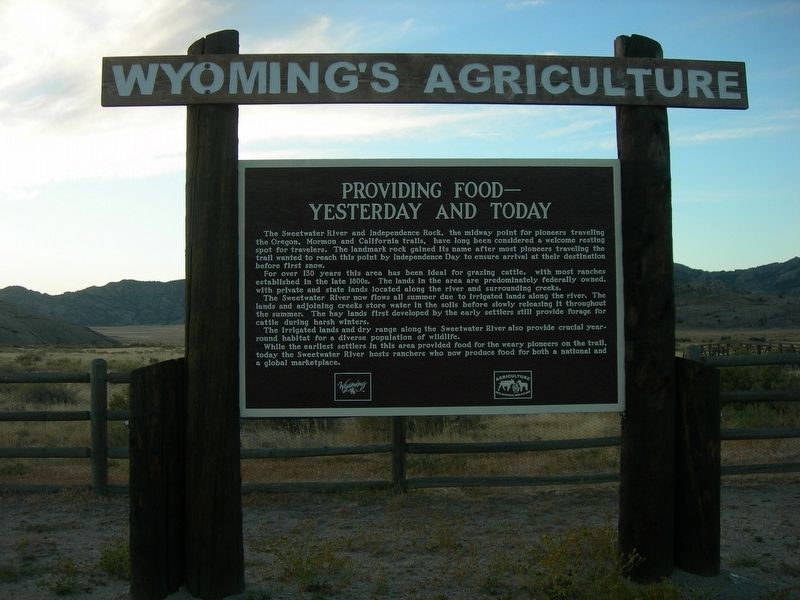
Providing Food--Yesterday and Today
Wyoming's Agriculture
Photographed by Jimmy Emerson, September 25, 2010
1. Providing Food--Yesterday and Today Marker
For over 130 years this area has been ideal for grazing cattle, with most ranches established in the late 1800s. The lands in the area are predominately federally owned, with private and state lands located along the river and surrounding creeks. The Sweetwater River now flows all summer due to irrigated lands along the river. The lands and adjoining creeks store water in the soils before slowly releasing it throughout the summer. The hay lands first developed by the early settlers still provide forage for cattle during harsh winters.
The irrigated lands and dry range along the Sweetwater River also provide crucial year round habitat for a diverse population of wildlife.
While the earliest settlers in this area provided food for the weary pioneers on
this page online
Topics. This historical marker is listed in these topic lists: Agriculture • Settlements & Settlers • Waterways & Vessels.
Location. Marker is missing. It was located near 42° 29.595′ N, 107° 8.183′ W. Marker was in Alcova, Wyoming, in Natrona County. It could be reached from Wyoming 220. Marker *was* at the rest area at Independence Rock State Historic Site. Per Google Maps, the marker was missing as of October 2024. Touch for map. Marker was at or near this postal address: 44655 WY-220, Alcova WY 82620, United States of America. Touch for directions.

Regionally, this marker was in the Westward Expansion Trails Region and in Greater Casper. It was also in the American Mountain West. Globally, it was in North America, the Rocky Mountains, the Western Hemisphere, the Western World, and the Anglosphere.
Other nearby markers. At least 8 other markers are within 5 miles of this location, measured as the crow flies: Geologic Story (within shouting distance of this marker); Independence Rock (within shouting distance of this marker); Naming a Landmark (about 400 feet away, measured in a direct line); The Ox-Team Monument Expedition (about 700 feet away); Oregon Trail (approx. 0.2 miles away); a different marker also named Independence Rock (approx. 0.2 miles away); The Preservation of Independence Rock (approx. 0.2 miles away); Frederick Richard Fulkerson (approx. 4.9 miles away). Touch for a list and map of all markers in Alcova.
Credits. This page was last revised on August 13, 2026. It was originally submitted on August 11, 2026, by Jimmy Emerson of Dalton, Georgia. This page has been viewed 29 times since then. Photo 1. submitted on August 11, 2026, by Jimmy Emerson of Dalton, Georgia. • Andrew Ruppenstein was the editor who published this page.
