Paw Paw in Lee County, Illinois — The American Midwest (Great Lakes)
Homes of Chief Waubonsie and Madeline Ogee
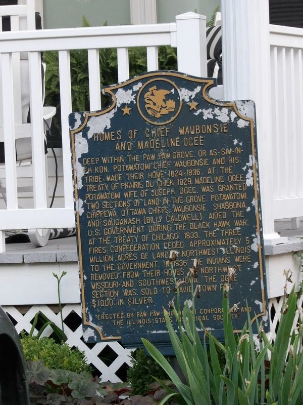
Photographed by Duane and Tracy Marsteller, July 8, 2023
1. Homes of Chief Waubonsie and Madeline Ocee Marker
Deep within the Paw Paw Grove, or As-Sim-In-Eh-Kon, Potawatomi Chief Waubonsie and his tribe made their home 1824-1836. At the Treaty of Prairie Du Chien 1829, Madeline Ogee, Potawatomi wife of Joseph Ogee, was granted two sections of land in the grove. Potawatomi, Chippewa, Ottawa Chiefs, Waubonsie, Shabbona, and Sauganash (Billy Caldwell) aided the U.S. Government during the Black Hawk War. At the Treaty of Chicago, 1833, the Three Fires Confederation ceded approximately 5 million acres of land in northwest Illinois to the government. In 1836 the Indians were removed from their homes to northwest Missouri and southwest Iowa. The Ogee section was sold to David Town for $1000 in silver.
Erected 1986 by Paw Paw Endowment Corporation and the Illinois State Historical Society.
Topics and series. This historical marker is listed in these topic lists: Indigenous Peoples and Communities • Settlements & Settlers • Wars, US Indian. In addition, it is included in the Illinois State Historical Society series list. A significant historical year for this entry is 1829.
Location. 41° 41.134′ N, 88° 58.726′ W. Marker is
this page online

Regionally, this marker is in the American Midwest and in the Corn Belt. Globally, it is in North America, the Western Hemisphere, the Western World, and the Anglosphere. Historically, it finds itself in what was once the territory of the Mississippian Culture and also the Northwest Territory.
Other nearby markers. At least 6 other markers are within 12 miles of this marker, measured as the crow flies: Old Chicago Trail (approx. half a mile away); Chief Shabbona Memorial (approx. 7.8 miles away); Shabbona Veterans Memorial (approx. 8 miles away); Chief Shabbona (approx. 8.1 miles away); Shabbona (approx. 8.3 miles away); Railroads and the Founding of Mendota (approx. 11.8 miles away).
Also see . . .
1. The Life of Wah-bahn-se: The Warrior Chief of the Pottawatamies. Transcript of biography that first appeared in the Kansas

Photographed by Duane and Tracy Marsteller, July 8, 2023
2. Homes of Chief Waubonsie and Madeline Ogee Marker
2. Potawatomi Leader Wabaunsee Remembered for His Prowess in Battle and Impact on 19th Century Indian. Wabaunsee, born Nakses, was a powerful and influential headman among the Potawatomi, Odawa and Ojibwe villages of Illinois and Indiana. ( Citizen Potawatomi Nation, posted Sept. 20, 2019) (Submitted on August 15, 2023, by Duane and Tracy Marsteller of Murfreesboro, Tennessee.)
3. 1833 Treaty of Chicago. Wikipedia entry on the treaty, in which the Chippewa, Odawa and Potawatomi tribes ceded the last of their lands in the state of Illinois and in the Michigan and Wisconsin territories. (Submitted on August 15, 2023, by Duane and Tracy Marsteller of Murfreesboro, Tennessee.)
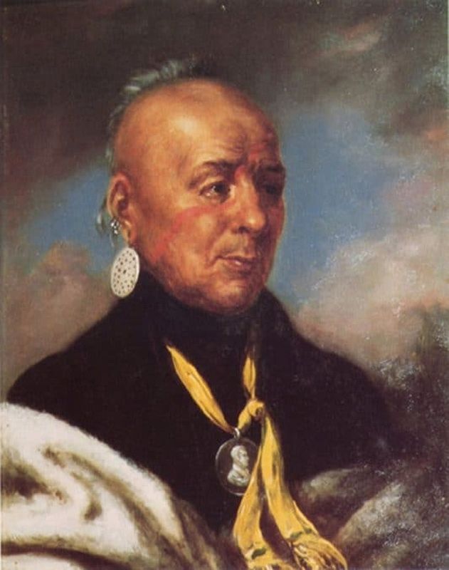
via Citizen Potawatomi Nation (Public Domain)
3. Chief Waubonsie
Credits. This page was last revised on August 14, 2026. It was originally submitted on August 15, 2023, by Duane and Tracy Marsteller of Murfreesboro, Tennessee. This page has been viewed 1,632 times since then and 147 times this year. Last updated on August 14, 2026, by Matthew Stevens of Washington, Illinois. Photos: 1, 2, 3. submitted on August 15, 2023, by Duane and Tracy Marsteller of Murfreesboro, Tennessee. • Devry Becker Jones was the editor who published this page.
