
Binnenstad in Delft, South Holland, Netherlands — Northwestern Europe
Deze gevelsteen
⎯⎯⎯
This Gable Stone

Photographed by Andrew Ruppenstein, March 11, 2023
1. Deze gevelsteen / This Gable Stone Marker

Onthuld op 1 oktober 1986 door Janneke Kromhout
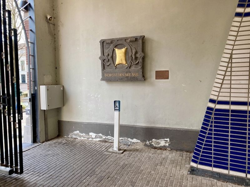
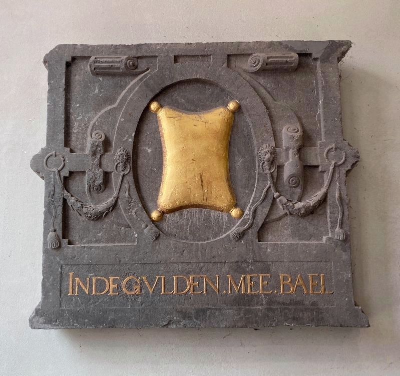
This facade stone was found during an archaeological survey prior to the construction of the administrative building. Originally, the stone adorned the facade of a house located where this passageway now stands. The word 'mee' refers to madder, a natural red dye.
Unveiled on October 1, 1986, by Janneke Kromhout.
Erected 1986.
Topics. This historical marker is listed in these topic lists: Anthropology & Archaeology • Man-Made Features. A significant historical year for this entry is 1986.
Location. 52° 0.659′ N, 4° 21.379′ E. Marker is in Delft, Zuid-Holland (South Holland). It is in Binnenstad. It is on Oude Delft, on the left when traveling north. The marker is is located just off the street in a public passageway leading off the street and through the building
this page online

Regionally, it is in Europe, the European Union, Atlantic Europe, the Benelux Low Countries, the Schengen Area, Western Europe, and the Western World. Historically, it finds itself in what was once the Roman Empire and specifically also the Holy Roman Empire.
Other nearby markers. At least 8 other markers are within walking distance of this marker: Meisjeshuis / Orphanage for Girls (within shouting distance of this marker); Heilige Geestkapel / Holy Ghost Chapel (within shouting distance of this marker); Huis “Het Tonnetgen” (about 90 meters away, measured in a direct line); Gemeenlandshuis van Delfland (about 120 meters away); Antoni van Leeuwenhoek (about 120 meters away); Gezicht op Delft… / The View of Delft… (about 120 meters away); Het Wapen van Savoyen / The Arms of Savoy (about 120 meters away); Vleeshal / Meathall (about 120 meters away). Touch for a list and map of all markers in Delft.
Also see . . . Oude Delft 137 (Achter de Gevels van Delft, in Dutch).
Photographed by Andrew Ruppenstein, March 11, 2023
2. The Gable Stone and marker
Gable stone - We still have an idea of what the two houses that stood on this site prior to 1892 looked like, thanks to an old photograph and a drawing based on it. Around 1875, the larger of the two was occupied by the lawyer Samuel Hartogh Heijs (Delft 1808–1878), a member of the Delfland Water Board.(Submitted on August 16, 2026.)
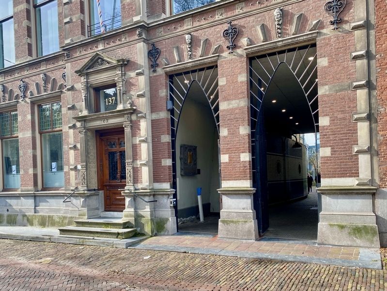
The house was named de Gulden Meebael (“The Golden Meebael”), as indicated by an inscription on a stone in the facade. During the construction of the new building, this facade stone was carelessly tossed into the back yard; it later resurfaced during excavations preceding the construction of the new municipal offices. It now adorns the small gateway leading to the municipal complex. That gateway is, in fact, a feature created during the construction of the municipal offices in 1985, a project that involved demolishing part of the building's ground floor.
Photographed by Andrew Ruppenstein, March 11, 2023
3. Gevelsteen / Gable Stone
Photographed by Andrew Ruppenstein, March 11, 2023
4. View of passageway and gable stone from the street
Credits. This page was last revised on August 16, 2026. It was originally submitted on August 15, 2026, by Andrew Ruppenstein of Lamorinda, California. This page has been viewed 7 times since then. Photos: 1. submitted on August 15, 2026, by Andrew Ruppenstein of Lamorinda, California. 2, 3, 4. submitted on August 16, 2026, by Andrew Ruppenstein of Lamorinda, California.
