Burnt Cabins in Fulton County, Pennsylvania — The American Northeast (Mid-Atlantic)
Burnt Cabins Grist Mill Property
Photographed by William Fischer, Jr., July 28, 2026
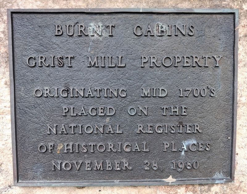
1. Burnt Cabins Grist Mill Property Marker
Originating mid 1700's
Placed on the
National Register
of Historic Places
November 28, 1980
Topics and series. This historical marker is listed in these topic lists: Agriculture • Colonial Era • Industry & Commerce • Settlements & Settlers. In addition, it is included in the National Register of Historic Places (NRHP) series list. A significant historical date for this entry is November 28, 1980.
Location. 40° 4.661′ N, 77° 53.258′ W. Marker is in Burnt Cabins, Pennsylvania, in Fulton County. It is on Grist Mill Road (Pennsylvania Route 1010) 0.3 miles east of Great Cove Road/Croghan Pike (U.S. 522), on the right when traveling east. Touch for map. Marker is at or near this postal address: 582 Grist Mill Road, Burnt Cabins PA 17215, United States of America. Touch for directions.

Regionally, this marker is in South-Central Pennsylvania. It is also in the American Northeast, in the Mid-Atlantic, in Appalachia, and specifically in Northern Appalachia. Globally, it is in North America, the Western Hemisphere, the Western World, and the Anglosphere. Historically, it finds itself in what was once the Haudenosaunee
this page online
Other nearby markers. At least 8 other markers are within 8 miles of this marker, measured as the crow flies: Celebrating Burnt Cabins Grist Mill Caterpillar D4600 75th Anniversary (a few steps from this marker); Burnt Cabins Grist Mill Water Wheel Shaft and Support Timber (a few steps from this marker); Burnt Cabins (approx. half a mile away); Forbes Road (approx. ¾ mile away); a different marker also named Burnt Cabins (approx. 0.8 miles away); Fort Lyttelton (approx. 4 miles away); Fort Littleton (approx. 4 miles away); Grand Army of the Republic Picnic (approx. 7.4 miles away). Touch for a list and map of all markers in Burnt Cabins.
Regarding Burnt Cabins Grist Mill Property. National Register Nomination Statement of Significance excerpt:
The Burnt Cabins Grist Mill property is a well preserved, excellent example of an early grist milling operation in a rural Pennsylvania community. This mill is not only structurally well-preserved but contains operable machinery and waterwheels. This mill still produces cornmeal, buckwheat and wheat flours. Commercially,
Photographed by William Fischer, Jr., July 28, 2026
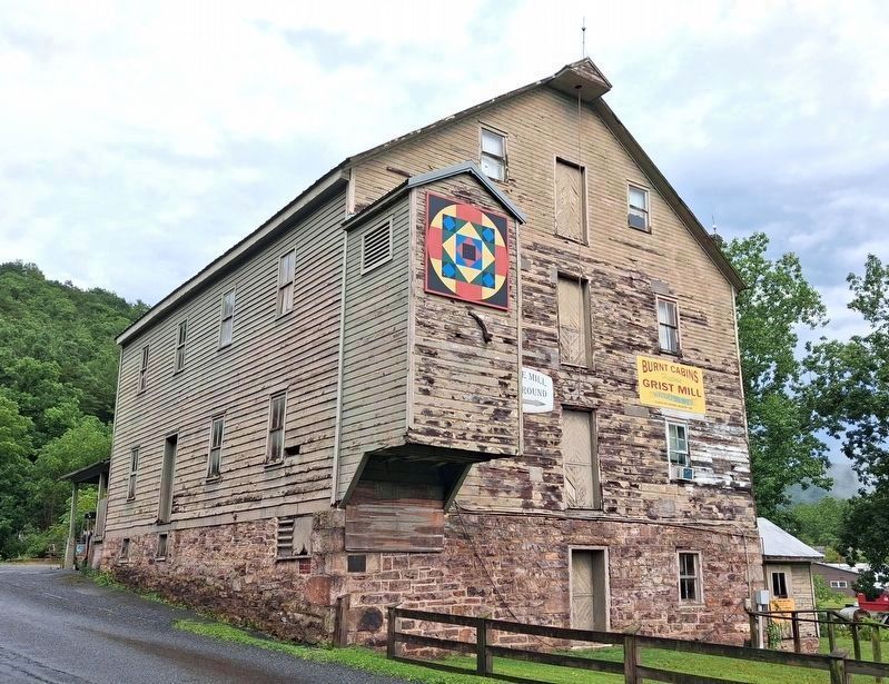
2. Burnt Cabins Grist Mill and Property Marker
Marker on stone foundation below the hoist house
Also see . . . Burnt Cabins Grist Mill Property National Register Nomination Form. (Submitted on August 16, 2026, by William Fischer, Jr. of Reynoldsburg, Ohio.)
Photographed by William Fischer, Jr., July 28, 2026
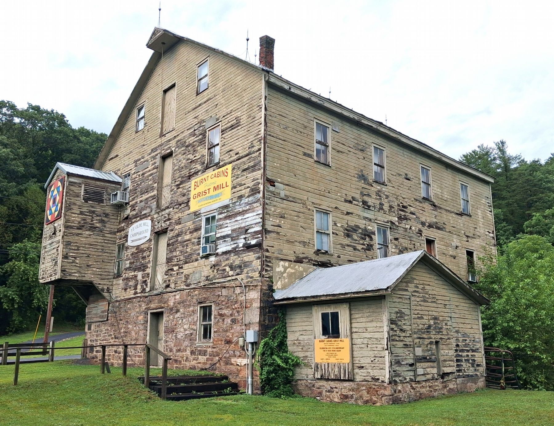
3. Burnt Cabins Grist Mill
Credits. This page was last revised on August 16, 2026. It was originally submitted on August 16, 2026, by William Fischer, Jr. of Reynoldsburg, Ohio. This page has been viewed 18 times since then. Photos: 1, 2, 3. submitted on August 16, 2026, by William Fischer, Jr. of Reynoldsburg, Ohio.
