Marker Logo
THE HISTORICAL
MARKER DATABASE
“Bite-Size Bits of Local, National, and Global History”
Oude Westen in Rotterdam, South Holland, Netherlands — Northwestern Europe
 

1ste Middellandstraat


1ste Middellandstraat Marker image. Click for full size.
Photographed by Andrew Ruppenstein, March 20, 2024
1. 1ste Middellandstraat Marker
Inscription.  
Door Ghisebrecht Bokel was in de tweede helft van de 13de eeuw aan Claes de Vriese verboden om een stuk land, dat grensde aan Bokels ambacht, te bedijken. Daardoor bleef midden tussen Schoonderloo en Beukelsdijk een onbedijkt land liggen. Omstreeks 1280 krijgt Jan van Scoenreloo, zoon van Claes de Vriese, toestemming tot bedijken. Dit Middelland heeft waarschijnlijk ongeveer ter plaatse van de huidige straat gelegen. Een 'Middelwateringhe' komt aldaar reeds in 1410 voor. Op de kaart van Stampioen (1653) heet deze watering Scheydsloot. Ze vormde de scheiding tussen twee ambachten. In 1906 werd de Middellandstraat in 1ste Middellandstraat herdoopt, terwijl toen tevens de 2de Middellandstraat haar naam ontving. De naam Middelland is later gegeven aan de wijk waarin genoemde straten liggen.

(English translation:)
In the second half of the 13th century, Ghisebrecht Bokel forbade Claes de Vriese from embanking a tract of land bordering Bokel's ambacht (manorial district). Consequently, an area of ​​undyked land remained situated between Schoonderloo and Beukelsdijk. Around 1280, Jan van Scoenreloo—Claes de Vriese's son—received permission to embank the land. This Middelland (“Middle Land”) was likely located roughly where the current street now lies. A Middelwateringhe (“Middle Watercourse”) is recorded in that location as early as 1410. On Stampioen's map (1653), this watercourse is named Scheydsloot (Boundary Ditch); it formed the dividing line between two ambachten. In 1906, Middellandstraat was renamed 1ste Middellandstraat, and at the same time, 2de Middellandstraat received its name. The name 'Middelland' was later applied to the neighborhood containing these streets.
 
Erected by the
Paid Advertisement
Click or scan to see
this page online
32N.
 
Topics. This historical marker is listed in these topic lists: Man-Made FeaturesRoads & Vehicles. A significant historical year for this entry is 1280.
 
Location. 51° 55.151′ N, 4° 27.882′ E. Marker is in Rotterdam, Zuid-Holland (South Holland). It is in Oude Westen. It is at the intersection of 1e Middellandstraat and Korte Bajonetstraat, on the right on 1e Middellandstraat. Touch for map. Marker is at or near this postal address: 1e Middellandstraat 17a, Rotterdam, Zuid-Holland 3014 BB, Netherlands. Touch for directions.

Regionally, it is in Europe, the European Union, Atlantic Europe, the Benelux Low Countries, the Schengen Area, Western Europe, and the Western World. Historically, it finds itself in what was once the Roman Empire and specifically also the Holy Roman Empire.
Other nearby markers. At least 8 other markers are within walking distance of this marker: Korte Bajonetstraat / “Little Bayonet” Street (a few steps from this marker); Tiendstraat / “Tithe Street” (within shouting distance of this marker); Henegouwerlaan (within shouting distance of this marker); Tiendplein (about 90 meters away, measured
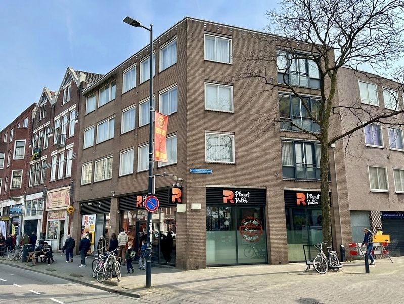
1ste Middellandstraat Marker - wide view image. Click for full size.
Photographed by Andrew Ruppenstein, March 20, 2024
2. 1ste Middellandstraat Marker - wide view
The subject marker is the leftmost of the two visible here on the corner of the building.
in a direct line); Zijdewindestraat (about 90 meters away); Van Speijkstraat - Jan van Speyk (about 150 meters away); Zijdewindeplein (about 150 meters away); Coolsestraat (about 150 meters away). Touch for a list and map of all markers in Rotterdam.
 
 
Credits. This page was last revised on August 19, 2026. It was originally submitted on August 19, 2026, by Andrew Ruppenstein of Lamorinda, California. This page has been viewed 7 times since then. Photos:   1, 2. submitted on August 19, 2026, by Andrew Ruppenstein of Lamorinda, California.

m=308725

CeraNet Cloud Computing sponsors the Historical Marker Database.
This website earns income from purchases you make after using our links to Amazon.com. We appreciate your support.
Paid Advertisement
Aug. 20, 2026