Gettysburg in Adams County, Pennsylvania — The American Northeast (Mid-Atlantic)
German Reformed Church
"In less than half an hour…"
Photographed by William Fischer, Jr., July 30, 2026
1. German Reformed Church Marker
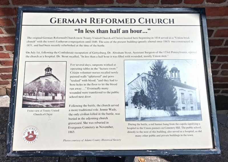
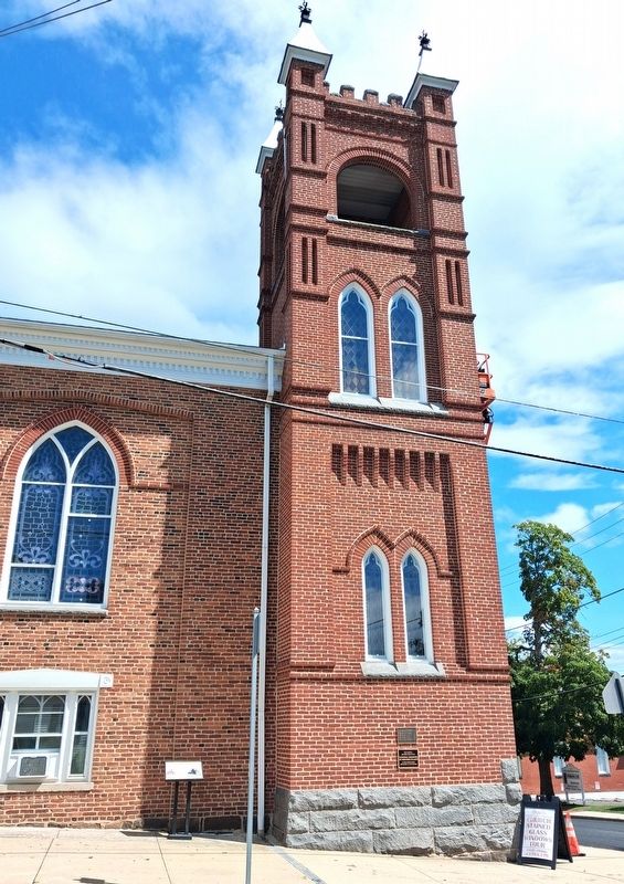
The original German Reformed Church (now Trinity United Church of Christ) located here beginning in 1814 served as a “Union brick church” with the town’s Lutheran congregation until 1848. The core of the present building (greatly altered since 1863) was constructed in 1851, and had been recently refurbished at the time of the battle.
On July 1st, following the Confederate occupation of Gettysburg, Dr. Abraham Stout, Surgeon of the 153rd Pennsylvania [Regiment], opened the church as a hospital. Dr. Stout recalled, “In less than a half hour it was filled with wounded, mostly Union men.”
For several days, surgeons worked at operating tables in the “lecture room.” Citizen volunteer nurses recalled newly painted walls “splattered” and pews “soaked” with blood, “and they had to bore holes in the floor to let the blood run away....” Eventually, many wounded were transferred to the public school next door.
Following the battle, the church served a more traditional role. Jenny Wade, the only civilian killed in the battle, was buried in the adjoining church graveyard. She was reburied in Evergreen Cemetery in November 1865.
[Photo captions, left to right, read]
this page online
• During the battle, a red banner hung from the cupola signifying a hospital to the Union gunners on Cemetery Hill. The public school, directly to the west of this building, also served as a hospital, as did many other public and private buildings in the town.
Erected by Main Street Gettysburg.
Topics. This historical marker is listed in these topic lists: Religion & Religious Structures • Science & Medicine • War, US Civil. A significant historical date for this entry is July 1, 1814.
Location. 39° 49.718′ N, 77° 13.741′ W. Marker is in Gettysburg, Pennsylvania, in Adams County. It is at the intersection of High Street and Stratton Street, on the left when traveling east on High Street. Touch for map. Marker is at or near this postal address: 60 East High Street, Gettysburg PA 17325, United States of America. Touch for directions.

Regionally, this marker is in South-Central Pennsylvania. It is also in the American Northeast, in the Mid-Atlantic, in Appalachia, and specifically in Northern Appalachia. Globally, it is in North America, the Western Hemisphere, the Western World,
Photographed by William Fischer, Jr., July 30, 2026
2. German Reformed Church Marker
Other nearby markers. At least 8 other markers are within walking distance of this marker: Trinity United Church of Christ (here, next to this marker); The Adams County Prison (within shouting distance of this marker); “bullets … rattling against our hospital … ” (within shouting distance of this marker); Public School (within shouting distance of this marker); Pioneer Organizers of Methodism in Adams County (about 300 feet away, measured in a direct line); Grand Army of the Republic Hall (about 400 feet away); Grand Army of the Republic Memorial (about 400 feet away); Gettysburg Address Memorial and Abraham Lincoln Statue (about 500 feet away). Touch for a list and map of all markers in Gettysburg.
Another marker is no longer nearby. "…in less than half an hour…" (was here, next to this marker but has been permanently removed).
Regarding German Reformed Church. This marker replaced an earlier marker, same subject, at same location.
Related marker. Click here for another marker that is related to this marker.
Credits. This page was last revised on August 20, 2026. It was originally submitted on August 20, 2026, by William Fischer, Jr. of Reynoldsburg, Ohio. This page has been viewed 28 times since then. Photos: 1, 2. submitted on August 20, 2026, by William Fischer, Jr. of Reynoldsburg, Ohio.
