
Near Vredenburgh in Monroe County, Alabama — The American South (East South Central)
Bell's Landing
⎯⎯⎯
Tinela & Hybart
Photographed by Jimmy Emerson, July 29, 2026
1. Bell's Landing / Tinela & Hybart Marker
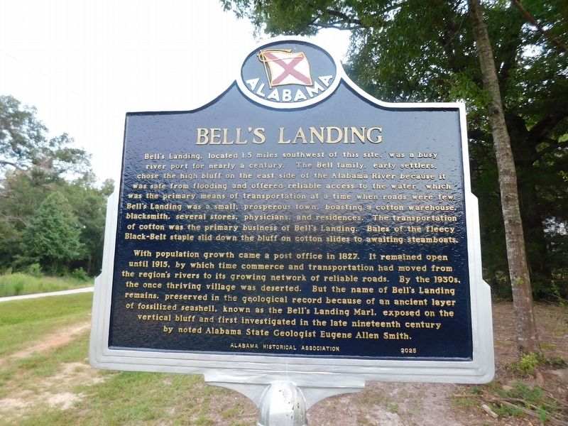
Bell's Landing
Bell's Landing, located 1.5 miles southwest of this site, was a busy river port for nearly a century. The Bell family, early settlers, chose the high bluff on the east side of the Alabama River because it was safe from flooding and offered reliable access to the water, which was the primary means of transportation at a time when roads were few. Bell's Landing was a small, prosperous town, boasting a cotton warehouse, blacksmith, several stores, physicians, and residences. The transportation of cotton was the primary business of Bell's Landing.
Bales of the fleecy Black-Belt staple slid down the bluff on cotton slides to awaiting steamboats. With population growth came a post office in 1827. It remained open until 1915, by which time commerce and transportation had moved from the region's rivers to its growing network of reliable roads. By the 1930s, the once thriving village was deserted. But the name of Bell's Landing remains, preserved in the geological record because of an ancient layer of fossilized seashell, known as the Bell's Landing Marl, exposed on the vertical bluff and first investigated
this page online
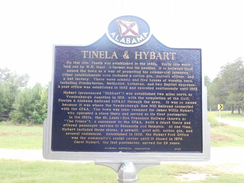
Tinela & Hybart
On this site, Tinela was established in the 1850s. Early lots were laid out by W.W. Hunt, a farmer and tin peddler, it is believed Hunt named the town as a way of promoting his commercial interests. Other establishments soon included a cotton gin, doctor's offices and a hat factory. There were schools and five houses of worship here, including Presbyterian, Methodist, Lutheran, and two Baptist churches. A post office was established in 1882 and operated continuously until 1925.
Hybart (pronounced "Hibbert") was established two miles north as Vredenburgh Junction in 1916, with the completion of the Gulf, Florida & Alabama Railroad (GF&A) through the area. It was so named because it was where the Vredenburgh Saw Mill Railroad connected with the GF&A. The town was later renamed for James Willis Hybart, who operated a store there and served as its first postmaster. In the 1920s, the St. Louis San Francisco Railway (known as "The Frisco"), a successor to the GF&A, built a depot there and offered passenger service to Pensacola and Memphis.
Photographed by Jimmy Emerson, July 29, 2026
2. Bell's Landing / Tinela & Hybart Marker
Erected 2025 by Alabama Historical Association.
Topics. This historical marker is listed in these topic lists: Anthropology & Archaeology • Industry & Commerce • Settlements & Settlers • Waterways & Vessels. A significant historical year for this entry is 1827.
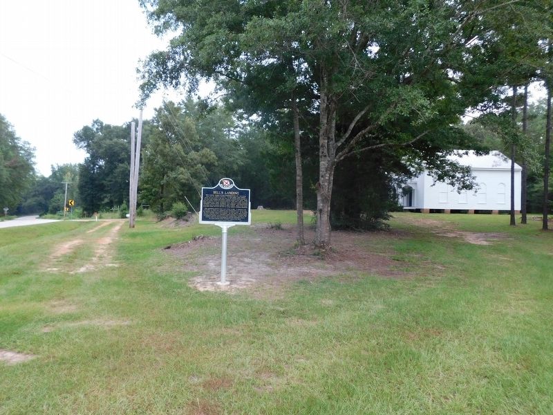
Location. 31° 48.462′ N, 87° 23.843′ W. Marker is near Vredenburgh, Alabama, in Monroe County. It is at the intersection of Alabama Route 41 and Tinela Road, on the right when traveling north on Alabama Route 41. The marker is about 0.1 mile north of mile marker 72, on the east side of AL Hwy 41, in front of Bell's Landing Presbyterian Church. Touch for map. Marker is at or near this postal address: 24796 State Route 41, Vredenburgh AL 36481, United States of America. Touch for directions.

Regionally, this marker is in the American South and specifically in the Deep South. Globally, it is in North
Photographed by Jimmy Emerson, July 29, 2026
3. Bell's Landing / Tinela & Hybart Marker
Bell's Landing Presbyterian Church in the background
Other nearby markers. At least 8 other markers are within 15 miles of this marker, measured as the crow flies: Mt Olive Ev. Lutheran Church & School (approx. one mile away); Johnson-McDuffie Cemetery (approx. 4½ miles away); Buena Vista (approx. 8.1 miles away); Robbins - Finklea Hotel (approx. 12.1 miles away); Bessie W. Munden Recreational Park (approx. 13.4 miles away); Veterans Monument (approx. 14.2 miles away); First Presbyterian Church of Camden (approx. 14.3 miles away); Camden Associate Reformed Presbyterian Church (approx. 14.3 miles away).
Also see . . . Hybart-Bell's Landing Preservation Society. Follow this link for more information about the history of this area. (Submitted on August 20, 2026, by Fred S Hybart of Kennesaw, Georgia.)
Credits. This page was last revised on August 27, 2026. It was originally submitted on July 30, 2026, by Jimmy Emerson of Dalton, Georgia. This page has been viewed 53 times since then. Last updated on August 20, 2026, by Fred S Hybart of Kennesaw, Georgia. Photos: 1, 2, 3. submitted on July 30, 2026, by Jimmy Emerson of Dalton, Georgia. • Devry Becker Jones was the editor who published this page.
