
Naperville in Will County, Illinois — The American Midwest (Great Lakes)
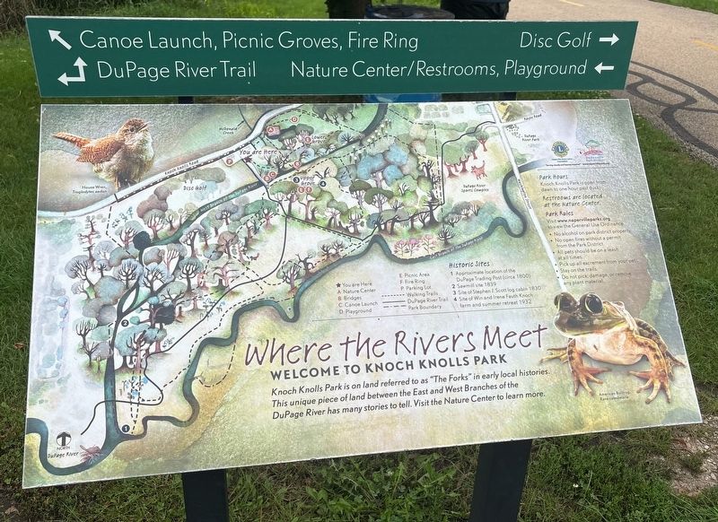
Where the Rivers Meet
Welcome to Knoch Knolls Park
Photographed by Sean P. Flynn, August 18, 2026
1. Where the Rivers Meet Marker
Historic Sites
1 Approximate location of the DuPage Trading Post (circa 1800)
2 Sawmill site 1839
3 Site of Stephen J. Scott log cabin 1830
4 Site of Win and Irene Fauth Knoch farm and summer retreat 1932
Erected by Naperville Park District.
Topics. This historical marker is listed in these topic lists: Parks & Recreational Areas • Settlements & Settlers • Waterways & Vessels. A significant historical year for this entry is 1830.
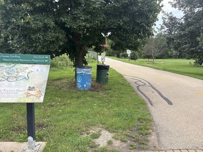
Location. 41° 42.789′ N, 88° 8.551′ W. Marker is in Naperville, Illinois, in Will County. It is on Knoch Knolls Road 1.2 miles east of 95th STreet, on the right when traveling east. The marker is in Knoch Knolls Park, next to the pedestrian bridge over the DuPage River West Branch and near the Nature Center parking lot. Touch for map. Marker is at or near this postal address: 336 Knoch Knolls Road, Naperville IL 60565, United States of America. Touch for directions.

Regionally,
this page online
Other nearby markers. At least 8 other markers are within walking distance of this marker: Are You Curious About the River? (about 300 feet away, measured in a direct line); The Land Where the Rivers Meet (about 400 feet away); Not Prairie, Not Woods (about 500 feet away); a different marker also named Where the Rivers Meet (about 500 feet away); First Claim on the Confluence (about 600 feet away); Scott Settlement (about 600 feet away); Knoch Knolls Park (approx. 0.2 miles away); a different marker also named Where the Rivers Meet (approx. 0.2 miles away). Touch for a list and map of all markers in Naperville.
More about this marker. Several maps identical to this one are found around Knoch Knolls Park.
Also see . . . Knoch Knolls Park. From the Naperville Park District. (Submitted on August 20, 2026, by Sean P. Flynn of Oak Park, Illinois.)
Photographed by Sean P. Flynn, August 18, 2026
2. Where the Rivers Meet Marker near the pedestrian bridge over the West Branch of the DuPage River
Photographed by Sean P. Flynn, August 18, 2026
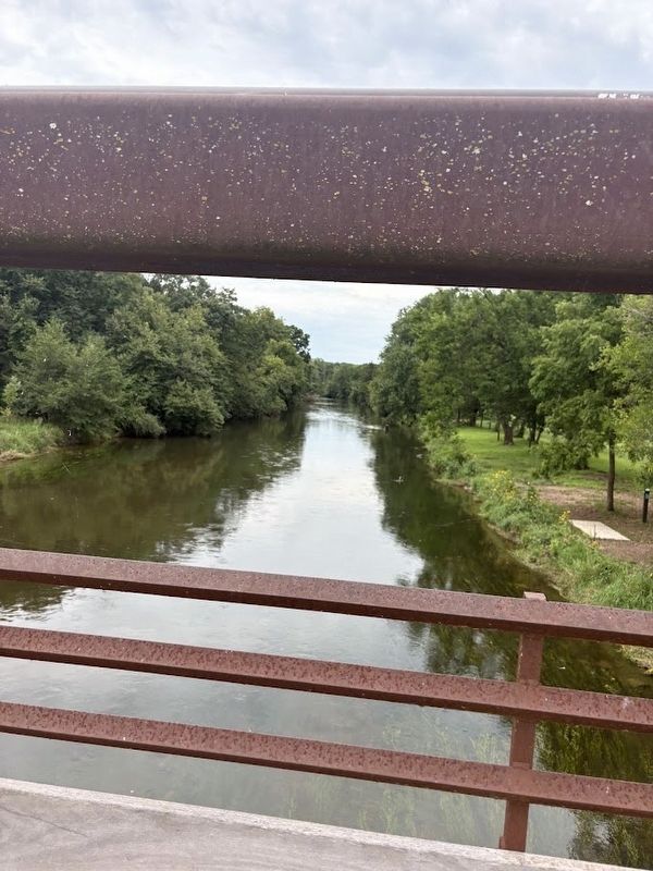
3. DuPage River West Branch
A southwesterly view from the pedestrian bridge near this marker. On the right (north) side of the river is a disc golf course.
Credits. This page was last revised on August 20, 2026. It was originally submitted on August 20, 2026, by Sean P. Flynn of Oak Park, Illinois. This page has been viewed 4 times since then. Photos: 1, 2, 3. submitted on August 20, 2026, by Sean P. Flynn of Oak Park, Illinois.
