Cimarron in Gray County, Kansas — The American Midwest (Upper Plains)
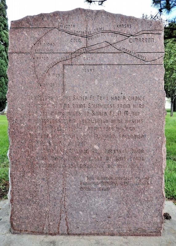
Travelers of the Santa Fe Trail Had a Choice to Make at this Point
Photographed by Cosmos Mariner, August 19, 2022
1. Santa Fe Trail Choice Marker
Travelers of the Santa Fe Trail had a choice to make at this point. Southwest from here cut off many miles to Santa Fe., N.M., but a waterless plain frequented with hostile Indians presented a formidable hazard. (The longer route via Trinidad followed water & was safer.)
The point of crossing the Arkansas River varied both east & west of this point, depending on the condition of the river.
Erected by Cimarron Business & Professional Women's Club.
Topics and series. This historical marker is listed in these topic lists: Roads & Vehicles • Waterways & Vessels. In addition, it is included in the Santa Fe Trail series list.
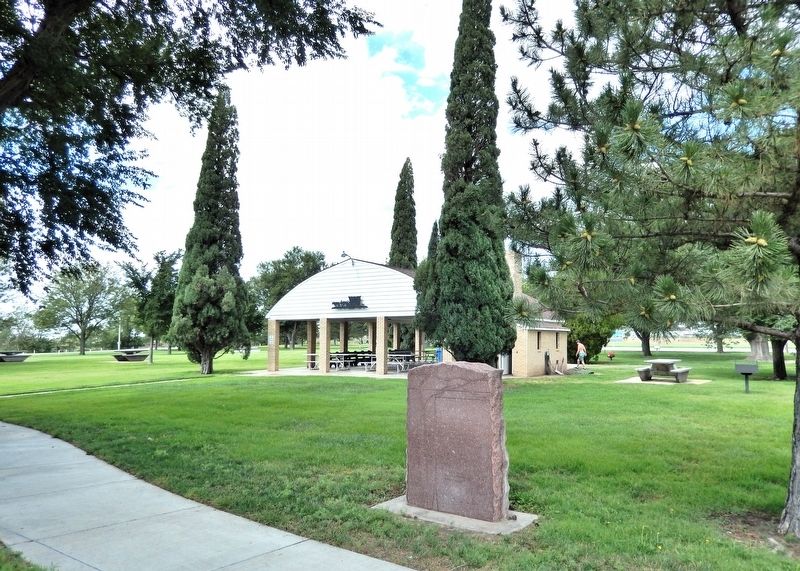
Location. 37° 47.984′ N, 100° 20.994′ W. Marker is in Cimarron, Kansas, in Gray County. It can be reached from South Main Street (State Highway 23) 0.1 miles south of West Avenue E, on the right when traveling south. The marker is along the walkway near the northeast corner of Cimarron Crossing Park. Touch for map. Marker is in this post office area: Cimarron KS 67835, United States of America. Touch for directions.

Regionally, this marker is
this page online
Other nearby markers. At least 8 other markers are within 9 miles of this marker, measured as the crow flies: The Ranch at Cimarron Crossing (within shouting distance of this marker); The Santa Fe Trail (within shouting distance of this marker); a different marker also named Santa Fe Trail (approx. 0.4 miles away); Cimarron Hotel (approx. 0.7 miles away); a different marker also named Santa Fe Trail (approx. 6 miles away); a different marker also named Santa Fe Trail (approx. 6.1 miles away); Campsite of the U.S. Survey Team Sept. 10-21, 1825 (approx. 8.4 miles away); Trails on the Prairie (approx. 8.4 miles away). Touch for a list and map of all markers in Cimarron.
Another marker is no longer nearby. Santa Fe Trail (was approx. 8.4 miles away but
Photographed by Cosmos Mariner, August 19, 2022
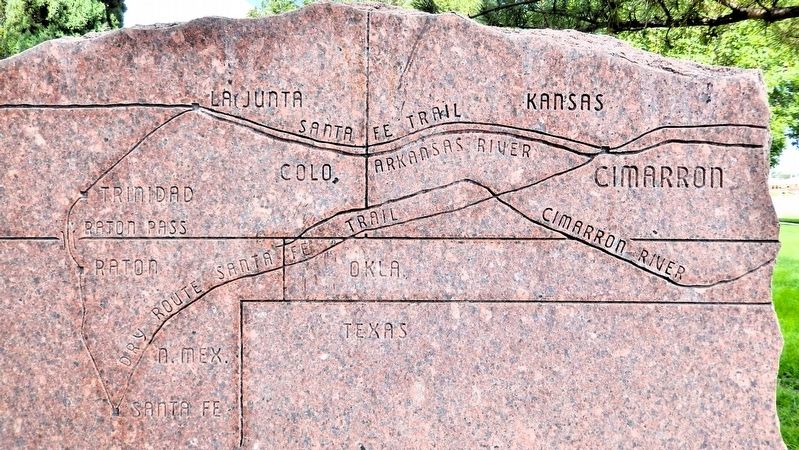
2. Marker detail: Cimarron Crossing Santa Fe Trail Map
Also see . . . Branches of the Santa Fe Trail (Legends of America).
(©Kathy Alexander/Legends of America) Excerpt: Though there were various paths and trails at different times throughout the history of the Santa Fe Trail, the journey was essentially the same until travelers reached western Kansas, in the area of present-day Cimarron, where the trail divided into two alternative routes — the Mountain Branch, following the Arkansas River further west to the site of Bent’s Fort, Colorado, south through Raton Pass into New Mexico; and the Cimarron Cutoff which, made a more direct diagonal route southwest through Oklahoma. The two paths rejoined in present-day Watrous, New Mexico, continuing southward to Santa Fe.(Submitted on August 22, 2026, by Cosmos Mariner of Cape Canaveral, Florida.)The Cimarron Route, also known as the Cimarron Cutoff and Cimarron Crossing, was the most favored in the earliest days of the Santa Fe Trail, even though the path was known for its water scarcity. This route was shorter by about 100 miles, shortened the traveling time by ten days, and was more suited to wagon travel. The Cimarron River, which gives the route its name, flows
through southwestern Kansas and northeastern Oklahoma. Depending upon where the travelers left the Arkansas River, it was a journey of fifty or more miles to reach the Cimarron River. With poor grass and scant water, the sandy Cimarron River, often dry, defined the landscape as one of the riskiest sections of the entire Trail. This much-dreaded, waterless area was often called the Cimarron Desert, Waterscape, and, by Mexicans, the Jornada del Muerte, or Journey of Death. Another, often greater fear, was Indian attacks. Although the government had made treaties with the Kanza and Osage tribes in Kansas to guarantee safe passage, no such treaties were made with the Comanche, Kiowa, Cheyenne, Pawnee, or Apache. These people had long roamed the Plains through which the Cimarron Cutoff was blazed.Photographed by Cosmos Mariner, August 19, 20223. Santa Fe Trail Choice MarkerLooking southwest across Cimarron Crossing Park.
Credits. This page was last revised on August 22, 2026. It was originally submitted on August 21, 2026, by Cosmos Mariner of Cape Canaveral, Florida. This page has been viewed 25 times since then. Photos: 1. submitted on August 21, 2026, by Cosmos Mariner of Cape Canaveral, Florida. 2, 3. submitted on August 22, 2026, by Cosmos Mariner of Cape Canaveral, Florida.
