Cimarron in Gray County, Kansas — The American Midwest (Upper Plains)
The Ranch at Cimarron Crossing
Cimarron Crossing Park and the Santa Fe Trail
Photographed by Cosmos Mariner, August 19, 2022
1. The Ranch at Cimarron Crossing Marker
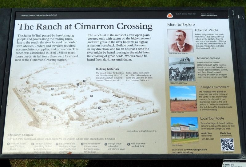
The Santa Fe Trail passed by here bringing people and goods along the trading route. Just to the south, the river formed the border with Mexico. Traders and travelers required accommodations, supplies, and protection. This ranch was established in 1866-1868 to meet those needs. At full force there were 12 armed men at the Cimarron Crossing station.
The ranch sat in the midst of a vast open plain, covered only with cactus on the higher ground and with grass in the river bottoms as high as a man on horseback. Buffalo could be seen in any direction, and for an hour at a time the river might be heard roaring in the night from the crossing of great herds. Wolves could be heard from darkness until dawn.
Building Materials
The closest timber for building was 20 miles away. Much of the ranch was turf, including the roof. The roof was laid first of poles, then a layer of buffalo hides and gunny sacks and upon this an eight inch course of dirt or sod.
More to Explore
Robert M. Wright
Robert Wright owned this ranch from 1866-1868 along with two others on the Santa Fe Trail. He was one of the founders of Dodge City and had several businesses
this page online
American Indians
American Indians viewed settlements such as the ranch as intrusions onto their homelands. Tension between settlers, traders, and the military increased, including an attack on a wagon train crossing here in June 1867.
Changed Environment
The Arkansas River played an important role in the history of the Santa Fe Trail. From water source to borderland, it has changed as much as the land around it. Today the riverbed is dry, but during the trail era, it was a difficult crossing.
Local Tour Route
Take advantage of these local tour options to retrace the Santa Fe Trail in the greater Dodge City area: Audio Tour (cell phone): 505-428-6429 and Media Tour (smartphone): oncell.mobi
[photo captions]
• Cimarron Crossing Park
• Boot Hill Museum
Learn more at www.nps.gov/safe
and santafetrail.org
Erected by National Park Service and Santa Fe Trail Association.
Topics and series. This historical marker is listed in these topic lists: Animals • Industry & Commerce • Roads & Vehicles • Waterways & Vessels. In addition, it is included in the Santa Fe Trail
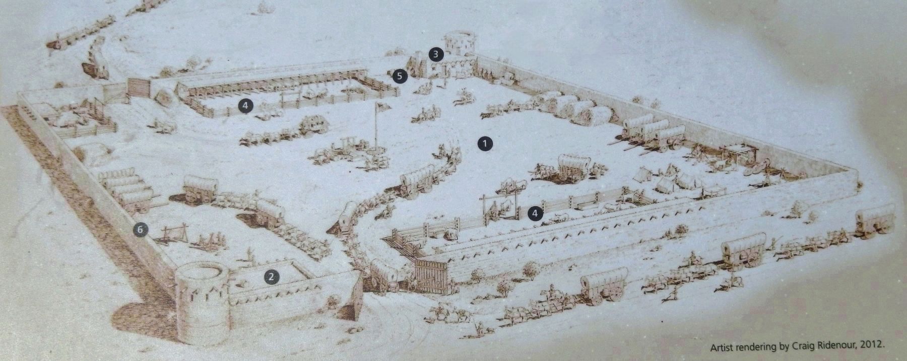
Rendering by Craig Ridenour, 2012
2. Marker detail: The Ranch Complex
Every part of the building was not only secure against fire and weather, but also proof against bullets. It included:
1 — the kaavl (corral) was 100 steps square
2 — the main building was 40 by 16 feet and joined a two-story round tower
3 — the corner of the kaavl was a stage driver's lobby and similar tower
4 — the remainder of this enclosure furnished stables for 40 mules
5 — enough water in barrels to withstand a siege
6 — walls that were two feet thick
1 — the kaavl (corral) was 100 steps square
2 — the main building was 40 by 16 feet and joined a two-story round tower
3 — the corner of the kaavl was a stage driver's lobby and similar tower
4 — the remainder of this enclosure furnished stables for 40 mules
5 — enough water in barrels to withstand a siege
6 — walls that were two feet thick
Location. 37° 47.981′ N, 100° 21.039′ W. Marker is in Cimarron, Kansas, in Gray County. It can be reached from South Main Street (State Highway 23) 0.1 miles south of West Avenue E, on the right when traveling south. The marker is along the walkway near the northeast corner of Cimarron Crossing Park. Touch for map. Marker is in this post office area: Cimarron KS 67835, United States of America. Touch for directions.

Regionally, this marker is in the American Midwest, in the Corn Belt, on the prairies, on the Great Plains, on the Southern Plains, and specifically on the High Plains. Globally, it is in North America, the Western Hemisphere, the Western World, and the Anglosphere. Historically, it finds itself in what was once the Comanchería, the Dust Bowl, the Louisiana Purchase, and the Republic of Texas.
Other nearby markers. At least 8 other markers are within 9 miles of this marker, measured as the crow flies: The Santa Fe Trail (a few steps from this marker); Travelers of the Santa Fe Trail Had a Choice to Make at this Point (within shouting distance of this

Photographed by Kansas Heritage Center, Dodge City
3. Marker detail: Robert M. Wright
Another marker is no longer nearby. Santa Fe Trail (was approx. 8.4 miles away but has been confirmed missing).
Related markers. Click here for a list of markers that are related to this marker. Robert M. Wright
Also see . . .
1. Cimarron Crossing Park (National Park Service).
Cimarron Crossing Park is located on the south side of Cimarron, KS, along the banks of the Arkansas River. Cimarron Crossing Park is located where the Ranch at Cimarron Crossing once stood. The ranch sat at the junction of the Mountain and Cimarron Routes of the Santa Fe Trail and provided travelers with accommodations, supplies, and protection.(Submitted on August 22, 2026, by Cosmos Mariner of Cape Canaveral, Florida.)
2. The Ranch at Cimarron Crossing (Kansas Historical Society).
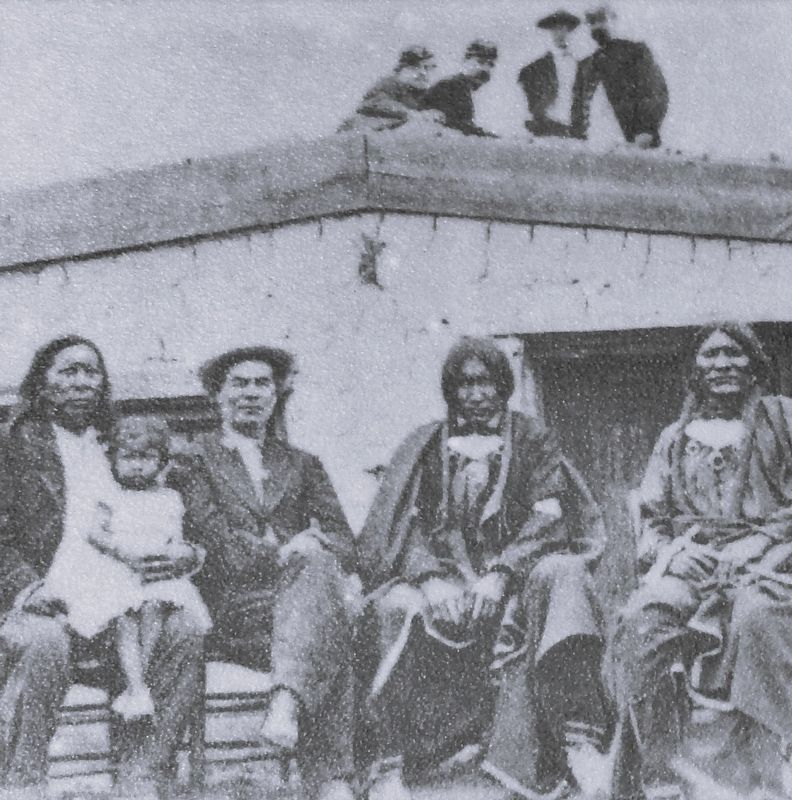
Western History Collection, University of Oklahoma
4. Marker detail: American Indians
(by Louise Barry) Excerpt: Cimarron ranch probably was abandoned in July, 1868. Maj. Henry Douglass, Fort Dodge, in a June 20, letter stated that the Southern Overland Mail agent had informed him that on "Monday next" mail communication between "this Post" and Hays City would cease. In an August 2 letter Douglass reported he had sent, that day, Lt. D. W. Wallingford and 40 men of the Seventh cavalry to Bluff ranch to bring in "the wagons and other property to this post." (Bluff ranch was the next station above Cimarron Crossing.) It is a fair assumption that Cimarron ranch was closed prior to that date, for there is an August 12 letter by Major Douglass reporting that a band of Cheyennes had robbed the camp of R. M. Wright of two horses and some arms. The Fort Dodge "Post Return" for August, 1868, noting this same August 12 incident, stated that R. M. Wright was the lime contractor for Fort Dodge; that the camp was on the middle branch of the Pawnee; and that four Cheyennes had taken three revolvers and two horses from him.(Submitted on August 22, 2026, by Cosmos Mariner of Cape Canaveral, Florida.)Robert Wright, in his reminiscences, said only: "The ultimate fate of the old [Cimarron] ranch was, that the
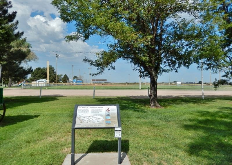
Indians burnt it, together with several hundred tons of hay, the day after Mr. Anthony abandoned it, by order of Major Douglass, commanding Fort Dodge. Upon the loss of our ranch, Mr. Anthony and I thought we would take our chances again, and burn lime on the Buckner, or middle branch of the Pawnee, about 30 miles north of Fort Dodge."Photographed by Cosmos Mariner, August 19, 20225. The Ranch at Cimarron Crossing MarkerLooking west through Cimarron Crossing Park. The baseball fields are in the background.
Credits. This page was last revised on August 22, 2026. It was originally submitted on August 21, 2026, by Cosmos Mariner of Cape Canaveral, Florida. This page has been viewed 20 times since then. Photos: 1, 2, 3, 4, 5. submitted on August 22, 2026, by Cosmos Mariner of Cape Canaveral, Florida.
