Near Megler in Pacific County, Washington — The American West (Northwest)
Crossing the River
Photographed by Barry Swackhamer, June 10, 2026
1. Crossing the River Marker
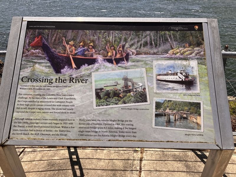
For centuries, crossing the Columbia River was a major challenge. At the time of the Lewis and Clark Expedition, the Corps watched in amazement s Cathlamet People in their high-prow canoes crossed this wide estuary with fish to sell despite a raging storm. The storm had nearly capsized the Corps' own canoes and forced then to shore.
Although salmon industry boats routinely stoped here in the late 1800s, passenger service only began in 1921 with the Tourist, a small diesel powered ferryboat. Within a few years, traveler3s had a choice of ferries - the Tourist, line, the North Beach, the M.R. Chessman, snf the Kitsap.
Forty years later, the Astoria-Meglar Bridge put ferries out of business. Opened in 1966, this soaring steel-truss bridge spans 4.1 miles, making it the longest single truss-bridge in North America. Today more than 7,000 vehicles use the Astoria-Meglar Bridge every day.
Erected by National Park Service.
Topics and series. This historical marker is listed in these topic lists: Bridges & Viaducts
this page online
Location. 46° 14.937′ N, 123° 51.666′ W. Marker is near Megler, Washington, in Pacific County. It is on Lewis and Clark Trail Highway (State Highway 401) near Hungry Harbor Lane, on the right when traveling east. Touch for map. Marker is in this post office area: Naselle WA 98638, United States of America. Touch for directions.

Regionally, this marker is in Southwest Washington State. It is also on the American Pacific Coast, in the Pacific Northwest, and in the Lewis & Clark Corridor. Globally, it is in North America, on the Ring of Fire, on the Pacific Rim, in the Western Hemisphere, in the Western World, and in the Anglosphere.
Other nearby markers. At least 8 other markers are within 3 miles of this marker, measured as the crow flies: Salmon Fortunes (here, next to this marker); Dangerous Days in "Dismal Nitch" (within shouting distance of this marker); Lewis & Clark at Dismal Nitch (about 600 feet away, measured in a direct line);

Photographed by Barry Swackhamer, June 10, 2026
2. Crossing the River Marker
Another marker is no longer nearby. Columbia River Explorers (was approx. 1.3 miles away but has been confirmed missing).
Credits. This page was last revised on August 21, 2026. It was originally submitted on August 21, 2026, by Barry Swackhamer of Brentwood, California. This page has been viewed 16 times since then. Photos: 1, 2. submitted on August 21, 2026, by Barry Swackhamer of Brentwood, California.
