Beach in Chesterfield in Chesterfield County, Virginia — The American South (Mid-Atlantic)
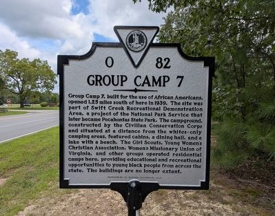
Group Camp 7
Photographed by Evan Dwyer, August 22, 2026
1. Group Camp 7 Marker
Erected 2021 by Virginia Department of Historic Resources. (Marker Number O-82.)
Topics. This historical marker is listed in these topic lists: African Americans • Charity & Public Work • Parks & Recreational Areas • Women. A significant historical year for this entry is 1939.
Location. 37° 21.896′ N, 77° 34.378′ W. Marker is in Chesterfield, Virginia, in Chesterfield County. It is in Beach. It is at the intersection
this page online

Regionally, this marker is in the Piedmont, in Central Virginia, and in the Richmond Metropolitan Area. It is also in the American South, specifically in the Upper South, and on the Eastern Seaboard. Globally, it is in the North Atlantic Region, North America, the Western Hemisphere, the Western World, and the Anglosphere. Historically, it finds itself in what was once the territory of the Mississippian Culture, one of the original Thirteen Colonies, one of the Confederate States of America, and the Antebellum South.
Other nearby markers. At least 8 other markers are within 4 miles of this marker, measured as the crow flies: Pocahontas State Park (about 300 feet away, measured in a direct line); Civilian Conservation Corps - Company 2386 (approx. half a mile away); CCC Camp Site (approx. half a mile away); Dividends for the Future (approx. 1.6 miles away); Apostles of Religious Liberty

Photographed by Evan Dwyer, August 22, 2026
2. Group Camp 7 Marker
The Beach Road entrance to Pocahontas State Park is in the background at left. View faces north; Group Camp 7 was in the opposite direction.
Photographed by Evan Dwyer, August 22, 2026
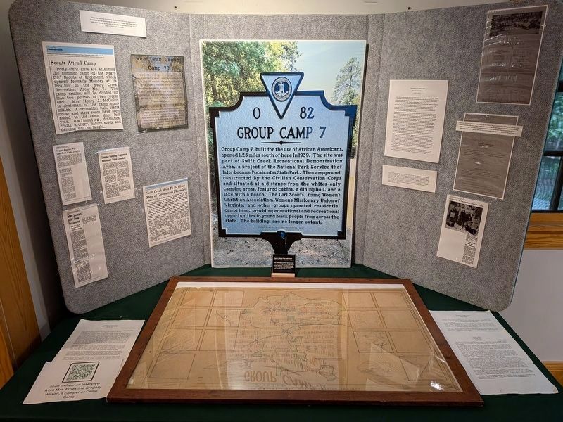
3. Group Camp 7 Display
In the Civilian Conservation Corps Museum within Pocahontas State Park.

Photographed by Evan Dwyer, August 22, 2026
4. Group Camp 7 Map
Plan map within the CCC Museum's exhibit.

Photographed by Evan Dwyer, August 22, 2026
5. Group Camp 7 Exhibit
Left side of exhibit at the CCC Museum

Photographed by Evan Dwyer, August 22, 2026
6. Group Camp 7 Exhibit
Right side of the CCC Museum exhibit
Photographed by Evan Dwyer, August 22, 2026
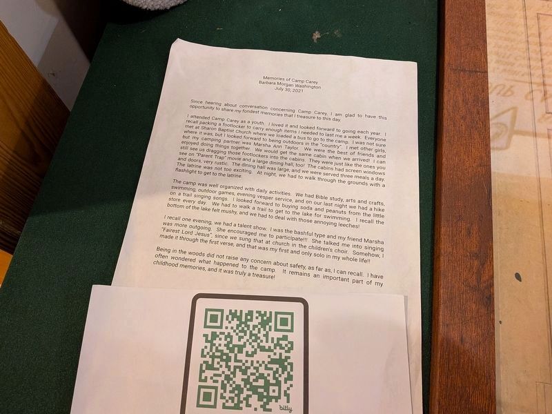
7. Group Camp 7 Exhibit
Left side of the CCC Museum's exhibit, printed story
Photographed by Evan Dwyer, August 22, 2026
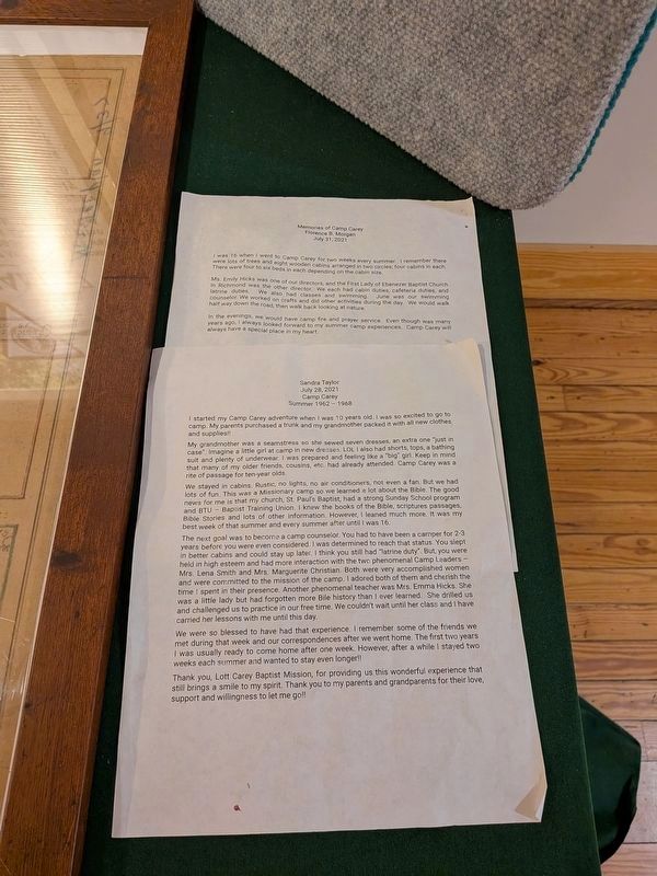
8. Group Camp 7 Exhibit
Right side of the CCC Museum's exhibit, printed story
Credits. This page was last revised on September 13, 2026. It was originally submitted on August 22, 2026, by Evan Dwyer of Richmond, Virginia. This page has been viewed 22 times since then. Photos: 1, 2. submitted on August 22, 2026, by Evan Dwyer of Richmond, Virginia. 3, 4, 5, 6, 7, 8. submitted on September 13, 2026, by Evan Dwyer of Richmond, Virginia.
