South Side in Billings in Yellowstone County, Montana — The American West (Mountains)
Billings — A Tale of Two Cities
Photographed by Cosmos Mariner, July 4, 2024
1. Billings — A Tale of Two Cities Marker
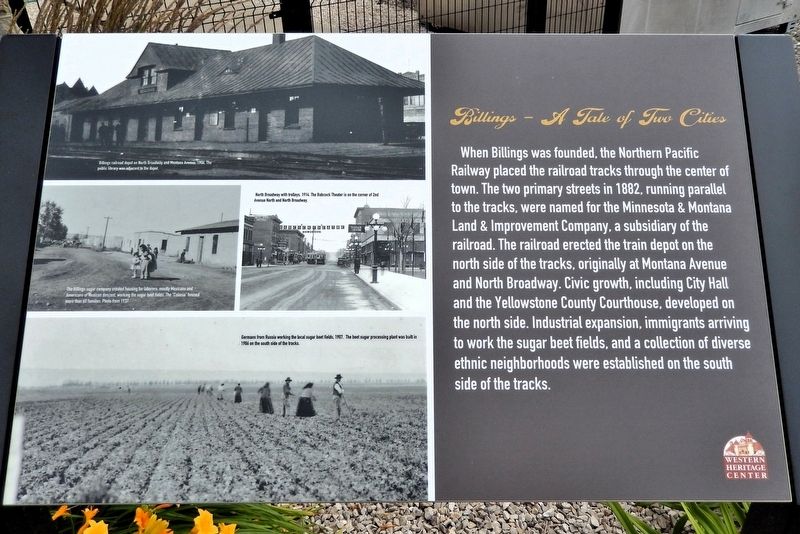
When Billings was founded, the Northern Pacific Railway placed the railroad tracks through the center of town. The two primary streets in 1882, running parallel to the tracks, were named for the Minnesota & Montana Land & Improvement Company, a subsidiary of the railroad. The railroad erected the train depot on the north side of the tracks, originally at Montana Avenue and North Broadway. Civic growth, including City Hall and the Yellowstone County Courthouse, developed on the north side. Industrial expansion, immigrants arriving to work the sugar beet fields, and a collection of diverse ethnic neighborhoods were established on the south side of the tracks.
Erected by Western Heritage Center.
Topics. This historical marker is listed in these topic lists: Agriculture • Immigration • Railroads & Streetcars • Settlements & Settlers. A significant historical year for this entry is 1882.
Location. 45° 46.828′ N, 108° 30.343′ W. Marker is in Billings, Montana, in Yellowstone County. It is in the South Side. It is on North 29th Street just south of Montana Avenue (Business Interstate 90), on the right when traveling
this page online

Regionally, this marker is in Yellowstone Country. It is also in the American Mountain West and in the Lewis & Clark Corridor. Globally, it is in North America, the Western Hemisphere, the Western World, and the Anglosphere. Historically, it finds itself in what was once Rupert’s Land and also the Louisiana Purchase.
Other nearby markers. At least 8 other markers are within walking distance of this marker: The Railroad Arrives (here, next to this marker); The Western Heritage Center (here, next to this marker); Indigenous Homeland (a few steps from this marker); The Parmly Billings Library Building (a few steps from this marker); Frederick Billings (within shouting distance of this marker); J.K. Ralston Cabin-Studio (within shouting distance of this marker); The Clark Hotel - 1928 (within shouting distance of this marker); The Losekamp Building - 1903 (within shouting distance of this marker).
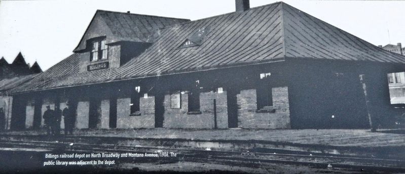
2. Marker detail: Billings Railroad Depot
Billings railroad depot on North Broadway and Montana Avenue, 1906. The public library was adjacent to the depot.
Also see . . .
1. Billings, Montana (Wikipedia).
Excerpt: In 1877, settlers from the Gallatin Valley area of the Montana Territory formed Coulson, the first town of the Yellowstone Valley. When the railroad came to the area, Coulson residents were sure the town would become the railroads hub and Coulson would soon be the territory's largest city. The railroad only had claim to odd sections and it had two sections side-by-side about two miles west of Coulson. Being able to make far more money by creating a new town on these two sections the railroad decided to create the new town of Billings. Named after the Northern Pacific Railway president Frederick H. Billings, the city was founded in 1882. The Railroad formed the city as a western railhead for its further westward expansion. At first the new town had only three buildings but within just a few months it grew to over 2,000. Most of Coulson's residents moved to the new booming town of Billings. In the end, Coulson faded away.(Submitted on August 23, 2026, by Cosmos Mariner of Cape Canaveral, Florida.)
2. Northern Pacific Railroad Patents in Billings Area.
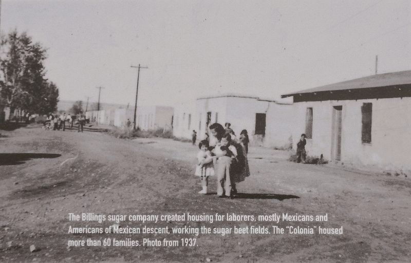
3. Marker detail: The “Colonia”
The Billings sugar company created housing for laborers, mostly Mexicans and Americans of Mexican descent, working the sugar beet fields. The “Colonia” housed more than 60 families. Photo from 1937.
Excerpt: As the railroad progressed through Montana Territory and Yellowstone County it acquired double the normal allowance of land granted to other railroads. Twenty sections at a time on each side of the line were granted along the track route in lieu of financial aid. The railroad construction faced many obstacles, political unrest, finances, and Indian attacks.(Submitted on August 23, 2026, by Cosmos Mariner of Cape Canaveral, Florida.)The railroad in Billings runs essentially parallel to Montana Avenue, with the original town center located slightly east of 27th Street & south of Montana Avenue. As the track extended west, the railroad filed for additional land grants sufficiently in advance to assure that they could prepare for future mortgages and property sales.
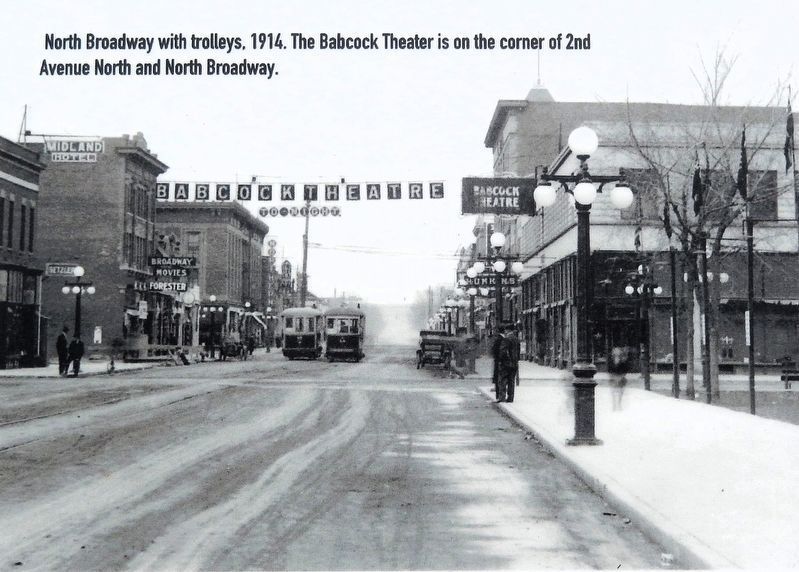
4. Marker detail: North Broadway with Trolleys, 1914
The Babcock Theater is on the corner of 2nd Avenue North and North Broadway.
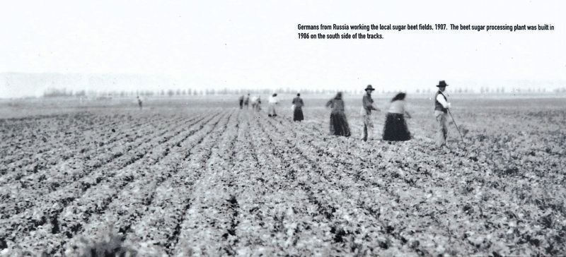
5. Marker detail: Germans from Russia working the local sugar beet fields, 1907
The beet sugar processing plant was built in 1906 on the south side of the tracks.
Photographed by Cosmos Mariner, July 4, 2024
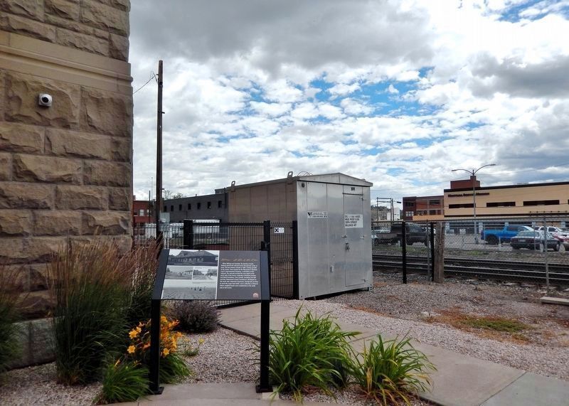
6. Billings — A Tale of Two Cities Marker
The marker is beside the southwest corner of the Western Heritage Center. The railroad tracks that still divide the city today can be seen crossing right to left (southwest to northeast) in the background.
Credits. This page was last revised on August 24, 2026. It was originally submitted on August 22, 2026, by Cosmos Mariner of Cape Canaveral, Florida. This page has been viewed 17 times since then. Photos: 1, 2, 3, 4, 5, 6. submitted on August 23, 2026, by Cosmos Mariner of Cape Canaveral, Florida.
