Welcome to the Huntley Project Museum
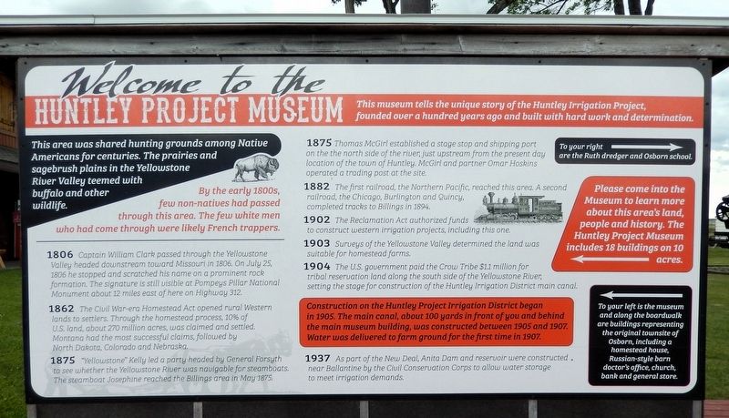
This museum tells the unique story of the Huntley Irrigation Project, founded over a hundred years ago and built with hard work and determination.
This area was shared hunting grounds among Native Americans for centuries. The prairies and sagebrush plains in the Yellowstone River Valley teemed with buffalo and other wildlife.
By the early 1800s, few non-natives had passed through this area. The few white men who had come through were likely French trappers.
1806 Captain William Clark passed through the Yellowstone Valley headed downstream toward Missouri in 1806. On July 25, 1806 he stopped and scratched his name on a prominent rock formation. The signature is still visible at Pompeys Pillar National Monument about 12 miles east of here on Highway 312.
1862 The Civil War-era Homestead Act opened rural Western lands to settlers. Through the homestead process, 10% of U.S. land, about 270 million acres, was claimed and settled. Montana had the most successful claims, followed by North Dakota, Colorado and Nebraska.
1875 “Yellowstone” Kelly led a party headed by General Forsyth to see whether the Yellowstone River was
this page online
1875 Thomas McGirl established a stage stop and shipping port on the north side of the river, just upstream from the present day location of the town of Huntley. McGirl and partner Omar Hoskins operated a trading post at the site.
1882 The first railroad, the Northern Pacific, reached this area. A second railroad, the Chicago, Burlington and Quincy, completed tracks to Billings in 1894.
1902 The Reclamation Act authorized funds to construct western irrigation projects, including this one.
1903 Surveys of the Yellowstone Valley determined the land was suitable for homestead farms.
1904 The U.S. government paid the Crow Tribe $1.1 million for tribal reservation land along the south side of the Yellowstone River, setting the stage for construction of the Huntley Irrigation District main canal.
Construction on the Huntley Project Irrigation District began in 1905. The main canal, about 100 yards in front of you and behind the main museum building, was constructed between 1905 and 1907. Water was delivered to farm ground for the first time

1937 As part of the New Deal, Anita Dam and reservoir were constructed near Ballantine by the Civil Conservation Corps to allow water storage to meet irrigation demands.
Erected by Huntley Project Museum.
Topics and series. This historical marker is listed in these topic lists: Exploration • Indigenous Peoples and Communities • Settlements & Settlers • Waterways & Vessels. In addition, it is included in the Civilian Conservation Corps (CCC) series list. A significant historical year for this entry is 1937.
Location. 45° 55.56′ N, 108° 14.462′ W. Marker is in Huntley, Montana, in Yellowstone County. It can be reached from Railroad Highway 0.2 miles west of South 8th Road, on the left when traveling west. The marker is on the Huntley Project Museum grounds. Touch for map. Marker is at or near this postal address: 770 Railroad Highway, Huntley MT 59037, United States of America. Touch for directions.

Regionally, this marker is in Yellowstone Country and in Greater Billings. It is also in the American Mountain West and in the Lewis & Clark Corridor. Globally, it is in North America, the Western Hemisphere, the Western World, and the Anglosphere. Historically, it finds itself in what was once Rupert’s Land and also the Louisiana Purchase.
Other nearby markers. At least 8 other markers are within walking distance of this marker: The Ruth Dredger (within shouting distance of this marker); Little Yankee Road Grader (within shouting distance of this marker); Osborn Schoolhouse (within shouting distance of this marker); William Fricke's Carpenter Shop (within shouting distance of this marker); 1910 Homestead House (within shouting distance of this marker); Hoover Potato Digger (within shouting distance of this marker); Volga Germans on the Huntley Project (within shouting distance of this marker); Russian Style Barn (about 300 feet away, measured in a direct line). Touch for a list and map of all markers in Huntley.
Also see . . .
1. Huntley Project (Wikipedia).
Excerpt: In 1904 the United States government obtained the northern part of the reservation by cession from the Crow Indians. Congress authorized the Reclamation Service of the U.S. Department of the Interior to survey the land for a possible irrigation project. The Huntley Project, the fifth federal project to convert arid western land to farmland, was authorized in April 1905, and construction began in October. The project took its name from the town of Huntley, a station on the Northern Pacific Railroad. In 1907 the new Huntley Project townsites of Worden, Ballantine, and Pompeys Pillar were laid out at intervals of about six miles along the railroad. On May 21, 1907, President Theodore Roosevelt declared the division to be open for settlement. The population of Huntley Project farms rose to 2,107 in 1917 but fell again to a probable low of 1,015 in 1923.(Submitted on August 24, 2026, by Cosmos Mariner of Cape Canaveral, Florida.)Much of the irrigation infrastructure of the Huntley Project had been poorly designed and cheaply built, and replacements were soon needed. Growing demand for water required more irrigation canals and an auxiliary pumping station, and by 1913 problems with inadequate drainage had caused hundreds of acres of arid land to become waterlogged. Settlers found that alkali in the soil made it difficult to profitably farm the area, and many farms failed in the recession following World War I. Poor crop yields made it difficult for farmers to pay their portion of the district's costs, so Reclamation refused to fund needed improvements. Tensions between Reclamation and the district farmers peaked during the 1920s, until on January 2, 1927, the two sides settled their dispute with a new contract.
Low water and dry weather in the 1930s led to the construction of the first retention dam, then a concrete weir in 1934. The Anita Dam and Reservoir project, about six miles southeast of Ballantine, was completed in 1937 by Civilian Conservation Corps workers.
2. Anita Dam and Reservoir – Pompeys Pillar, Montana (Living New Deal).
Excerpt: Anita Dam and Reservoir, features of the Huntley Project, are located 6 miles southeast of Ballantine, Montana near Billings. This offstream storage dam was completed by the Civilian Conservation Corps in 1937. Water is released from Anita Reservoir into the Reservoir Canal which flows across Fly Creek to the vicinity of Pompeys Pillar.(Submitted on August 24, 2026, by Cosmos Mariner of Cape Canaveral, Florida.)
Credits. This page was last revised on August 24, 2026. It was originally submitted on August 22, 2026, by Cosmos Mariner of Cape Canaveral, Florida. This page has been viewed 22 times since then. Photos: 1, 2. submitted on August 24, 2026, by Cosmos Mariner of Cape Canaveral, Florida.
