Liberty Township near Powell in Delaware County, Ohio — The American Midwest (Great Lakes)
Federal Conservation History of the Bald Eagle
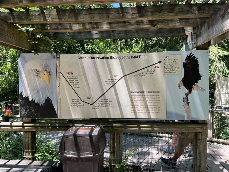
Photographed by Devry Becker Jones (CC0), June 24, 2022
1. Federal Conservation History of the Bald Eagle Marker
1900s
Victims of trapping, hunting and DDT poisoning, eagle numbers began to decline in the mid-to-late 1900s.
1978
The bald eagle was listed for protection under the Federal Endangered Species Act.
As a result of increased conservation efforts and the banning of the use of DDT, bald eagle numbers began to increase dramatically.
1995
Bald eagles were down-listed from endangered to threatened.
2007
The bald eagle was finally removed from the Federal Endangered Species list altogether.
2020
Now listed as "least concern" by the IUCN, bald eagles remain protected by the Migratory Bird Treaty Act and the Bald and Golden Eagle Act.
Remaining Threats to the Bald Eagle
Although their numbers have impressively recovered, bald eagles are still vulnerable to several threats including lead poisoning from ammunition, car and building collisions, and habitat destruction from the ever-growing human population.
Environmental pollution is also a continued threat. For example - it is estimated that 247 eagles died from oil exposure during the 1989 Exxon Valdez oil spill. It took over six years for the local eagle
this page online
Erected by Columbus Zoo and Aquarium.
Topics. This historical marker is listed in these topic lists: Animals • Environment • Industry & Commerce • Science & Medicine. A significant historical year for this entry is 1978.
Location. Marker has been permanently removed. It was located near 40° 9.53′ N, 83° 7.037′ W. Marker was near Powell, Ohio, in Delaware County. It was in Liberty Township. It could be reached from West Powell Road (Ohio Route 750) east of Route 257, on the right when traveling west. Touch for map. Marker was in this post office area: Powell OH 43065, United States of America.
We have been informed that this marker is no longer there and will not be replaced. This page is an archival view of what was.
Regionally, this marker was in the Scioto Valley and in the Columbus Metropolitan Area. It was also in the American Midwest and in the Corn Belt. Globally, it was in North America, the Western Hemisphere, the Western World, and the Anglosphere. Historically, it found itself in what was once the Haudenosaunee (Iroquois) Confederacy, the territory of the Mississippian Culture, and the Northwest Territory.

Other nearby markers. At least 8 other markers are within walking distance of this location: Dr. Bernard F. Master (within shouting distance of this marker); Wetlands Conservation Projects (within shouting distance of this marker); Profile of a Prairie Dog (within shouting distance of this marker); Little House on the Prairie (about 300 feet away, measured in a direct line); American Bison (about 300 feet away); Canada Lynx (about 300 feet away); Prairie Sampler (about 400 feet away); From Seven To Survival (about 400 feet away). Touch for a list and map of all markers in Powell.
Other markers no longer nearby. Bald Eagles in Ohio (was here, next to this marker but has been permanently removed); Dr. Bernard Master (was within shouting distance of this marker but has been permanently removed).
Credits. This page was last revised on August 25, 2026. It was originally submitted on June 28, 2022, by Devry Becker Jones of Washington, District of Columbia. This page has been viewed 430 times since then and 29 times this year. Last updated on August 23, 2026, by Craig Doda of Napoleon, Ohio. Photo 1. submitted on June 28, 2022, by Devry Becker Jones of Washington, District of Columbia.
