
Alcalde in Rio Arriba County, New Mexico — The American Mountains (Southwest)
Los Luceros Hacienda
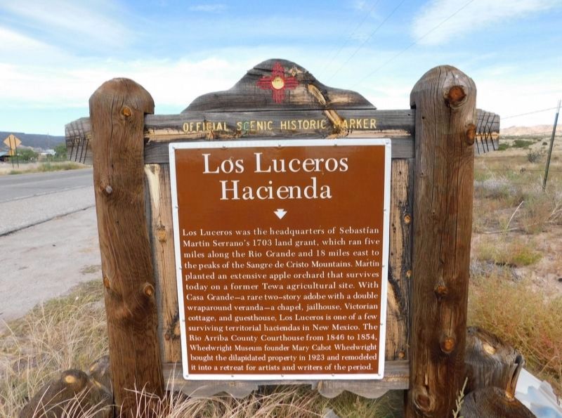
Photographed by Jimmy Emerson, October 7, 2021
1. Los Luceros Hacienda Marker
Topics. This historical marker is listed in these topic lists: Agriculture • Architecture • Law Enforcement. A significant historical year for this entry is 1703.
Location. 36° 6.569′ N, 106° 1.665′ W. Marker is in Alcalde, New Mexico, in Rio Arriba County. It is on State Highway 68 near Los Luceros Road, on the right when traveling north. Touch for map. Marker is in this post office area: Alcalde NM 87511, United
this page online

Regionally, this marker is in Northern New Mexico. It is also in the American Southwest, in the Mountain West, and at the Four Corners. Globally, it is in North America, the Rocky Mountains, the Western Hemisphere, the Western World, and the Anglosphere. Historically, it finds itself in what was once New Spain and also the Republic of Texas.
Other nearby markers. At least 8 other markers are within 8 miles of this marker, measured as the crow flies: Doña Margarita Martín c1700-1743 / Historic Women of Colonial New Mexico and their Wills 1598 - 1821 (here, next to this marker); San Gabriel (approx. 4½ miles away); Esther Martinez - P’oe Tsáwäˀ (1912-2006) (approx. 4½ miles away); Shrine of Our Lady of Lourdes (approx. 4½ miles away); Velarde (approx. 5½ miles away); Rio Grande Gaging Station (approx. 5.8 miles away); Dominguez Escalante Trail (approx. 6.7 miles away); Española Valley (approx. 7.4 miles away). Touch for a list and map of all markers in Alcalde.
Another marker is no longer nearby. Historic Los Luceros (was here, next to this marker but has been replaced with another marker now near it).
More about this marker. Per Google Street View this marker replaced a previous marker entitled "Historic Los Luceros" sometime between June 2016 and April 2021.
Credits. This page was last revised on August 27, 2026. It was originally submitted on August 23, 2026, by Jimmy Emerson of Dalton, Georgia. This page has been viewed 17 times since then. Photo 1. submitted on August 23, 2026, by Jimmy Emerson of Dalton, Georgia. • Andrew Ruppenstein was the editor who published this page.
