Bulltown in Braxton County, West Virginia — The American South (Appalachia)
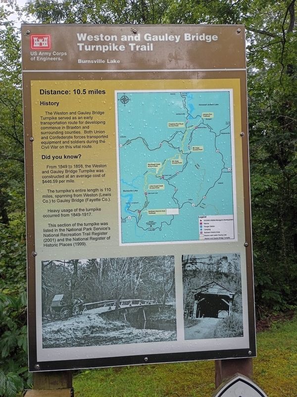
Weston and Gauley Bridge Turnpike Trail
Burnsville Lake
| — | US Army Corps of Engineers | — |
Photographed by Craig Doda, August 2, 2026
1. Weston and Gauley Bridge Turnpike Trail Marker
Distance: 10.5 miles
History
The Weston and Gauley Bridge Turnpike served as an early transportation route for developing commerce in Braxton and surrounding counties. Both Union and Confederate forces transported equipment and soldiers during the Civil War on this vital route.
Did you know?
From 1849 to 1858, the Weston and Gauley Bridge Turnpike was constructed at an average cost of $446.59 per mile.
The turnpike's entire length is 110 miles, spanning from Weston (Lewis Co.) to Gauley Bridge (Fayette Co.).
Heavy usage of the turnpike occurred from 1849-1917.
This section of the turnpike was listed in the National Park Service's National Recreation Trail Register (2001) and the National Register of Historic Places (1999).
Erected by U.S. Army Corps of Engineers.
Topics. This historical marker is listed in these topic lists: Bridges & Viaducts • Roads & Vehicles • War, US Civil. A significant historical year for this entry is 1849.
Location. 38° 47.551′ N, 80° 33.663′ W. Marker is in Bulltown, West Virginia, in Braxton County. It is at the intersection of Bulltown Campground Road and Millstone Run
this page online

Regionally, this marker is in North Central West Virginia. It is also in the American South, specifically in the Upper South, in Appalachia, and specifically in Southern Appalachia. Globally, it is in North America, the Western Hemisphere, the Western World, and the Anglosphere. Historically, it finds itself in what was once the territory of the Mississippian Culture.
Other nearby markers. At least 8 other markers are within walking distance of this marker: Cunningham House (a few steps from this marker); Cunningham Farmstead (within shouting distance of this marker); Coal-and-Wood House (within shouting distance of this marker); Food Cellar (within shouting distance of this marker); Spring House (within shouting distance of this marker); McCauley Barn (within shouting distance of this marker); Granary (within shouting distance of this marker); Battle of Bulltown (within shouting distance of this marker).
Photographed by Craig Doda, August 2, 2026
2. Weston and Gauley Bridge Turnpike Trail Marker
Credits. This page was last revised on August 27, 2026. It was originally submitted on August 24, 2026, by Craig Doda of Napoleon, Ohio. This page has been viewed 9 times since then. Photos: 1, 2. submitted on August 24, 2026, by Craig Doda of Napoleon, Ohio. • Devry Becker Jones was the editor who published this page.
