Terry Sanford in Fayetteville in Cumberland County, North Carolina — The American South (South Atlantic)
C. M. Stedman
1841 - 1930
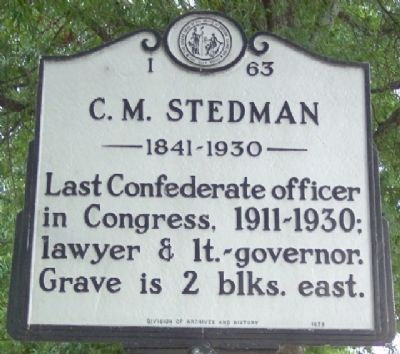
Photographed by William Fischer, Jr., July 28, 2009
1. C. M. Stedman Marker
Erected 1979 by North Carolina Division of Archives and History. (Marker Number I-63.)
Topics and series. This historical marker is listed in these topic lists: Cemeteries & Burial Sites • War, US Civil. In addition, it is included in the North Carolina Division of Archives and History series list.
Location. 35° 3.627′ N, 78° 52.657′ W. Marker is in Fayetteville, North Carolina, in Cumberland County. It is in Terry Sanford. It is on Ramsey Street, on the left when traveling north. Marker is about 300 feet north of the intersection of Ramsey and Moore Streets. Touch for map. Marker is at or near this postal address: 515 Ramsey Road, Fayetteville NC 28301, United States of America. Touch for directions.

Regionally, this marker is in the Coastal Plain. It is also in the American South and specifically in the Upper South. Globally, it is in North America, the Western Hemisphere, the Western World, and the Anglosphere. Historically, it finds itself in what was once
this page online
Other nearby markers. At least 8 other markers are within walking distance of this marker: Lafayette's Tour (approx. 0.3 miles away); Phoenix Lodge No. 8 (approx. 0.3 miles away); Phoenix Masonic Lodge #8 (approx. 0.3 miles away); a different marker also named Phoenix Masonic Lodge #8 (approx. 0.3 miles away); Henry F. Shaw Cross Creek Linear Park (approx. 0.4 miles away); Warren Winslow (approx. 0.4 miles away); Plummer Bridge (approx. 0.4 miles away); Cornwallis (approx. 0.4 miles away). Touch for a list and map of all markers in Fayetteville.
Also see . . . Charles Manly Stedman Congressional Bio. (Submitted on May 19, 2010, by William Fischer, Jr. of Reynoldsburg, Ohio.)
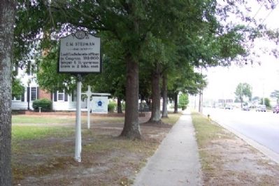
Photographed by William Fischer, Jr., July 28, 2009
2. C. M. Stedman Marker
Looking north along Ramsey Street.
Credits. This page was last revised on March 20, 2021. It was originally submitted on May 19, 2010, by William Fischer, Jr. of Reynoldsburg, Ohio. This page has been viewed 949 times since then and 26 times this year. Photos: 1, 2. submitted on May 19, 2010, by William Fischer, Jr. of Reynoldsburg, Ohio.
