Whitehouse in Marion County, Alabama — The American South (East South Central)
Whitehouse Cemetery Grounds

Photographed by Jimmy Emerson, August 23, 2026
1. Whitehouse Cemetery Grounds Marker
This land was originally part of a land grant claim by Captain Joseph Burleson, a Tennessee Militia Soldier during the War of 1812 and Creek War under Andrew Jackson. By 1820 the Forks of the Buttahatchee Primitive Baptist Church was founded on the ridge northwest of this site.
Captain Burleson promoted his kin and fellow soldier's families to join him here. While serving as councilman for the City of Moulton, he built the Burleson Toll Road to parallel the Byler Toll Road Into present Haleyville, then to the Forks of the Buttahatchee and onward to Old Pikeville on the Jackson Military Road. He also built the old Burleson Trace to conhect the Cheatham Road, from near Old Houston Into Larissa (now Lynn), to Natural Bridge and then to this place. In 1832 Captain Burleson went to Walnut Creek in Bastrop County, Texas and participated in the fight for Texas independence. His nephew, Edward Burleson was a General in the Texas Army and first vice president of the Texas Republic under Sam Houston.
The first burials here were members of the Forks Church. By 1850 Green Haley relocated to a home just south of the entry road,
this page online
Topics. This historical marker is listed in these topic lists: Cemeteries & Burial Sites • Religion & Religious Structures • War, US Civil. A significant historical year for this entry is 1820.
Location. 34° 7.38′ N, 87° 44.092′ W. Marker is in Whitehouse, Alabama, in Marion County. It is on Haley's Road south of U.S. 278, on the right when traveling south. Touch for map. Marker is at or near this postal address: 375 Haley's Rd, Haleyville AL 35565, United States of America. Touch for directions.

Regionally, this marker is in North Alabama. It is also in the American South, specifically in the Deep South, in Appalachia, and specifically in Southern Appalachia. Globally, it is in North America, a Gulf of Mexico state, the Western Hemisphere,
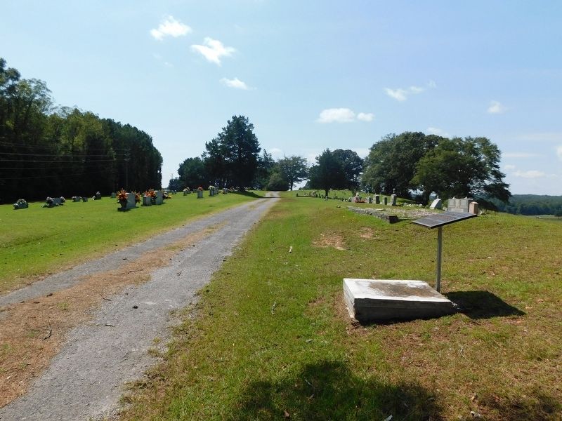
Photographed by Jimmy Emerson, August 23, 2026
2. Whitehouse Cemetery Grounds Marker and Cemetery
Other nearby markers. At least 8 other markers are within 10 miles of this marker, measured as the crow flies: Buttahatchee Cemetery (approx. 5.8 miles away); The Free State of Winston / Natural Bridge (approx. 7.2 miles away); Natural Bridge Park (approx. 7.2 miles away); Yankee Trace (approx. 7½ miles away); Bald Rock / Rock House (approx. 7.7 miles away); Byler Road / History of Natural Bridge (approx. 7.8 miles away); Byler Road Displaced by the Railroad (approx. 7.9 miles away); Haleyville Ice Company (approx. 9.1 miles away).
Another marker is no longer nearby. Whitehouse Cemetery Grounds (was within shouting distance of this marker but has been replaced with another marker now near it).
Related marker. Click here for another marker that is related to this marker. This marker has been replaced with the linked marker, which has differences in inscription.
Credits. This page was last revised on August 25, 2026. It was originally submitted on August 24, 2026, by Jimmy Emerson of Dalton, Georgia. This page has been viewed 27 times since then. Photos: 1, 2. submitted on August 24, 2026, by Jimmy Emerson of Dalton, Georgia. • Devry Becker Jones was the editor who published this page.
