Great Malvern in Worcestershire, England, United Kingdom — Northwestern Europe (the British Isles)
Leading the Field
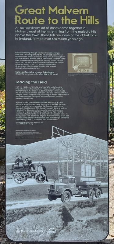
| — | Great Malvern Route to the Hills | — |
Photographed by Ray Gurganus, May 13, 2026
1. Leading the Field Marker
Malvern's quiet location led to its selection as the wartime refuge of several government departments in 1942, the town had to adapt to accommodate the Telecommunications Research Establishment (TRE). Secret research done at Malvern included the development of radar for aircraft detection which was to prove vital to the Allied victory. Post-war the scientific establishment stayed, and Malvern was soon home to more people with doctorate degrees than almost anywhere be Britain. Innovations with their roots here include flight simulators, cathode ray tubes, LCD displays and touchscreens.
Topics. This historical marker is listed in these topic lists: Roads & Vehicles • Science & Medicine • War, World II. A significant historical year for this entry is 1887.
Location. 52° 6.618′ N, 2° 19.817′ W. Marker is in Great Malvern, England, in Worcestershire. It is at the intersection of Well Road and Belle Vue Terrace, on the right when traveling north on Well Road. The marker is located just outside the gates of the Rose Bank Gardens. Touch for map. Marker is at or near this postal address: 50 Belle Vue Terrace, Great Malvern, England WR14 4PZ, United Kingdom. Touch for directions.

Regionally, this marker is in the Midlands. Globally, it is on the Atlantic Ocean, in the North Atlantic Region, in Europe, in Atlantic Europe, on one of the British Isles, in the Western World, and in the Anglosphere. Historically, it finds itself in
this page online
Other nearby markers. At least 8 other markers are within 13 kilometers of this marker, measured as the crow flies: Malvhina Spout of Malvern Spring Water (about 90 meters away, measured in a direct line); The Water Cure (about 90 meters away); Sandstones (about 150 meters away); Malvern's 19th Century Boom (approx. 0.8 kilometers away); The Edinburgh Dome (approx. 0.8 kilometers away); Frieda Salvendy (approx. 1.2 kilometers away); North Parade (approx. 11.5 kilometers away); South Parade (approx. 11.5 kilometers away). Touch for a list and map of all markers in Great Malvern.
Credits. This page was last revised on August 27, 2026. It was originally submitted on August 27, 2026, by Ray Gurganus of Washington, District of Columbia. This page has been viewed 12 times since then. Photo 1. submitted on August 27, 2026, by Ray Gurganus of Washington, District of Columbia. • Andrew Ruppenstein was the editor who published this page.
