
Near Vancouver in Clark County, Washington — The American West (Northwest)
Densely Populated Region
Photographed by Barry Swackhamer, June 11, 2026
1. Densely Populated Region Marker
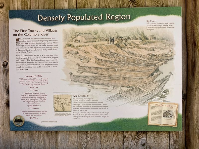
The Lewis and Clark Expedition encountered more American Indian towns and villages along the Columbia River than at any other time during the journey. Almost every day, the explorers met and traded with new people from various tribes. This region was more densely populated at the time of Lewis and Clark's visit than portion of the eastern United States.
Tribes and settlers found this area to be an ideal place to live. Food was plentiful. The rivers teemed with salmon, sturgeon, and other fish. Elk, deer, bear, and other game roamed the nearby woods. Edible berries, roots and tubers such as the prized wapato grew in abundance. The temperate climate made living conditions comfortable year-round, as it still does today.
"We landed at a village 200 men...25 houses 50 canoes...we were treated verry kindly by them, they gave us round root near the Size of a hens egg roasted which they called Wap-to to eat"
William Clark
"The Indians at this Village was very numerous, & had a vast quantity of pounded Salmon in their Cabbins, & had about 50 Canoes laying at a landing...This village was by far the handsomest of the kind that we had yet seen"
this page online
Joseph Whitehouse
"we passed Several large villages on each Side the natives verry numerous the country appears good the Soil rich."
John Ordway
At a Crossroads
This area has always been an important crossroads for trade and industry. A sophisticated network of land and water transportation routes connected tribal villages. Chinookan-speaking tribes of the Lower Columbia were expert traders who relied on the river for transporting their goods. The Cowlitz and other tribes used an ancient trail from the north to travel to and from this area.
Tragically, in the late 1700s trading ships from around the world brought diseases to the tribes. By the time Lewis and Clark arrived in 1805, tribal populations had been greatly reduced as a result of smallpox and other diseases.
Big River
Various tribes have referred to this area as Chutxwa, Sketcutxat and Katchuteq ua (the plain) and the Columbia River as Iyagaytl imal and Nch'-Wana (the big river).
Erected by Washington Lewis and Clark Bicentennial Commission.
Topics and series. This historical marker is listed in these topic lists: Exploration • Indigenous Peoples and Communities
Photographed by Barry Swackhamer, June 11, 2026
2. Densely Populated Region Marker
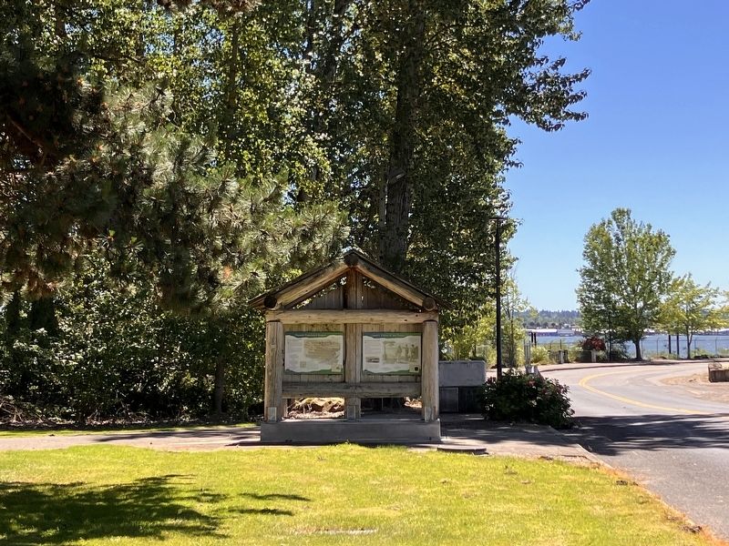
Location. 45° 36.891′ N, 122° 37.642′ W. Marker is near Vancouver, Washington, in Clark County. It is on Southeast Marine Park Way near Southeast Columbia Way, on the right when traveling north. The marker is located in Marine Park. Touch for map. Marker is in this post office area: Vancouver WA 98661, United States of America. Touch for directions.

Regionally, this marker is in Greater Portland Area and in Southwest Washington State. It is also on the American Pacific Coast, in the Pacific Northwest, and in the Lewis & Clark Corridor. Globally, it is in North America, the Pacific Rim, the Western Hemisphere, the Western World, and the Anglosphere.
Other nearby markers. At least 8 other markers are within 2 miles of this marker, measured as the crow flies: Lewis's Vision of the Future (a few steps from this marker); Lewis and Clark National Historic Trail (a few steps from this marker); Lewis and Clark on the Lower Columbia (a few steps from this marker); The First Fort Vancouver (approx. 0.9 miles away); From Military to Municipal Airfield (approx. 1.1 miles away); Ilchee (approx. 1.3 miles away); U. S. Grant Memorial (approx. 1.4 miles away); Whose Anchor? (approx. 1.6 miles away). Touch for a list and map of all markers in Vancouver.
Credits. This page was last revised on August 27, 2026. It was originally submitted on August 27, 2026, by Barry Swackhamer of Brentwood, California. This page has been viewed 5 times since then. Photos: 1, 2. submitted on August 27, 2026, by Barry Swackhamer of Brentwood, California.
