Buffalo Junction in Mecklenburg County, Virginia — The American South (Mid-Atlantic)
Buffalo Springs
Interpretive Trail
— John H. Kerr Dam & Reservoir —
Buffalo Springs Resort
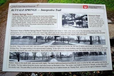
On the other side of the county road was the resort area of Buffalo “Lithia” Springs. Spring #1 was located here, as were the hotels, cabins, a pavilion, tennis court, bowling alley, game room, barbershop, post office, kitchen and dining facilities as well as riding stables and a large vegetable garden. Today, forest has reclaimed the area and little remains that would indicate that people came from throughout the region to visit Buffalo Springs.
Solomon’s Temple
To the left is a photo postcard, circa 1930’s of Solomon’s Temple, one of three hotels. This hotel was actually located on this side of the county road about 100 yards to your left.
Panoramic Views of Buffalo Springs Resort: These two photos were taken in 1936, a few years prior to the dismantling of the resort. The photographer stood in the center of the main resort area, which was on the other side of the county road, and took ten photographs that were then merged together to form these two panoramic views. The two photographs comprise a 360 degree view of the resort.
Top photo: Views to the north (left), east and south (right); Patterson Heights is on the far left, the row of cabins was known as Sycamore or Smokey Row. The large building is the administration building. To the right is the Goode Building, and the dining room and kitchen was behind, but out of view. Spring #1 was under the pavilion. Next is the men’s bathroom/barber shop/billiards room. The stables and garden are on the far right.
Bottom: Views to the south (left), west and north (right). The men’s bathroom/barbershop/billiards room is at the far left, with pavilion and Spring #1 nearby. The four cabins lining the county road was known as Bachelor’s Row. The center road leads to Solomon’s Temple, on the other side of the county road. The post office is at the far left end of the long row of cabins known as “Rowdy Row”, and on the far right is Patterson Heights.
Erected by US Army Corps of Engineers, Wilmington District.
Topics. This historical marker is listed in these topic lists: Man-Made Features • Natural Features • Natural Resources • Notable Places. A significant historical year for this entry is 1936.
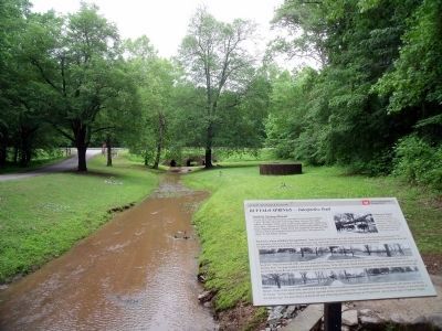
Location. 36° 38.9′ N, 78° 39.728′ W. Marker is in Buffalo Junction, Virginia, in Mecklenburg County. Marker can be reached from Buffalo Springs Road (Virginia Route 767) 0.2 miles north of Highway Fifty Eight (U.S. 58). This marker is located at the Buffalo Springs Historic Site. Touch for map. Marker is in this post office area: Buffalo Junction VA 24529, United States of America. Touch for directions.
Other nearby markers. At least 8 other markers are within 6 miles of this marker, measured as the crow flies. A different marker also named Buffalo Springs (a few steps from this marker); a different marker also named Buffalo Springs (a few steps from this marker); a different marker also named Buffalo Springs (approx. 0.2 miles away); Mecklenburg County / Halifax County (approx. 2.2 miles away); Charlotte County / Mecklenburg County (approx. 5.4 miles away); Prestwould Plantation (approx. 5.7 miles away); Mecklenburg County Veterans Memorial (approx. 5.7 miles away); Patrick Robert “Parker” Sydnor (approx. 6 miles away). Touch for a list and map of all markers in Buffalo Junction.
More about this marker. On the upper left is a photo of “Solomon’s temple, Buffalo Springs, Va.”
On the lower panel are two panoramic photos of the resort.
Also see . . . Buffalo Springs Archaeological District. National Register of Historic Places (Submitted on November 10, 2021.)
Credits. This page was last revised on November 4, 2023. It was originally submitted on May 20, 2010, by Bernard Fisher of Richmond, Virginia. This page has been viewed 877 times since then and 41 times this year. Photos: 1, 2. submitted on May 20, 2010, by Bernard Fisher of Richmond, Virginia.

