
Canoe Lake in Alongquin Provincial Park in Nipissing District, Ontario — Central Canada (North America)
To The Memory Of Tom Thomson
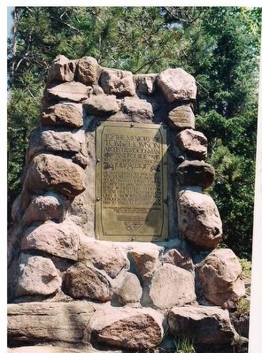
Photographed by Kevin Westell, May 25, 1998
1. To The Memory Of Tom Thomson - Marker
Tom Thomson
artist woodsman and guide
who was drowned in Canoe Lake
July 8th 1917
He lived humbly but passionately with the wild. It made him brother to all untamed things of nature. It drew him apart and revealed itself wonderfully to him. It sent him out from the woods only to show these revelations, through his art, and it took him to itself at last.
His fellow artists and other friends and admirers join gladly in this tribut to his character and genius
His body is buried at Own Sound Ontario near where he was born August, 1877
Erected 1917 by an informal group of three fellow artists and friends.
Topics. This historical marker is listed in these topic lists: Arts, Letters, Music • Environment • Parks & Recreational Areas. A significant historical month for this entry is August 1877.
Location. 45° 33.506′ N, 78° 42.938′ W. Marker is in Alongquin Provincial Park, Ontario, in Nipissing District. It is in Canoe Lake. It can be reached from Hwy 60 (Frank MacDougall Pkwy). Marker and totem pole are at the north end of Canoe Lake, 3 km north (by canoe) of the Canoe Lake Portage
this page online

Regionally, this marker is in Northeastern Ontario and specifically in Northern Ontario. It is also in Central Canada. Globally, it is in North America, the Great North Woods, the Western Hemisphere, the Western World, and the Anglosphere. Historically, it finds itself in what was once a British colony, the Viceroyalty of New France, the Haudenosaunee (Iroquois) Confederacy, and Rupert’s Land.
Other nearby markers. At least 2 other markers are within 16 kilometers of this marker, measured as the crow flies: Algonquin Provincial Park (approx. 15.3 kilometers away); Frank MacDougall Parkway (approx. 15.3 kilometers away).
Also see . . . Tom Thomson (by the Canadian Encyclopedia). (Submitted on August 28, 2026, by Kevin Westell of St. Catharines, Ontario.)
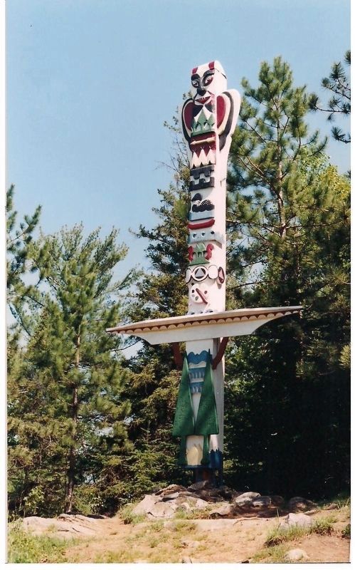
Photographed by Kevin Westell, May 25, 1998
2. Totem Pole (15 metres north of the marker's cairn)
The totem pole is a prominent landmark, to help you find the cairn!
Credits. This page was last revised on August 28, 2026. It was originally submitted on August 28, 2026, by Kevin Westell of St. Catharines, Ontario. This page has been viewed 9 times since then. Photos: 1, 2. submitted on August 28, 2026, by Kevin Westell of St. Catharines, Ontario.
