Hilton Beach in Algoma District, Ontario — Central Canada (North America)
Major Intersection/Une intersection importante
| — | Fort Saint Joseph National Historic Site | — |
Photographed by Cosmos Mariner, June 10, 2024
1. Major Intersection Marker

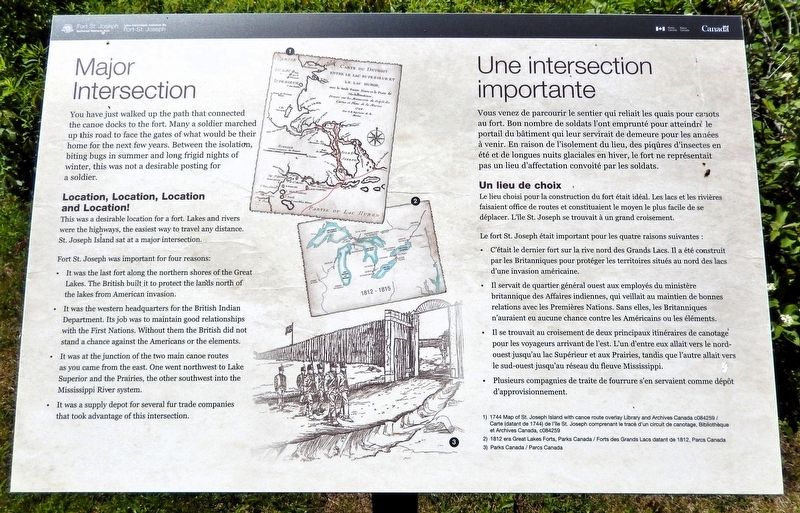
You have Just walked up the path that connected the canoe docks to the fort. Many a soldier marched up this road to face the gates of what would be their home for the next few years. Between the isolation, biting bugs in summer and long frigid nights of winter, this was not a desirable posting for a soldier.
Location, Location, Location and Location!
This was a desirable location for a fort. Lakes and rivers were the highways, the easiest way to travel any distance. St. Joseph Island sat at a major intersection.
Fort St. Joseph was important for four reasons:
• It was the last fort along the northern shores of the Great Lakes. The British built it to protect the lands north of the lakes from American invasion.[image captions]
• It was the western headquarters for the British Indian Department. Its job was to maintain good relationships with the First Nations. Without them the British did not stand a chance against the Americans or the elements.
• It was at the junction of the two main canoe routes as you came from the east. One went northwest to Lake Superior and the Prairies, the other southwest intothe Mississippi River system.
Click or scan to see
this page online
• It was a supply depot for several fur trade companies that took advantage of this intersection.
• 1744 Map of St. Joseph Island with canoe route overlay [Library and Archives Canada c084259]
• 1812 era Great Lakes Forts [Parks Canada]
Vous venez de parcourir le sentier qui reliait les quais pour canots au fort. Bon nombre de soldats l'ont emprunté pour atteindre le portail du bâtiment qui leur servirait de demeure pour les années à venir. En raison de l'isolement du lieu, des piqûres d'insectes en été et de longues nuits glaciales en hiver, le fort ne représentait pas un lieu d'affectation convoité par les soldats.
Un lieu de choix
Le lieu choisi pour la construction du fort était idéal. Les lacs et les rivières faisaient office de routes et constituaient le moyen le plus facile de se déplacer. L'île St. Joseph se trouvait à un grand croisement.
Le fort St. Joseph était important pour les quatre raisons suivantes :
• C'était le dernier fort sur la rive nord des Grands Lacs. Il a été construit par les Britanniques pour protéger les territoires situés au[légendes d'images]nord des lacs d'une invasion américaine.Photographed by Cosmos Mariner, June 10, 20242. Major Intersection Marker
• Il servait de quartier général ouest aux employés du ministère britannique des Affaires indiennes, qui veillait au maintien de bonnes relations avec les Premières Nations. Sans elles, les Britanniques n'auraient eu aucune chance contre les Américains ou les éléments.
• Il se trouvait au croisement de deux principaux itinéraires de canotage pour les voyageurs arrivant de l'est. L'un d'entre eux allait vers le nord-ouest jusqu'au lac Supérieur et aux Prairies, tandis que l'autre allait vers le sud-ouest jusqu'au réseau du fleuve Mississippi.
• Plusieurs compagnies de traite de fourrure s'en servaient comme dépôt d'approvisionnement.
• Carte (datant de 1744) de l'île St. Joseph comprenant le tracé d'un circuit de canotage [Bibliothèque et Archives Canada, c084259]
• Forts des Grands Lacs datant de 1812 [Parcs Canada]
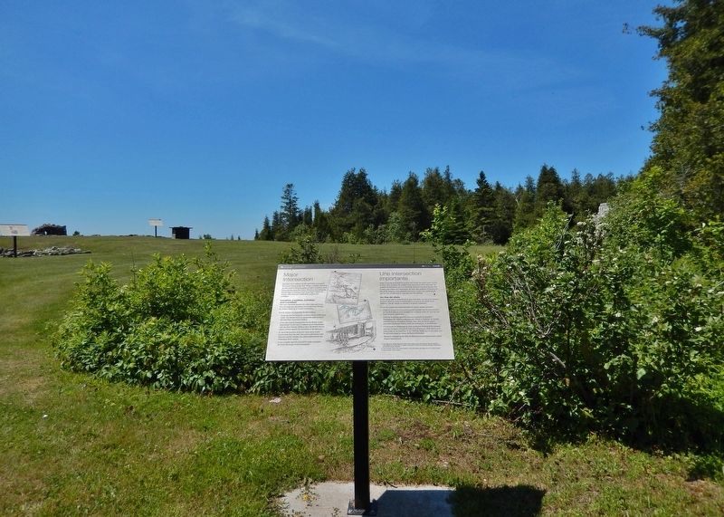
Erected by Parks Canada / Parcs Canada.
Topics. This historical marker is listed in these topic lists: Forts and Castles • Indigenous Peoples and Communities • Industry & Commerce • Waterways & Vessels.
Location. 46° 3.812′ N, 83° 56.775′ W. Marker is in Hilton Beach, Ontario, in Algoma District. It can be reached from Fort Road 4.8 kilometers west of A Line Road. The marker is on the Fort St. Joseph National Historic Site interpretive trail. Touch for map. Marker is at or near this postal address: 185 Fort Road, Hilton Beach ON P0R 1G0, Canada. Touch for directions.

Regionally, this marker is in the Sault Ste. Marie and Algoma Area and in Northern Ontario. It is also in Central Canada. Globally, it is in North America, in the Great North Woods, on the Great Lakes, on Lake Superior’s North Shore, in the Western Hemisphere, in the Western World, and in the Anglosphere. Historically, it finds itself in what was once a British colony, the Viceroyalty of New France, the Haudenosaunee (Iroquois) Confederacy, and Rupert’s Land.
Other nearby markers. At least 8 other markers are within walking distance of this marker: Inside the Walls/À l'intérieur des remparts (here, next to this marker); Land of Little Comfort / Un Territoire offrant peu de confort (a few steps from this marker); Build it Better/Une construction améliorée (within shouting distance of this marker); Want to be a Soldier?/Vous voulez être un soldat? (within shouting distance of this marker); The Importance of Friends/L'importance des amis (within shouting distance of this marker); Black Hole or Flogging/Le trou noir, ou le fouet? (within shouting distance of this marker); Making Do/Se débrouiller avec les moyens du bord (within shouting distance of this marker); What's the Story?/Histoire de la cheminée (within shouting distance of this marker). Touch for a list and map of all markers in Hilton Beach.
Related markers. Click here for a list of markers that are related to this marker. Fort Saint Joseph National Historic Site
Also see . . . Fort St. Joseph (Wikipedia).
Excerpt: Fort St. Joseph is a former British outpost on the southernmost point of St. Joseph Island in Ontario, Canada, on Lake Huron. Situated on approximately 325 hectares along the St. Marys River, Fort St. Joseph was the staging ground for the initial attack in the War of 1812. The fort was an important regional military outpost and a significant meeting place for trade and commerce in the region. During its short but significant occupation, it was the most westerly British outpost in North America. Today, Fort St. Joseph is operated by Parks Canada and is designated a National Historic Site of Canada.(Submitted on August 31, 2026, by Cosmos Mariner of Cape Canaveral, Florida.)
Credits. This page was last revised on September 1, 2026. It was originally submitted on August 30, 2026, by Cosmos Mariner of Cape Canaveral, Florida. This page has been viewed 14 times since then. Photos: 1, 2. submitted on August 30, 2026, by Cosmos Mariner of Cape Canaveral, Florida.
