Near Bankston in Fayette County, Alabama — The American South (East South Central)
A Post Office with Three Names
Fayette County
Photographed by Jimmy Emerson, September 5, 2026
1. A Post Office with Three Names Marker
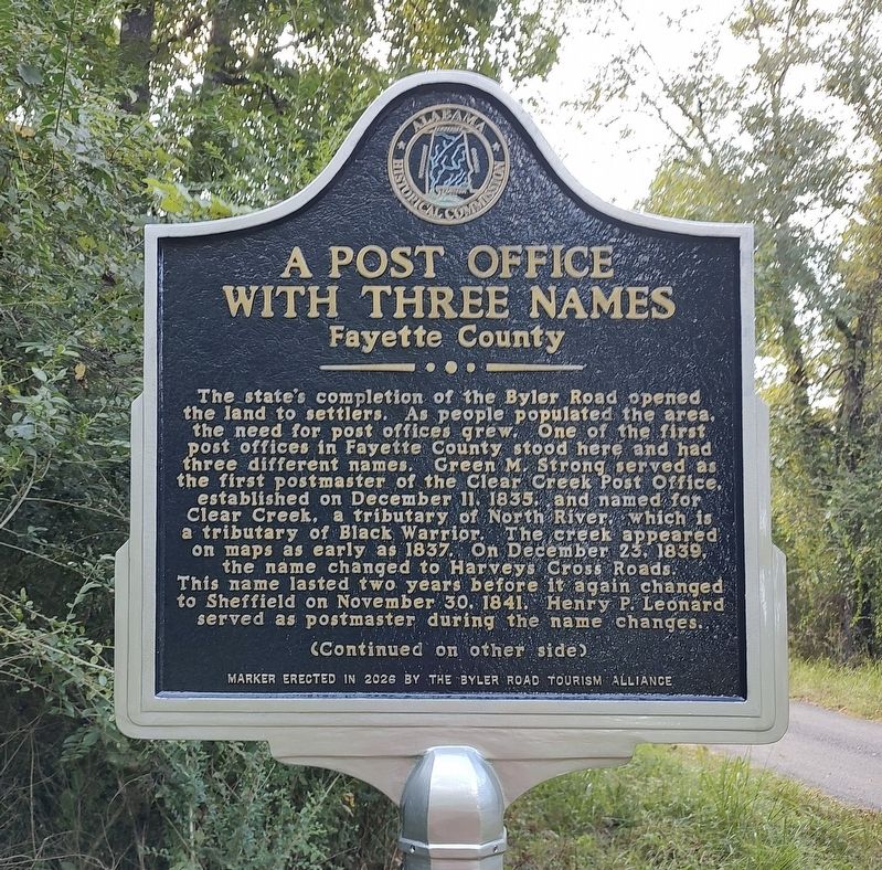
The state's completion of the Byler Road opened the land to settlers. As people populated the area, the need for post offices grew. One of the first post offices in Fayette County stood here and had three different names. Green M. Strong served as the first postmaster of the Clear Creek Post Office, established on December 11, 1835, and named for Clear Creek, a tributary of North River, which is a tributary of Black Warrior. The creek appeared on maps as early as 1837. On December 23, 1839, the name changed to Harveys Cross Roads. This name lasted two years before it again changed to Sheffield on November 30, 1841. Henry P. Leonard served as postmaster during the name changes.
(Reverse Side)
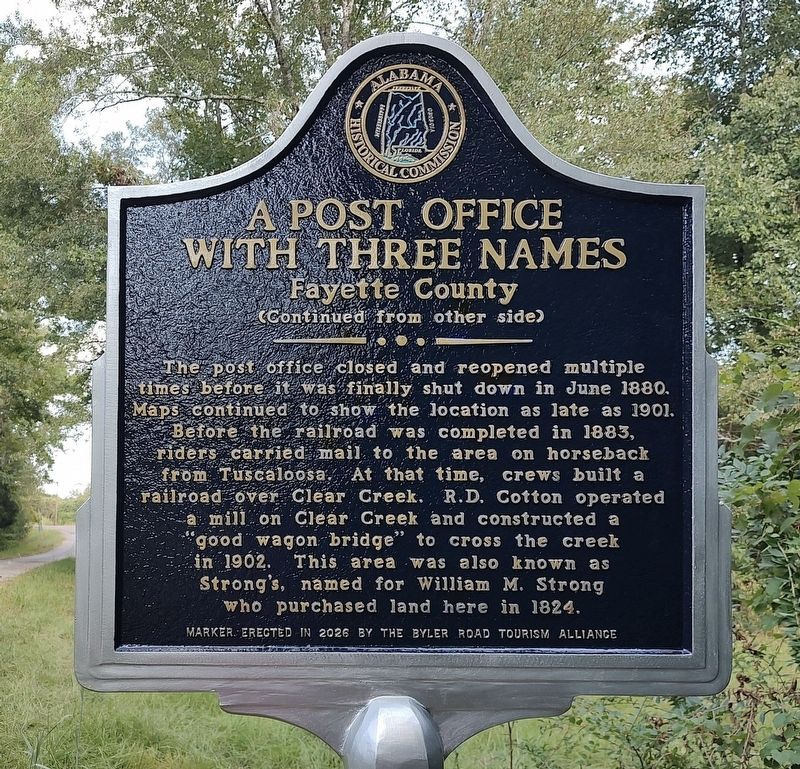
The post office closed and reopened multiple times before it was finally shut down in June 1880. Maps continued to show the location as late as 1901. Before the railroad was completed in 1883, riders carried mail to the area on horseback from Tuscaloosa. At that time, crews built a railroad over Clear Creek. R.D. Cotton operated a mill on Clear Creek and constructed a "good wagon bridge” to cross the creek in
this page online
Erected 2026 by Byler Road Tourism Alliance and Alabama Historical Commission.
Topics. This historical marker is listed in these topic lists: Communications • Railroads & Streetcars • Roads & Vehicles • Waterways & Vessels. A significant historical year for this entry is 1835.
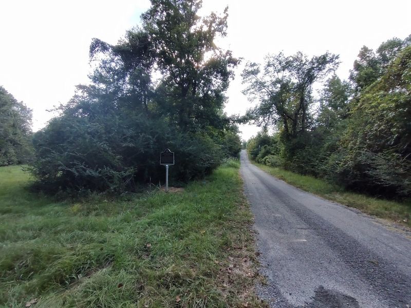
Location. 33° 39.163′ N, 87° 40.009′ W. Marker is near Bankston, Alabama, in Fayette County. It is on County Road 132 0.1 miles west of U.S. 43, on the left when traveling west. Touch for map. Marker is at or near this postal address: 522 Co Rd 132, Berry AL 35546, United States of America. Touch for directions.

Regionally, this marker is in the American South and specifically in the Deep South. Globally, it is in North America, a Gulf of Mexico state, the Western Hemisphere, the Western World, and the Anglosphere. Historically, it finds itself in what was once the territory of the Mississippian Culture, one of the Confederate States of America, and the Antebellum South.
Other nearby markers. At least 8 other markers are within
Photographed by Jimmy Emerson, September 5, 2026
2. A Post Office with Three Names Marker
Photographed by Jimmy Emerson, September 5, 2026
3. A Post Office with Three Names Marker
Credits. This page was last revised on September 7, 2026. It was originally submitted on September 5, 2026, by Jimmy Emerson of Dalton, Georgia. This page has been viewed 18 times since then. Photos: 1, 2, 3. submitted on September 5, 2026, by Jimmy Emerson of Dalton, Georgia. • James Hulse was the editor who published this page.
