Millstone Township in Monmouth County, New Jersey — The American Northeast (Mid-Atlantic)
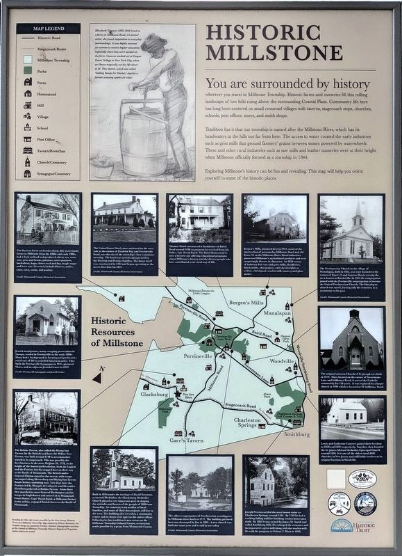
Historic Millstone
Photographed by Richard Peterson, September 6, 2026
1. Historic Millstone Marker
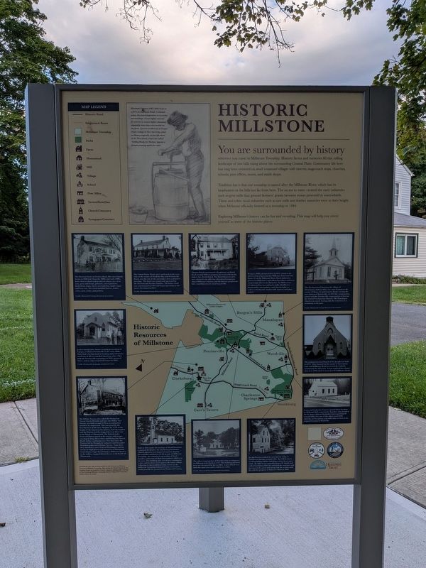
Tradition has it that our township is named after the Millstone River, which has its headwaters in the hills not far from here. The access to water created the early industries such as grist mills that ground farmers’ grains between stones powered by waterwheels. These and other rural industries such as saw mills and leather tanneries were at their height when Millstone officially formed as a township in 1844.
Exploring Millstone’s history can be fun and revealing. This map will help you orient yourself to some of the historic places.
(Drawing caption) Elizabeth Conover (1883-1909) lived on a farm on Stillhouse Road. A talented artist, she found inspiration in everyday surroundings. It was highly unusual for women to receive higher education, especially since they were
this page online
(Photo captions, clockwise from top left)
— The Davison Farm on Gordon Road, like most family farms in Millstone from the 1800s and early 1900s, had a fruit orchard and produced wheat, rye, corn, oats, peas and beans, potatoes, sweet potatoes, buckwheat, hops, clover seed and hay, maple sugar and bees wax. Livestock included horses, mules, cows, oxen, swine, and poultry. Credit: Monmouth County Historical Association
— The Union House Hotel, once anchored on the west side at the corner of Prodelin Way and Perrineville Road, was the site of the township’s first committee meeting. The hotel was owned and operated by the Davison and Perrine families. The house itself was constructed in 1784 and began operating as the area’s first hotel in 1821. Credit: Monmouth County Historical Association
— Thomas Baird constructed a farmhouse on Baird Road around 1830 on property he received from his father, Cpt.
Photographed by Richard Peterson, September 6, 2026
2. Historic Millstone Marker
— Bergen’s Mills, pictured here in 1912, stood at the intersection of present-day Millstone Road and old Route 33 on the Millstone River. Rural industries processed Millstone’s agricultural products and were surprisingly diverse in character. An 1850 census of industry lists saw and grist mills, distilleries, blacksmiths, shoemakers, and wheelwrights as well as a brickyard, woolen mill, tannery and plow maker.
— The Presbyterian Church in the village of Manalapan, built in 1855, was once located on the corner of Route 33 and Conover Road, serving the area known as Bairdsville. In 1951 the congregation joined with the Perrineville congregation to become the United Presbyterian Church. The Manalapan church was razed, leaving only the cemetery as a testimony to the past. Credit: Monmouth County Historical Association
— The original mission Church of St. Joseph was built in 1879. Once located on the corner of Sweetmans Lane and Stillhouse Road, it served
Photographed by Richard Peterson, September 6, 2026
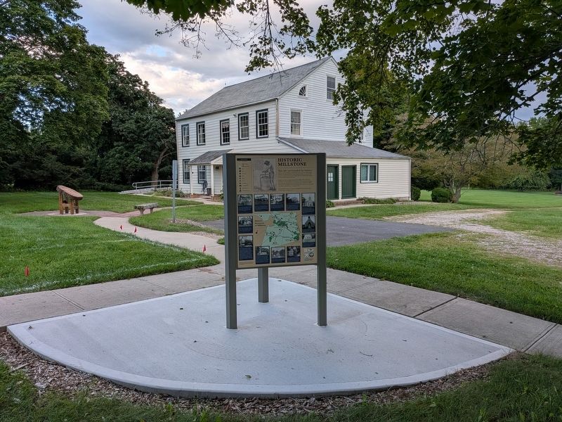
3. Historic Millstone Marker and Baird House
— Lewis and Catherine Conover gained their freedom in 1828 and 1829 respectively. Together, they founded the St. James African Methodist Episcopal Church around 1836. It is one of the oldest rural AME churches in New Jersey and still holds services at its original location in Woodville.
— Joseph Preston settled the area known today as Charleston Springs around 1705. By 1740 he had a working fulling mill for finishing woolen homespun cloth. By 1862 it was owned by James M. Smith and called Smithburg Mill. He enlarged the structure and incorporated a grist mill along with the woolen mill. He sold the property to Robert T. Blain in 1868.
— The oldest congregation of Presbyterian worshippers in Millstone dates bark to 1777. The building pictured here was destroyed by fire in 1881. A new church was built the same year and is still in use today. Credit: Monmouth County Historical Association
— Built in 1814 under the tutelage of David Bowman, a staunch Methodist, the Clarksburg Methodist Church played a very important part in shaping the attitudes and hearts of the people of Millstone Township. Its cemetery is an archive of local families, and some of their descendants still live in the area. The building also served as a community center and its doors were open to the entire village. Following in that tradition it now serves as the Millstone Township Cultural Center, restoration made possible by a grant from Monmouth County.
— The Robins Tavern, also called the Rising Sun Tavern (by the British) and later the Willow Tree Tavern, was built around 1710 to accommodate travelers by stagecoach. This was possibly the First business is the arsa. On June 26, 1778, at the height of the American Revolution, both the English and the Patriots briefly stopped here on their way to the Battle of Monmouth. The British under General Clinton stayed at the tavern, with troops encamped along Shrewsbury and Rising Sun Tavern Roads before continuing east. Two days later the Patriots led by Marquis de Lafayette and Alexander Hamilton gathered at Robins Tavern. From there they marched to meet General Washington and his troops in Englishtown and moved on to Monmouth Court House. Capt’n David Baird, a Millstone farmer in the militia, engaged British forces at the Battle of Monmouth.
— Jewish immigrants, many escaping persecution in Europe, settled in Perrineville in the early 1900s. Many had a background in farming and preferred a rural way of life to crowded American cities. They built the Perrineville Synagogue in 1925, pictured above, and an adjacent Jewish Center in 1937. Credit: Perrineville Synagogue and Jewish Center.
Funding for this sign made possible by the New Jersey Historic Trust and Millstone Township. Sign content by Hunter Research, Inc. Graphic design by Jonathan Connor. Historic photographs courtesy of the Friends of Millstone Township Historic Registered Properties unless otherwise noted.
Topics. This historical marker is listed in these topic lists: Agriculture • Industry & Commerce • Religion & Religious Structures • Settlements & Settlers • Women. A significant historical year for this entry is 1705.
Location. 40° 14.554′ N, 74° 23.553′ W. Marker is in Millstone Township, New Jersey, in Monmouth County. It can be reached from Baird Road 0.2 miles west of Wagner Farm Lane, on the left when traveling east. Touch for map. Marker is at or near this postal address: 24 Baird Road, Millstone Township NJ 08535, United States of America. Touch for directions.

Regionally, this marker is in Central Jersey and in the New York City Metropolitan Area. It is also in the American Northeast, in the Mid-Atlantic, and on the Eastern Seaboard. Globally, it is in the North Atlantic Region, North America, the Western Hemisphere, the Western World, and the Anglosphere. Historically, it finds itself in what was once New Netherland and also one of the original Thirteen Colonies.
Other nearby markers. At least 8 other markers are within 5 miles of this marker, measured as the crow flies: A Prosperous Millstone Family Farm (here, next to this marker); Welcome to Baird Homestead (a few steps from this marker); Woodville (approx. 0.4 miles away); Mary Hays, nicknamed “Molly Pitcher" (approx. 4 miles away); Combs Hill Cannonade (approx. 4.1 miles away); Monmouth Battlefield (approx. 4.1 miles away); General von Steuben (approx. 4.1 miles away); D’Annae: A French, Swedish-Style 4-pounder (approx. 4.1 miles away). Touch for a list and map of all markers in Millstone Township.
Credits. This page was last revised on September 13, 2026. It was originally submitted on September 6, 2026, by Richard Peterson of East Windsor, New Jersey. This page has been viewed 39 times since then. Photos: 1, 2, 3. submitted on September 6, 2026, by Richard Peterson of East Windsor, New Jersey. • Andrew Ruppenstein was the editor who published this page.
